Cushion > Arts > Artists > S > John Speed
Cushion : Lincolnshire Historical John Speed 1610 Map


![]()
Home Decor from Map Marketing
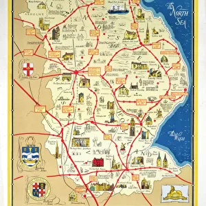
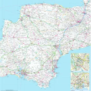
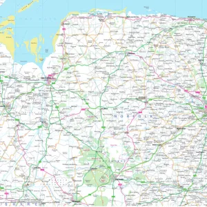
Lincolnshire Historical John Speed 1610 Map
A reproduction of John Speeds historical map of the county of Lincolnshire. Originally published as part of his atlas called The Theatre of the Empire of Great Britain in 1610. John Speed ((1552-1629) was a renowned English cartographer, his maps themselves were of high quality and gained a great reputation for being among the best county maps
Media ID 19950681
© Map Marketing Ltd
1610 Historical Map John Speed Lincolnshire
Medium 18" Cushion (46x46cm)
18"x18" (46x46cm) Fibre filled cushion with a plush soft feel. Your choice of image fills the front, with a stone coloured faux suede back. Flat sewn concealed white zip.
Accessorise your space with decorative, soft cushions
Estimated Image Size (if not cropped) is 45.7cm x 34.7cm (18" x 13.7")
Estimated Product Size is 45.7cm x 45.7cm (18" x 18")
These are individually made so all sizes are approximate
Artwork printed orientated as per the preview above, with landscape (horizontal) orientation to match the source image.
FEATURES IN THESE COLLECTIONS
> Arts
> Artists
> S
> John Speed
> Europe
> United Kingdom
> England
> Lincolnshire
> Related Images
> Maps and Charts
> British Empire Maps
> Maps and Charts
> Early Maps
> Maps and Charts
> Related Images
MADE IN THE UK
Safe Shipping with 30 Day Money Back Guarantee
FREE PERSONALISATION*
We are proud to offer a range of customisation features including Personalised Captions, Color Filters and Picture Zoom Tools
SECURE PAYMENTS
We happily accept a wide range of payment options so you can pay for the things you need in the way that is most convenient for you
* Options may vary by product and licensing agreement. Zoomed Pictures can be adjusted in the Basket.