
Maps Collection
Maps of Saudi Arabia Asia are important tools for understanding the geography and culture of this region
Choose a picture from our Maps Collection for your Wall Art and Photo Gifts
41 items


All Professionally Made to Order for Quick Shipping
-
Maps Collection
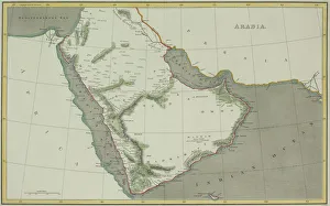
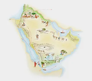
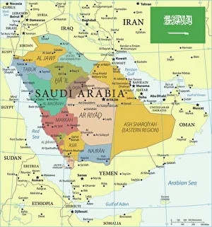
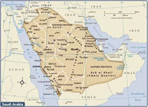
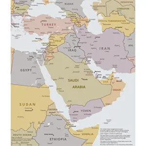
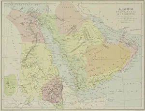
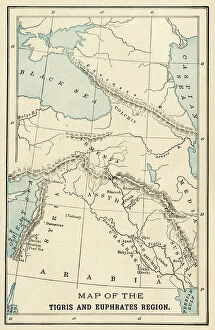
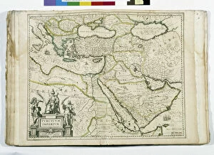
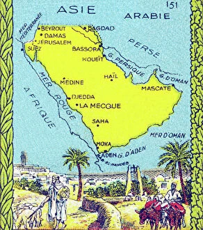
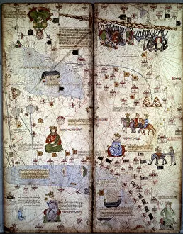
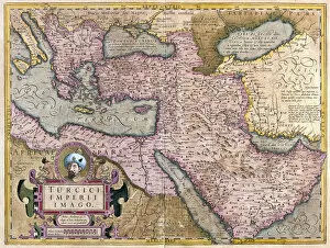
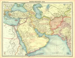
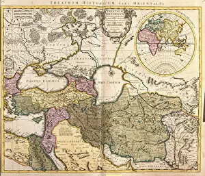
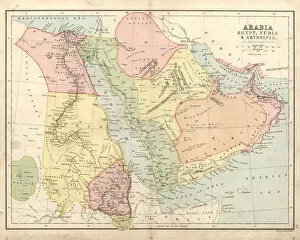
Maps of Saudi Arabia Asia are important tools for understanding the geography and culture of this region. Located in the Middle East, Saudi Arabia is bordered by Jordan, Iraq, Kuwait, Qatar, Bahrain, United Arab Emirates and Oman, and is a large country with deserts and mountains as well as coastal areas along the Red Sea and Persian Gulf. Maps of Saudi Arabia Asia provide an overview of its major cities such as Riyadh, Jeddah and Mecca. They also show its many oil fields which are a major source of income for the country. Additionally they highlight important religious sites such as Medina which is considered to be one of Islam's holiest cities and are help travelers plan their trips by providing information on roads and highways that connect different parts of the country together. Finally they can provide insight into local customs and cultures that make up this diverse region.
+
Our beautiful pictures are available as Framed Prints, Photos, Wall Art and Photo Gifts
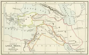
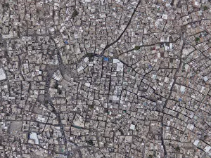
The Maps of Saudi Arabia Asia collection from Media Storehouse is a stunning and informative assortment of wall art and framed prints that showcase the geography, history, and culture of Saudi Arabia. Our collection features an array of maps that highlight various regions, cities, landmarks, and historical events in Saudi Arabia. The maps are beautifully designed with intricate details and vibrant colors that make them visually appealing as well as educational. Whether you're a geography enthusiast or simply looking to decorate your home or office with unique artwork, our collection has something for everyone. From vintage maps dating back to the early 1900s to modern-day satellite imagery, these prints offer a fascinating glimpse into the evolution of Saudi Arabia's landscape over time. The Maps of Saudi Arabia Asia collection from Media Storehouse is an excellent choice for anyone interested in exploring the rich history and diverse landscapes of this fascinating country.
+
What are Maps of Saudi Arabia Asia art prints?
Maps of Saudi Arabia Asia art prints are high-quality reproductions of maps that depict the geography, topography and political boundaries of Saudi Arabia and its surrounding regions in Asia. These prints are created using advanced printing technology to ensure that they accurately capture every detail of the original map. They can be used for a variety of purposes including educational, decorative or informational. These maps showcase the intricate details and features of Saudi Arabia's landscape such as mountains, deserts, rivers and cities. They also highlight important landmarks like historical sites, airports, ports and borders with neighboring countries. The prints come in various sizes to suit different display needs. Maps of Saudi Arabia Asia art prints make great gifts for anyone interested in geography or history. They can be framed or mounted on walls to add an interesting touch to any room decor. Whether you're looking for a unique piece for your home or office space or simply want to learn more about this fascinating region, these maps offer a wealth of information at your fingertips.
+
What Maps of Saudi Arabia Asia art prints can I buy from Media Storehouse?
We offer a wide range of Maps of Saudi Arabia Asia art prints that are perfect for those who love to explore and learn about the geography and culture of this region. These maps come in various styles, sizes, and formats such as vintage, modern, political, physical or topographical. You can choose from different types of maps including city maps like Riyadh or Jeddah; regional maps like Makkah or Madinah; country maps showing all major cities and landmarks; or even world maps highlighting Saudi Arabia's location on the globe. These Maps of Saudi Arabia Asia art prints are printed using high-quality materials to ensure that they last for years without fading. They make great additions to any home decor setting whether you're looking to add some color to your walls or want something educational for your kids' room. With so many options available at Media Storehouse, you're sure to find the perfect map print that suits your taste and preferences.
+
How do I buy Maps of Saudi Arabia Asia art prints?
To buy maps of Saudi Arabia Asia art prints from Media Storehouse, you can browse through our extensive collection of high-quality prints online. You can search for the specific type of map or artwork that you are interested in using their search bar or by browsing through different categories such as geography, travel, and culture. Once you have found the print that you want to purchase, simply add it to your cart and proceed to checkout. During the checkout process, you will be prompted to enter your shipping and payment information. After completing this step, your order will be processed and shipped out to you within a reasonable timeframe. We offer a wide range of printing options including canvas prints, framed prints, and poster prints so that you can choose the best option for your needs. Whether you're looking for a unique piece of wall art or a gift for someone special, we have something for everyone.
+
How much do Maps of Saudi Arabia Asia art prints cost?
As We offer a wide range of Maps of Saudi Arabia Asia art prints, the cost may vary depending on factors such as size, framing options and printing materials. However, you can rest assured that they will receive high-quality prints at competitive prices. The company sources its images from reputable archives and photographers to ensure that each print is authentic and visually stunning. Whether you're looking for a vintage map or a contemporary artwork depicting the region's landscapes or landmarks, there are plenty of options available to suit different tastes and budgets. You can browse through the collection online or contact customer service for assistance in finding the perfect piece for their home or office decor. Media Storehouse strives to offer affordable yet premium quality art prints that capture the beauty and diversity of Saudi Arabia Asia's geography and culture.
+
How will my Maps of Saudi Arabia Asia art prints be delivered to me?
We take pride in ensuring that your Maps of Saudi Arabia Asia art prints are delivered to you in the best possible condition. We use high-quality packaging materials to protect your artwork during transit and ensure it arrives at your doorstep safely. Your art print will be carefully rolled and placed inside a sturdy cardboard tube for protection. The tube is then sealed with tape to prevent any damage or moisture from entering. We work with trusted delivery partners who provide reliable shipping services worldwide. Once your order has been dispatched, you will receive an email notification containing tracking information so that you can keep track of its progress until it reaches you. We understand how important it is to receive your artwork promptly and in perfect condition. That's why we go above and beyond to ensure that every order is handled with care and attention to detail.