Antique Framed Print : Satellite map of Antarctic ozone hole, 1987
![]()

Framed Photos from Science Photo Library
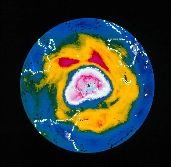
Satellite map of Antarctic ozone hole, 1987
Satellite map showing a severe depletion or " hole" in the ozone layer over Antarctica on October 2, 1987. The hole is probably due to pollution of the atmosphere by chlorofluorocarbons (CFCs). First seen in 1980, the " hole" has grown in severity. It reaches a maximum in October, the Antarctic spring. It is visible here as the white & pink area covering Antarctica (outlined in white) & beyond. Australia, southern Africa & part of South America are also outlined. The colours represent Dobson units, a measure of atmospheric ozone. The map was made from data obtained by the Nimbus-7 weather satellite
Science Photo Library features Science and Medical images including photos and illustrations
Media ID 6376309
© LABORATORY FOR ATMOSPHERES, NASA GODDARD SPACE FLIGHT CENTER/SCIENCE PHOTO LIBRARY
Antarctic Atmosphere Earth Science Hole Ozone Ozone Depletion Ozone Hole Pollution Sciences
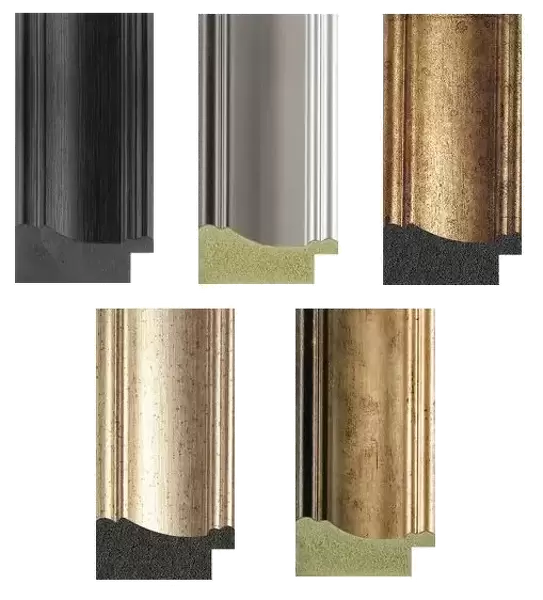
18"x18" (46x46cm) Antique Frame
Bevelled wood effect frame, card mounted, 12x12 archival quality photo print. Overall outside dimensions 18x18 inches (46x46cm). Environmentally and ozone friendly, Polycore® moulding has the look of real wood, is durable and light and easy to hang. Biodegradable and made with non-chlorinated gases (no toxic fumes) it is efficient; producing 100 tons of polystyrene can save 300 tons of trees! Prints are glazed with lightweight, shatterproof, optical clarity acrylic (providing the same general protection from the environment as glass). The back is stapled hardboard with a sawtooth hanger attached. Note: To minimise original artwork cropping, for optimum layout, and to ensure print is secure, the visible print may be marginally smaller
Bevelled Wood Effect Framed and Mounted Prints - Professionally Made and Ready to Hang
Estimated Image Size (if not cropped) is 29.4cm x 28.8cm (11.6" x 11.3")
Estimated Product Size is 46.5cm x 46.5cm (18.3" x 18.3")
These are individually made so all sizes are approximate
Artwork printed orientated as per the preview above, with landscape (horizontal) orientation to match the source image.
EDITORS COMMENTS
This print showcases a satellite map of the Antarctic ozone hole in 1987, revealing a distressing depletion or "hole" in the protective layer of ozone over this pristine continent. The image, taken on October 2nd, vividly illustrates the severity of this phenomenon caused by pollution from chlorofluorocarbons (CFCs) released into the atmosphere. Initially observed in 1980, this ominous "hole" has progressively worsened over time and reaches its peak intensity during October, coinciding with the Antarctic spring. The photograph portrays Antarctica as an expanse covered in white and pink hues, representing areas where atmospheric ozone is significantly reduced. The outline of Antarctica is clearly visible amidst this disheartening display. Additionally outlined are regions such as Australia, southern Africa, and part of South America that also bear witness to the impact of this environmental crisis. The colors depicted on this map correspond to Dobson units - a metric used to measure atmospheric ozone levels. This invaluable visual representation was created using data collected by the Nimbus-7 weather satellite. As we reflect upon this thought-provoking image captured by Science Photo Library, it serves as a stark reminder of our responsibility to address issues related to pollution and climate change for the preservation of our planet's delicate ecosystems.
MADE IN THE UK
Safe Shipping with 30 Day Money Back Guarantee
FREE PERSONALISATION*
We are proud to offer a range of customisation features including Personalised Captions, Color Filters and Picture Zoom Tools
SECURE PAYMENTS
We happily accept a wide range of payment options so you can pay for the things you need in the way that is most convenient for you
* Options may vary by product and licensing agreement. Zoomed Pictures can be adjusted in the Basket.


