Acrylic Blox > North America > Canada > Maps
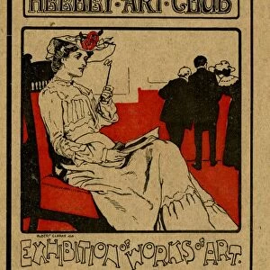
Acrylic Blox : Antique Map of Canada - 19th Century


![]()
Mounted Prints from Fine Art Storehouse
Antique Map of Canada - 19th Century
Vintage map of Canada at the end of the 19th century. Vintage etching circa late 19th century
Unleash your creativity and transform your space into a visual masterpiece!
powerofforever
Media ID 15149715
© This content is subject to copyright
8"x6" (20x15cm) Acrylic Blox
Your photographic print is held in place by magnets and a micro thin sheet of metal covering the back of a 20mm piece of clear acrylic. Your print is held in place with magnets so can easily be replaced if needed.
Streamlined, one sided modern and attractive table top print
Estimated Product Size is 20.3cm x 15.2cm (8" x 6")
These are individually made so all sizes are approximate
Artwork printed orientated as per the preview above, with landscape (horizontal) orientation to match the source image.
FEATURES IN THESE COLLECTIONS
> Maps and Charts
> Related Images
> North America
> Canada
> Maps
> North America
> Canada
> Related Images
> Fine Art Storehouse
> Map
> Historical Maps
EDITORS COMMENTS
This print transports us back in time to the late 19th century, showcasing an antique map of Canada. With its vintage etching style, this piece exudes a sense of nostalgia and historical significance. The intricately detailed map offers a glimpse into the territorial landscape of Canada during this era. As we gaze upon this remarkable artwork, we are reminded of the vastness and diversity that defines Canada's geography. From coast to coast, every province and territory is meticulously depicted on this map, allowing us to appreciate the immense size and beauty of this great nation. The fine lines and delicate shading used in creating this vintage masterpiece evoke a sense of craftsmanship rarely seen in modern cartography. It serves as a testament to the artistry involved in mapping out uncharted territories during an age when exploration was at its peak. Whether you are a history enthusiast or simply captivated by the allure of vintage aesthetics, "Antique Map of Canada - 19th Century" will undoubtedly be an exquisite addition to your collection. This print invites you to embark on a journey through time, offering glimpses into our past while celebrating the rich heritage that has shaped present-day Canada.
MADE IN THE UK
Safe Shipping with 30 Day Money Back Guarantee
FREE PERSONALISATION*
We are proud to offer a range of customisation features including Personalised Captions, Color Filters and Picture Zoom Tools
SECURE PAYMENTS
We happily accept a wide range of payment options so you can pay for the things you need in the way that is most convenient for you
* Options may vary by product and licensing agreement. Zoomed Pictures can be adjusted in the Basket.