Tote Bag > Europe > France > Canton > Landes
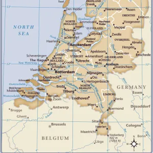
Tote Bag : Map of New Netherlands


![]()
Home Decor from Mary Evans Picture Library
Map of New Netherlands
Map of the New Netherlands area in 1652, from the writings and descriptions of Adriaen Vanderdonck. Date: 1656
Mary Evans Picture Library makes available wonderful images created for people to enjoy over the centuries
Media ID 23090170
© Mary Evans Picture Library
1656 Adriaen Area Colonialism Colony Descriptions Maps Netherlands
Canvas Tote Bag
Our tote bags are made from soft, durable, poly-poplin fabric and include a one inch (2.5cm) black strap for easy carrying on your shoulder. All seams are double-stitched for added durability. Each tote bag is machine-washable in cold water and is printed on both sides using the same image. Approximate size of bag is 50x33cm (20"x13")
Our tote bags are made from soft durable fabric and include a strap for easy carrying
Estimated Product Size is 32.7cm x 50cm (12.9" x 19.7")
These are individually made so all sizes are approximate
FEATURES IN THESE COLLECTIONS
> Mary Evans Prints Online
> New Images August 2021
> Arts
> Landscape paintings
> Landscape art
> Landscape paintings
> Europe
> France
> Canton
> Landes
> Europe
> Netherlands
> Maps
> Europe
> Netherlands
> Posters
> Europe
> Netherlands
> Related Images
> Maps and Charts
> Netherlands
> Maps and Charts
> Related Images
> Maps and Charts
> World
> North America
> Related Images
EDITORS COMMENTS
This exquisite map, titled "Nieuwe Nederlandt," is a rare and intriguing representation of the New Netherlands area in 1652, as depicted in the writings and descriptions of Adriaen Vanderdonck. Dated 1656, this map offers a unique perspective into the Dutch colonial expansion in North America during the 17th century. Adriaen Vanderdonck, also known as Adriaen van der Donck, was a prominent Dutch colonial figure, who served as a secretary for the New Netherlands colony and was an advocate for its development. His extensive knowledge of the region is evident in this detailed map, which covers the area from the Delaware Bay in the south to the Saint Lawrence River in the north, and from the Atlantic Ocean in the east to the Mississippi River in the west. The map is adorned with various topographical features, including rivers, mountains, and bodies of water, as well as the locations of Dutch settlements and Native American tribes. The cartouche at the bottom right corner features a Native American man and woman, symbolizing the interaction between the Dutch colonizers and the indigenous peoples. The map's intricate details and accurate depictions of the landscape make it an invaluable resource for historians, geographers, and anyone interested in the history of colonialism and the exploration of the New World. This map is a testament to the rich cultural exchange that took place between Europeans and Native Americans during the colonial era, and serves as a reminder of the complex and dynamic history of the region that is now known as the United States.
MADE IN THE UK
Safe Shipping with 30 Day Money Back Guarantee
FREE PERSONALISATION*
We are proud to offer a range of customisation features including Personalised Captions, Color Filters and Picture Zoom Tools
SECURE PAYMENTS
We happily accept a wide range of payment options so you can pay for the things you need in the way that is most convenient for you
* Options may vary by product and licensing agreement. Zoomed Pictures can be adjusted in the Basket.