
Maps Collection
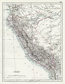
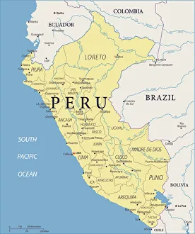
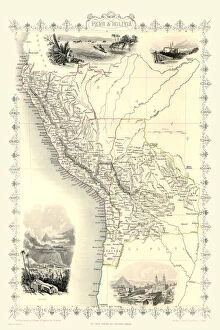
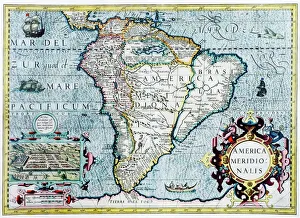
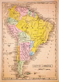
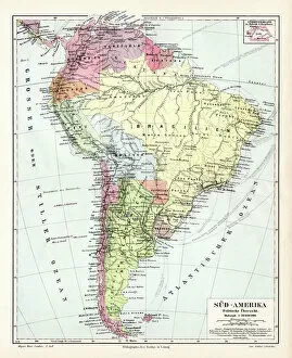
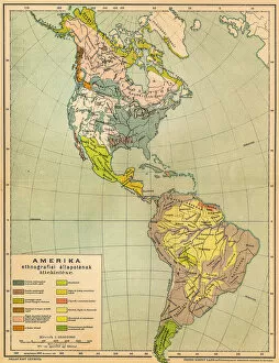
Peru is a country located in South America, bordered by Ecuador and Colombia to the north, Brazil and Bolivia to the east, Chile to the south
Choose a picture from our Maps Collection for your Wall Art and Photo Gifts
148 items


All Professionally Made to Order for Quick Shipping
-
Maps Collection
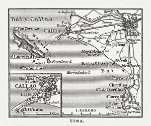
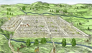
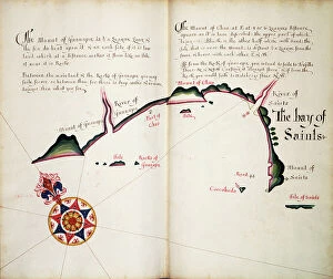
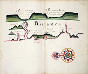
Peru is a country located in South America, bordered by Ecuador and Colombia to the north, Brazil and Bolivia to the east, Chile to the south, and the Pacific Ocean on its western coast, and is home to some of the most diverse landscapes in South America, ranging from tropical rainforests in its Amazon basin region to snow-capped mountain peaks of its Andes range. Maps of Peru show that it is divided into 25 regions and contains a variety of cities including Lima (the capital), Cusco (the former Inca capital), Arequipa (the second largest city) and Trujillo (known for its archaeological sites). Peru also has many national parks such as Manu National Park which protects an area of over 1 million hectares and can essential for navigating this vast country with its many attractions.
+
Our beautiful pictures are available as Framed Prints, Photos, Wall Art and Photo Gifts
The Maps of Peru South America collection from Media Storehouse is a stunning array of wall art and framed prints that showcase the beauty and diversity of Peru's landscapes, cities, and historical landmarks. Our collection features an extensive range of maps that highlight the country's geography, including its mountain ranges, rivers, deserts, and coastline. These maps are not only informative but also visually striking with their intricate details and vibrant colors. In addition to maps, our collection includes photographs of iconic Peruvian sites such as Machu Picchu, Lake Titicaca, Lima's historic center, and the Nazca Lines. These images capture the essence of Peru's rich cultural heritage while showcasing its natural wonders. Whether you're looking for a unique piece to adorn your home or office walls or seeking inspiration for your next travel adventure in South America, our collection offers something for everyone. With high-quality printing techniques used on premium materials like fine art paper or canvas fabric stretched over wooden frames - these prints will last a lifetime.
+
What are Maps of Peru South America art prints?
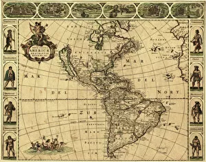
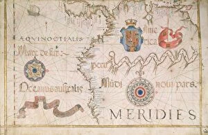
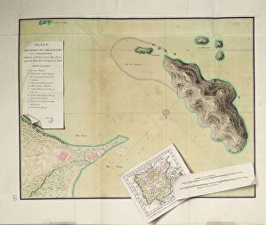
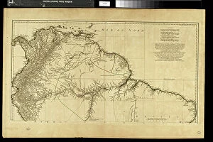
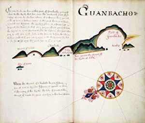
Maps of Peru South America art prints are high-quality reproductions of maps depicting the geography and topography of Peru, a country located in South America. These art prints showcase the intricate details of the landforms, rivers, lakes, mountains, and cities that make up this beautiful country. These maps are not only aesthetically pleasing but also serve as educational tools for those interested in learning more about Peru's history and culture. They can be used to plan trips or study the geography of different regions within the country. Maps of Peru South America art prints come in various sizes and styles to suit any decor style. They can be framed or hung as posters on walls to add a touch of sophistication to any room. Maps of Peru South America art prints are an excellent way to celebrate this unique country's beauty while also providing valuable information about its geography and culture.
+
What Maps of Peru South America art prints can I buy from Media Storehouse?
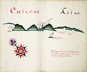
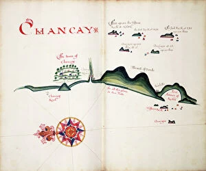
We offer a wide range of Maps of Peru South America art prints that are perfect for anyone who loves the country's rich history and culture. These maps showcase various regions, cities, and landmarks in Peru, including Lima, Cusco, Machu Picchu, Lake Titicaca, and the Amazon rainforest. You can choose from vintage-style maps or more modern designs that highlight different aspects of the country. Some popular options include detailed topographical maps that show the Andes mountain range or satellite images of Peru's coastline. There are also political maps that display borders between neighboring countries and administrative divisions within Peru itself. Whether you're looking to decorate your home or office with beautiful artwork inspired by this fascinating country or want to give a unique gift to someone special who shares your love for all things Peruvian, we have something for everyone.
+
How do I buy Maps of Peru South America art prints?
To buy Maps of Peru South America art prints, you can visit our online gallery. The website offers a vast collection of high-quality art prints that are perfect for decorating your home or office space. You can browse through the different categories and select the one that interests you the most. Once you have selected your desired print, simply add it to your cart and proceed to checkout. We accept various payment methods such as credit cards, PayPal, and Apple Pay. We also offer worldwide shipping options so that you can receive your order wherever you are located. The Maps of Peru South America art prints available on Media Storehouse come in various sizes and finishes such as canvas, framed paper, or mounted prints. You can choose the finish that best suits your needs and preferences. Buying Maps of Peru South America art prints from Media Storehouse is a hassle-free process that allows you to enjoy beautiful artwork in just a few clicks.
+
How much do Maps of Peru South America art prints cost?
We offer a wide range of Maps of Peru South America art prints at varying prices. Our collection includes both vintage and contemporary maps that showcase the beauty and diversity of Peru's landscapes, cities, and historical sites. The cost of each print depends on factors such as its size, framing options, and printing materials. Our high-quality prints are produced using state-of-the-art technology to ensure that every detail is captured with precision and clarity. Whether you're looking for a small map to adorn your office or a large statement piece for your living room, we have something for everyone. We take pride in providing our customers with affordable yet stunning art prints that will enhance any space they occupy. So if you're looking to add some Peruvian flair to your home or office decor, browse through our collection today.
+
How will my Maps of Peru South America art prints be delivered to me?
We take great care in ensuring that your Maps of Peru South America art prints are delivered to you in the best possible condition. We use high-quality packaging materials and reliable shipping carriers to ensure that your order arrives safely and on time. Once you have placed an order with us, our team will carefully print and prepare your Maps of Peru South America art prints for shipment. Depending on the size and quantity of your order, we may ship it in a sturdy cardboard tube or flat-packed envelope. We offer standard delivery options for all orders, which typically takes between 3-5 working days depending on your location. If you require expedited shipping or special handling instructions for your order, please contact our customer service team who will be happy to assist you. At Media Storehouse we strive to provide a seamless shopping experience from start to finish so that you can enjoy beautiful artwork from the comfort of your own home.