Fraud Blocker Skip to main content

Home > Sheffield City Archives > Maps and Plans > Maps of Sheffield

Maps of Sheffield Collection (page 2)

93 items

We are proud to offer this selection in partnership with Sheffield City Archives

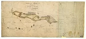
Background imageMaps of Sheffield Collection: Fulwood Mills etc belonging to George Smith, Sheffield, Yorkshire, 1802

Fulwood Mills etc belonging to George Smith, Sheffield, Yorkshire, 1802
From an original at Sheffield Libraries: arc03970

Background imageMaps of Sheffield Collection: Endcliffe Crescent, Sheffield. c. 1830

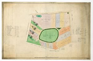
Endcliffe Crescent, Sheffield. c. 1830
Full title: The Endcliffe Building Companys land as finally divided Original at Sheffield City Libraries: arc03957

Background imageMaps of Sheffield Collection: Plan of several estates in the townships of Ecclesall Bierlow and Nether Hallam

Plan of several estates in the townships of Ecclesall Bierlow and Nether Hallam
Full title: Plan of several estates in the townships of Ecclesall Bierlow and Nether Hallam, the property of Joseph and William Wilson. Dated [c

Background imageMaps of Sheffield Collection: Plan of Broomhall area of Sheffield, 1810

Plan of Broomhall area of Sheffield, 1810
Full title: Lots of Broom Hall estate referred to by conditions of sale. Right: Broom Hall [Broomhall Road], Broom Lodge, [Wharncliffe Road, Broomhall Road, Collegiate Crescent, Ecclesall Road]

Background imageMaps of Sheffield Collection: Plan of Broomgrove estate, Sheffield, 1830

Plan of Broomgrove estate, Sheffield, 1830
Full title: Plan of Broom Grove estate in the township of Ecclesall Bierlow divided into lots for sale. Right hand side: Shows Broom Grove House (with gardens, orchard, yard, barn)

Background imageMaps of Sheffield Collection: The Duke of Norfolks estates in Brightside Bierlow, Sheffield, [mid 19th cent]

The Duke of Norfolks estates in Brightside Bierlow, Sheffield, [mid 19th cent]
From an original at Sheffield Libraries: arc03909

Background imageMaps of Sheffield Collection: Plan of the Cutlers Wheel House on Little Sheffield Moor, 1784

Plan of the Cutlers Wheel House on Little Sheffield Moor, 1784
Full title: A plan of the Cutlers Wheel House on Little Sheffield Moor held of the Earl of Surrey by James Bennett. Bennetts Wheel and dam

Background imageMaps of Sheffield Collection: Sheffield, Canal Basin, early 19th cent

Sheffield, Canal Basin, early 19th cent
From an original at Sheffield Libraries: arc03509

Background imageMaps of Sheffield Collection: Sheffield markets and street layout, c. 1839

Sheffield markets and street layout, c. 1839
The Duke of Norfolk and Sheffield Corporation - Sheffield Markets - tracing from plan attached to the 1839 settlement (tracing made in 1898) from an original at Sheffield Libraries: arc03513

Background imageMaps of Sheffield Collection: Plan of property at the northern end of Shaw Tongue, Sheffield, 1786

Plan of property at the northern end of Shaw Tongue, Sheffield, 1786
Full title: A Plan of part of George Wilkinsons parcel of ground in Shaw Tongue assigned by him to Joseph Ward. cale 10 yards : 1 inch. Surveyor: William Fairbank II

Background imageMaps of Sheffield Collection: Plan showing Clifford House, Psalter Lane, Sheffield, Yorkshire, 1820

Plan showing Clifford House, Psalter Lane, Sheffield, Yorkshire, 1820
Scale 1 inch : 100 yards. Surveyors: W and J. Fairbank. Includes Clifford House, pleasure gardens and plantation; school, parcels of lands such as Workhouse Croft

Background imageMaps of Sheffield Collection: Plan of Sandbed Wheel held of the Earl of Surrey by the assignees of Thomas Broadbent, Neepsend

Plan of Sandbed Wheel held of the Earl of Surrey by the assignees of Thomas Broadbent, Neepsend, Sheffield, 1783
Scale: 2 chains : 1 inch [40 inches : 1 mile] Surveyor: William Fairbank II. Wheels, dam and goit clearly shown and named; numerical list with descriptions and acreages; height of fall given

Background imageMaps of Sheffield Collection: Map of Several strips and a close between Heeley Town Gate and Heeley Green

Map of Several strips and a close between Heeley Town Gate and Heeley Green, on (modern Gleadless Road), Sheffield
Full title: Map of several parcels of land, [the] property of [the] Duke of Norfolk and R. Gillot. Scale [3 chains : 1 inch] [26.6 inches : 1 mile] Surveyor: William Fairbank I

Background imageMaps of Sheffield Collection: Plan of Nether Heeley, Sheffield, 1783

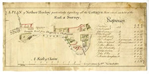
Plan of Nether Heeley, Sheffield, 1783
Full title: Plan of Nether Heeley particularly describing all the Cottages there which are held of the Earl of Surrey, From an original at Sheffield Libraries: arc02729

Background imageMaps of Sheffield Collection: Map of land at Heeley, Sheffield, 1758

Map of land at Heeley, Sheffield, 1758
Full title: Map of several intermixed parcels of land at Heeley, the property of the Duke of Norfolk and S. Shore, esquire

Background imageMaps of Sheffield Collection: Map of Owlerbottoms in Stephen Hawksworths Farm, Nether Green, Sheffield, 1746

Map of Owlerbottoms in Stephen Hawksworths Farm, Nether Green, Sheffield, 1746
Scale 2 chains : 1 inch [40 inches : 1 mile] Surveyor: William Fairbank I. Woodland alongside the Porter Brook, west of Smith Wood; acreage of the whole; boundary trees and border coloured

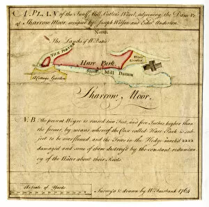
Background imageMaps of Sheffield Collection: Plan of the Snuff Mill, Cutlers Wheel, adjoining the Dam etc at Sharrow Moor, Sheffield, 1764

Plan of the Snuff Mill, Cutlers Wheel, adjoining the Dam etc at Sharrow Moor, Sheffield, 1764
Scale 45 yards : 1 inch [approx. 40 inches : 1 mile]. Surveyor: William Fairbank II. Weir, dam and wheel shown; a note explains the extension of the new weir into Hare Park

Background imageMaps of Sheffield Collection: Map of the Two Lock Lodge Closes, with the Upper and Lower Slack Wheels

Map of the Two Lock Lodge Closes, with the Upper and Lower Slack Wheels and the Ground held with them of the Earl of
From an original at Sheffield Libraries: arc02711

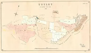
Background imageMaps of Sheffield Collection: Plan of Totley as allotted for sale, 1859

Plan of Totley as allotted for sale, 1859
From an original at Sheffield Libraries: y10756

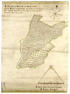
Background imageMaps of Sheffield Collection: A survey of the Winco-Bank [Wincobank] Wood, called Great Winco... the Howlt included... 1730

A survey of the Winco-Bank [Wincobank] Wood, called Great Winco... the Howlt included... 1730
From an original at Sheffield Libraries: arc02698

Background imageMaps of Sheffield Collection: A map of the lands near Attercliffe and Darnall, [?1820s]

A map of the lands near Attercliffe and Darnall, [?1820s]
From an original at Sheffield Libraries: arc02686

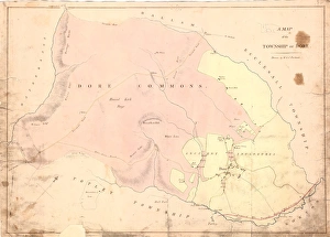
Background imageMaps of Sheffield Collection: A map of the township of Dore, by W. and J. Fairbank, c. 1810-1820

A map of the township of Dore, by W. and J. Fairbank, c. 1810-1820
No scale stated. Shows Wilmer Edge, Reeve Edge, Burbage Rocks, Sheep hill, Hound Kirk Bage, Stony Ridge, Brawn Side, Strawberry Lee, Hall Field, White Lowe, Hound Kirk Hill, paper mill

Background imageMaps of Sheffield Collection: View of Sheffield, c. 1720-1740

View of Sheffield, c. 1720-1740
Full title: To the Worshipful the Master, Wardens, Searchers and Assistants of the Corporation of the Cutlers in Hallamshire in the County of York

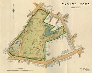
Background imageMaps of Sheffield Collection: Plan of Weston Park, Sheffield, 1897

Plan of Weston Park, Sheffield, 1897
Original at Sheffield Libraries: y09352

Background imageMaps of Sheffield Collection: Roads at Lodge Moor Hospital: A plan showing carriageways and ash paths, early 20th cent

Roads at Lodge Moor Hospital: A plan showing carriageways and ash paths, early 20th cent
Surveyor: Sheffield City Council.Scale: 60 feet : 1 inch.Original at Sheffield Local Studies Library:s (9) 5 L

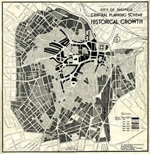
Background imageMaps of Sheffield Collection: City of Sheffield Central Planning Scheme, Historical Growth, 1938

City of Sheffield Central Planning Scheme, Historical Growth, 1938
Shows how Sheffield developed from 1736 onwards.Published by Sheffield City Council, Town Planning CommitteeScale: 208.33 feet : 1 inch.Size: 52 x 45 cm.Original at Sheffield Local Studies Library

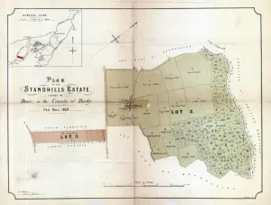
Background imageMaps of Sheffield Collection: Plan of the Standhills Estate, Dore, Derbyshire, 1969

Plan of the Standhills Estate, Dore, Derbyshire, 1969
Scale [1/8th inch : 10 yards]. S. F. Holmes, Surveyors, Sheffield. Printed by S. Harrison, Lithographer. Lot 2 Standhills Farm (house, building and stack yards (tenant Hugh Mount)

Background imageMaps of Sheffield Collection: Map of Sheffield by R. Creighton, c. 1835

Map of Sheffield by R. Creighton, c. 1835
Original at Sheffield Local Studies Librarys 49 S

Background imageMaps of Sheffield Collection: Sheffield drink (temperance) map, 1884

Sheffield drink (temperance) map, 1884
Full title: Map of the Town of Sheffield with the licensed public houses, beer shops, grocers and other licenses, marked thereon From an original at Sheffield Libraries: y09165

Background imageMaps of Sheffield Collection: Map of the town and environs of Sheffield by J. Tayler, 1832

Map of the town and environs of Sheffield by J. Tayler, 1832
Scale 1 inch : 180 yards. From an original at Sheffield Libraries: arc01933

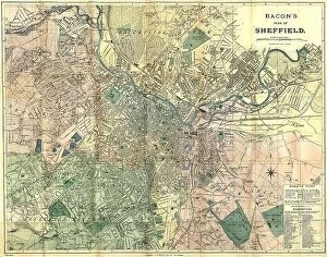
Background imageMaps of Sheffield Collection: Bacon's large scale plan of Sheffield, c.1890s

Bacon's large scale plan of Sheffield, c.1890s
Published by G W Bacon & Co Ltd. c. 1890s. Scale [7.4 inches : 1 mile]. Shows Borough wards. Dimensions of original: 70 x 55 cm. Original at Sheffield Libraries: y15494

Background imageMaps of Sheffield Collection: Lower ground floor plan of new Castle Market, Haymarket / Waingate, 1958

Lower ground floor plan of new Castle Market, Haymarket / Waingate, 1958
Original at Sheffield Libraries: y10488

Background imageMaps of Sheffield Collection: Plan of land for sale situate at Ranmoor, Sheffield, 1869

Plan of land for sale situate at Ranmoor, Sheffield, 1869
S. F. Holmes, Surveyor, Sheffield. Printed by Pawson and Brailsford. Three closes of land called The Watt Fields in the occupation of John Elliott, the owner. Original at Sheffield Libraries: y12222

Background imageMaps of Sheffield Collection: land at Upperthorpe and an estate at Hollins, near Malin Bridge, in the hamlet of Stannington, 1869

land at Upperthorpe and an estate at Hollins, near Malin Bridge, in the hamlet of Stannington, 1869
Full title: Plan of freehold land at Upperthorpe and an estate at Hollins, near Malin Bridge, in the hamlet of Stannington belonging to the trustees of the will of the late Thomas Blake, esquire

Background imageMaps of Sheffield Collection: Plan of the High Storrs Estate, 1869

Plan of the High Storrs Estate, 1869
S. F. Holmes, Surveyors, Sheffield. Printed by Pawson and Brailsford. Lot 1 Patrick Storrs. Plot 2 Near Carr Head, Middle Carr and Far Carr. Lot 3 Briary Carr and Rough Bank

Background imageMaps of Sheffield Collection: Endcliffe Hall estate, Sheffield, 1895

Endcliffe Hall estate, Sheffield, 1895
Scale 100 feet : 1 inch. Flockton and Gibbs, Surveyors, Sheffield. Printed by Pawson and Brailsford. From an original at Sheffield Libraries: y12214

Background imageMaps of Sheffield Collection: Endcliffe Hall, Sheffield floor plans, 1895

Endcliffe Hall, Sheffield floor plans, 1895
Original at Sheffield Libraries: y12213

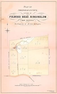
Background imageMaps of Sheffield Collection: Sale plan Fulwood Head, Ringinglow, Sheffield, 1867

Sale plan Fulwood Head, Ringinglow, Sheffield, 1867
From an original at Sheffield Libraries: y11251

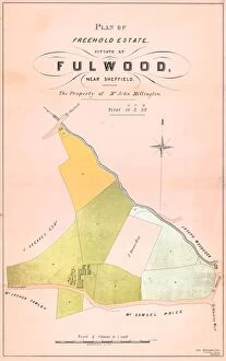
Background imageMaps of Sheffield Collection: Property at Fulwood, Sheffield, 1867

Property at Fulwood, Sheffield, 1867
Full title: Plan of freehold estate situate at Fulwood the property of Mr John Millington From an original at Sheffield Libraries: y11250

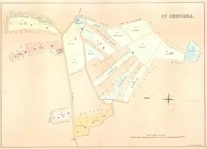
Background imageMaps of Sheffield Collection: Farmhouse, land and other property at Greenhill, Norton, 1858

Farmhouse, land and other property at Greenhill, Norton, 1858
Lot 10 a comfortable house in the village of Greenhill and adjoining the Town Street there, in the occupation of Mr William Outwin, together with the garden and orchard, barn, stable, cowhouses

Background imageMaps of Sheffield Collection: East view of the Town of Sheffield in the County of York, 1826

East view of the Town of Sheffield in the County of York, 1826
Surveyed by William Ibbitt.Engraved by Henry White.Printed by R Fenner.Original at Sheffield Local Studies Library:s 21 L

Background imageMaps of Sheffield Collection: Plan of Sheffield, 1838

Plan of Sheffield, 1838
Published with William Whites History and Directory of Yorkshire. Includes a view of Sheffield Parish Church, now Sheffield Cathedral. Scale 500 yards : 1.6 inches

Background imageMaps of Sheffield Collection: Plan of the Broom Grove [Broomgrove] Estate, in the Township of Ecclesall Bierlow

Plan of the Broom Grove [Broomgrove] Estate, in the Township of Ecclesall Bierlow, divided into Lots for Sale
By Josiah Fairbank and Son. Scale 3 chains to 1 inch. Size 55 x 45 cm. Original at Sheffield Local Studies Library: y09227

Background imageMaps of Sheffield Collection: A complete plan of the Town of Sheffield by William Fairbank, 1771

A complete plan of the Town of Sheffield by William Fairbank, 1771
From an original at Sheffield Libraries: y09226

Background imageMaps of Sheffield Collection: New Central Library and Art Gallery building, Surrey Street - sections, 1930

New Central Library and Art Gallery building, Surrey Street - sections, 1930
Scale: 1 inch : 8 feet. Original at Sheffield Archives arc01114


All Professionally Made to Order for Quick Shipping


-

Why Choose Us?

We are a leading provider of Art Prints and Photo Gifts since 2003, working in partnership with a range of Sporting Clubs, Charities, Museums and Picture Libraries. A large share of profits from any of their images will go directly towards supporting that charity or club. Our archive of images is carefully curated to bring you a wide range of subjects, including landscapes, wildlife, architecture, and more. We ship from our partner labs in the UK, USA, EU (Netherlands) and Australia.
+

How do I place an order?

Ordering is quick & easy - Just follow 5 Simple Steps:
  1. Find your image: Use our search box or browse our online photo Collections to find the image you want.

  2. Choose your print format: Select your desired product and add it to your cart.

  3. Enter your details: If you're a returning customer, simply enter your email address and password, and we'll fill in your billing and shipping address details. All personal details are held securely and are fully GDPR compliant. As standard, we remove all Personally Identifiable Information after 12 months.

  4. Pay for your purchase: We use state-of-the-art security for online shopping and do not have access to your card details.

  5. Sit back and relax: We'll email you confirmation of your order and when it's dispatched. Registered customers can also track orders in the 'My Account' area.

+

How do I pay for an order?

You can pay for your order with most of the major credit and debit cards, or PayPal. For added security, major financial institutions process payment details separately and securely on our behalf. We do not have access to your online payment card details. Online payments are preferred however we do take phone orders. For UK customers only we accept cheques issued against a UK bank.
+

Is my data safe?

We take data security very seriously. We do not have access to your full card details and all payments are requested over a fully secure connection. Additionally, we fully comply with current European and GDPR legislation, and automatically remove all personal data after at most 12 months (unless you have an account with us and have signed in recently). We also have a strict opt-in policy and would never sell your personal details. Your data is only used to fulfill your order promptly and efficiently.
+

Is wall art ready to hang?

For quick and easy installation all wall art, including framed prints, canvas prints and metal prints are supplied with a ready to hang solution on the back. Generally, saw tooth hangers are applied as they allow wall art to hang flush against the wall. The serrated edge of the hanger prevents the frame from shifting or tilting when hung.
+

Are the photo prints fade resistant?

Yes, we use archival quality photo paper photographic paper for vivid reproduction Prints are an accurate representations of the original artwork, which is preserved for artistic character and authenticity. We guarantee they match previews shown on our web site