Fraud Blocker Skip to main content

Home > Scottish Canals > ScottishCanals

ScottishCanals Collection

Choose a picture from our collection for your Wall Art and Photo Gifts

28 Items

We are proud to offer this selection in partnership with Scottish Canals

Background imageScottishCanals Collection: SC0150reduced

SC0150reduced

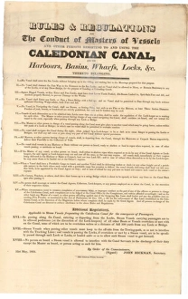
Background imageScottishCanals Collection: Rules & Regulations for the Conduct of Masters of Vessels and Other Persons Resorting to

Rules & Regulations for the Conduct of Masters of Vessels and Other Persons Resorting to
Poster advertising the rules and regulations for boaters and other customers of the Caledonian Canal from 1824

Background imageScottishCanals Collection: Canal Basin Area. The Corporation of Edinburgh and The North British Railway Company

Canal Basin Area. The Corporation of Edinburgh and The North British Railway Company
Plan of the former Union Canal terminus basins at Port Hopetoun and Port Hamilton, Edinburgh, an area of the city now known as Lochrin Basin or Edinburgh Quay

Background imageScottishCanals Collection: SC0362Breduced

SC0362Breduced

Background imageScottishCanals Collection: ScottishCanals

ScottishCanals
Scottish Canals ScottishCanals

Background imageScottishCanals Collection: Map or Chart of the Caledonian Canal

Map or Chart of the Caledonian Canal
Plan showing the Caledonian Canal from Fort William to Inverness including nearby lochs, rivers and settlements. Ordered by the House of Commons and printed by W. & A. K. Johnston Limited, Edinburgh

Background imageScottishCanals Collection: Plan of the Crinan Canal from the March of Dunadry on the South to Port Ree on the North No

Plan of the Crinan Canal from the March of Dunadry on the South to Port Ree on the North No
Plan showing the route of the Crinan Canal from Bellanoch to Crinan. Surveyed and planned by David Smith

Background imageScottishCanals Collection: Plan of the Crinan Canal from the March of Oakfield on the South to the March of Blarindibbart on the North Plan No

Plan of the Crinan Canal from the March of Oakfield on the South to the March of Blarindibbart on the North Plan No
Plan showing the route of the Crinan Canal from Craiglass to Bellanoch. Surveyed and planned by David Smith

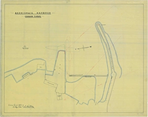
Background imageScottishCanals Collection: Plan of Ardrishaig Harbour

Plan of Ardrishaig Harbour showing the pier, breakwater and lighthouse, sea lock, and pier buildings

Background imageScottishCanals Collection: Plan of the Caledonian Canal and lands belonging thereto Part V

Plan of the Caledonian Canal and lands belonging thereto Part V
Part 5 in a series of plans showing land belonging to Locheil of Invernessshire and Argyleshire and Lord Abinger of Inverlochy

Background imageScottishCanals Collection: Plan of the Caledonian Canal and lands belonging thereto Part IV

Plan of the Caledonian Canal and lands belonging thereto Part IV
Part 4 in a series of plans showing land belonging to Lord Ward of the estate of Glengarry where they meet land belonging to the Caledonian Canal Company from Aberchalder to Loch Lochy

Background imageScottishCanals Collection: SC0503reduced

SC0503reduced

Background imageScottishCanals Collection: Plan of the Caledonian Canal and lands belonging thereto Part I

Plan of the Caledonian Canal and lands belonging thereto Part I
Part 1 in a series of plans showing land belonging to the Estate of Muirtown

Background imageScottishCanals Collection: Plan of the Crinan Canal through the Estate of Oakfield Plan No. I

Plan of the Crinan Canal through the Estate of Oakfield Plan No. I
Plan showing the route of the Crinan Canal from Ardrishaig to Craiglass and through the Oakfield Estate. Surveyed and planned by David Smith

Background imageScottishCanals Collection: SC0556reduced

SC0556reduced

Background imageScottishCanals Collection: SC0128reduced

SC0128reduced

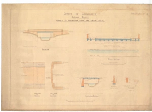
Background imageScottishCanals Collection: County of Linlithgow Bathgate District Bridge at Broxburn over the Union Canal Drawing No

County of Linlithgow Bathgate District Bridge at Broxburn over the Union Canal Drawing No
Plan, sections and elevations of the bridge over the Union Canal at Broxburn

Background imageScottishCanals Collection: Plan of the Caledonian Canal and lands belonging thereto Part II

Plan of the Caledonian Canal and lands belonging thereto Part II
Part 2 in a series of plans showing land belonging to Lady Saltoun of Ness Castle Estate, the Estate of Dunain

Background imageScottishCanals Collection: Plan of the Caledonian Canal and lands belonging thereto Part III

Plan of the Caledonian Canal and lands belonging thereto Part III
Part 3 in a series of plans showing land belonging to A. T. F

Background imageScottishCanals Collection: Plan of the Caledonian Canal and lands belonging thereto Part VI

Plan of the Caledonian Canal and lands belonging thereto Part VI
Part 6 in a series of plans showing land belonging to D. Cameron Esquire of Loch Eil where they meet land belonging to the Caledonian Canal Company

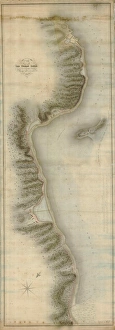
Background imageScottishCanals Collection: Plan of the Caledonian Canal betwixt Clachnacharry and Lochness with the Adjacent Country

Plan of the Caledonian Canal betwixt Clachnacharry and Lochness with the Adjacent Country
Plan of a section of the Caledonian Canal between Clachnacharry and Lochness and showing the adjacent land boundaries. A note on the reverse of the plan states that it was surveyed by W

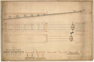
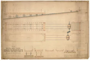
Background imageScottishCanals Collection: Monkland Canal. Details of the Machinery of the Proposed Inclined Plane at Blackhill

Monkland Canal. Details of the Machinery of the Proposed Inclined Plane at Blackhill
Plan showing details of the machinery of the proposed inclined plane at Blackhill. Part of a series of plans of Blackhill drawn by James Leslie

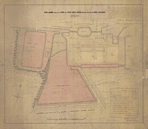
Background imageScottishCanals Collection: Plan of Gound Feued by the Forth and Clyde Canal Company from the Earl of Zetland

Plan of Gound Feued by the Forth and Clyde Canal Company from the Earl of Zetland
Plan of lands leased to the Forth and Clyde Canal Company by the Earl of Zetland at Grangemouth

Background imageScottishCanals Collection: A Map of the Monkland Canal Drawn by Hugh Pate

A Map of the Monkland Canal Drawn by Hugh Pate
A map of the route of the Monkland Canal showing the locations, and listing the names of, houses and bridges adjacent to the canal

Background imageScottishCanals Collection: Plan of the Monkland Canal from Coats Lands to the Termination at Wood Hall Bridge

Plan of the Monkland Canal from Coats Lands to the Termination at Wood Hall Bridge
Plan of a section of the Monkland Canal at Coatbridge

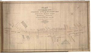
Background imageScottishCanals Collection: Plan of the boundary line between the Inchbelly Road

Plan of the boundary line between the Inchbelly Road
Plan showing the boundary line between the Inchbelly and Sitrlings turnpike roads, Glasgow, and also showing the former Monkland Canal basin

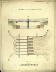
Background imageScottishCanals Collection: Turnpike Road Bridge

Turnpike Road Bridge
Plan and sections of the turnpike road bridge drawn as a set of plans of the bridges and culverts to be built on a proposed extension of the canal from Wyndford to Donnyloanhead

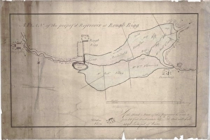
Background imageScottishCanals Collection: Plan of the Proposed Reservoir at Roughrigg

Plan of the Proposed Reservoir at Roughrigg
Plan of the proposed reservoir at Roughrigg showing land ownership


All products are expertly crafted, using premium materials, tailored to your specifications and promptly shipped


© Copyright Media Storehouse, All Rights Reserved 2003 - 2025
Facebook     Pinterest     100% Payment Secure     Reviews IO