Postcard > Europe > United Kingdom > England > West Sussex > Cuckfield
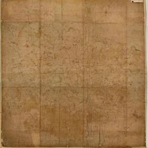
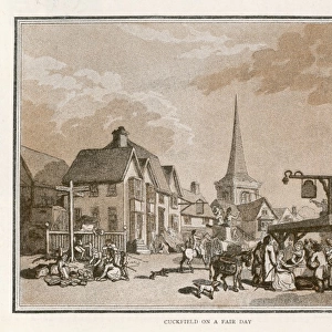
Postcard : Cuckfield tithe map, 1845


![]()
Cards from West Sussex County Council
Cuckfield tithe map, 1845
Surveyor unknown. 8 in. to 1m. 53 × 42
Tithe Award Map Collection
West Sussex Record Office Ref No: TD/E91
West Sussex County Council Record Office contains a fascinating history of the county of West Sussex, England
Media ID 10702224
© West Sussex County Council - All Rights Reserved
1840s 19th Century Historical Mapping South Of England
Postcards (8 pack of A6)
Set of 8, A6 Postcards, featuring the same image on all cards in a set. Printed on 350gsm premium white satin card, the back of the postcard includes space to write messages and an area for the address and stamp. Size of each postcard is 15cm x 10.6cm.
Photo postcards are a great way to stay in touch with family and friends.
Estimated Product Size is 10.6cm x 15cm (4.2" x 5.9")
These are individually made so all sizes are approximate
Artwork printed orientated as per the preview above, with landscape (horizontal) or portrait (vertical) orientation to match the source image.
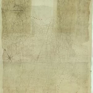
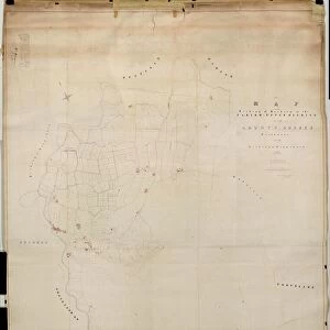
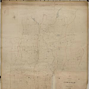
FEATURES IN THESE COLLECTIONS
> Europe
> United Kingdom
> England
> Maps
> Europe
> United Kingdom
> England
> Sussex
> Cuckfield
> Europe
> United Kingdom
> England
> Sussex
> Related Images
> Europe
> United Kingdom
> England
> West Sussex
> Cuckfield
> Europe
> United Kingdom
> England
> West Sussex
> Related Images
> Maps and Charts
> Early Maps
> Maps and Charts
> Related Images
> West Sussex County Council
> West Sussex Record Office
> Tithe Award Maps, 1808-1859
EDITORS COMMENTS
This print showcases the Cuckfield tithe map from 1845, an invaluable piece of historical mapping that offers a glimpse into the past. The surveyor responsible for this remarkable creation remains unknown, yet their meticulous attention to detail is evident in every inch of this masterpiece. Measuring at a scale of 8 inches to 1 meter, the map spans an impressive area of 53 by 42 meters. Part of the esteemed Tithe Award Map Collection housed at West Sussex Record Office, this artifact holds immense significance for researchers and history enthusiasts alike. Transporting us back to the vibrant era of the mid-19th century, it provides valuable insights into land ownership and usage during that time period. The Cuckfield tithe map serves as a testament to the rich heritage and cultural tapestry found in South England. Its intricate depiction captures not only geographical features but also highlights various settlements and landmarks that have shaped local communities over centuries. It is important to note that this particular image should not be associated with any commercial use or company. Instead, its true value lies in preserving our collective history and fostering a deeper understanding of our roots. Thanks to West Sussex County Council's commitment to safeguarding these treasures, we can continue exploring our past through such extraordinary relics like this one.
MADE IN THE UK
Safe Shipping with 30 Day Money Back Guarantee
FREE PERSONALISATION*
We are proud to offer a range of customisation features including Personalised Captions, Color Filters and Picture Zoom Tools
SECURE PAYMENTS
We happily accept a wide range of payment options so you can pay for the things you need in the way that is most convenient for you
* Options may vary by product and licensing agreement. Zoomed Pictures can be adjusted in the Basket.