Postcard > Fine Art Finder > Artists > John (after) Smith
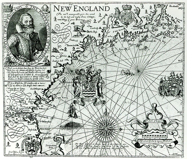
Postcard : Map of the New England coastline in 1614, engraved by Simon de Passe (1595-1647) 1616
Resolution may be poor at this size (98 DPI)
![]()

Cards from Fine Art Finder
Map of the New England coastline in 1614, engraved by Simon de Passe (1595-1647) 1616
XJF103759 Map of the New England coastline in 1614, engraved by Simon de Passe (1595-1647) 1616 (engraving) (b&w photo) by Smith, John (1580-1631) (after); Private Collection; English, out of copyright
Media ID 12696815
© www.bridgemanart.com
Boston Cartouche Charles River Compass New Hampshire Royal Coat Of Arms
Postcards (8 pack of A6)
Set of 8, A6 Postcards, featuring the same image on all cards in a set. Printed on 350gsm premium white satin card, the back of the postcard includes space to write messages and an area for the address and stamp. Size of each postcard is 15cm x 10.6cm.
Photo postcards are a great way to stay in touch with family and friends.
Estimated Product Size is 15cm x 10.6cm (5.9" x 4.2")
These are individually made so all sizes are approximate
Artwork printed orientated as per the preview above, with landscape (horizontal) or portrait (vertical) orientation to match the source image.
EDITORS COMMENTS
This print showcases a remarkable piece of history - the "Map of the New England coastline in 1614". Engraved by Simon de Passe, a talented artist from the early 17th century, this map offers us a glimpse into the past. The intricate details on this engraving are truly awe-inspiring. From the beautifully designed cartouche to the portrait of Simon de Passe himself at age 37, every element has been carefully crafted. The compass rose indicates direction while adding an elegant touch to the overall composition. As we explore this map, our eyes are drawn to significant landmarks such as Charles River and Boston. These names evoke images of bustling colonial towns that would later become integral parts of American history. Further north, we can see New Hampshire with its own distinct features. One cannot help but notice the presence of the royal coat of arms prominently displayed on this map. It serves as a reminder that during this time period, England held dominion over these lands. This particular print is part of a private collection and holds immense historical value. It allows us to appreciate both Simon de Passe's artistic talent and gain insight into what life was like along New England's coastline in 1614.
MADE IN THE UK
Safe Shipping with 30 Day Money Back Guarantee
FREE PERSONALISATION*
We are proud to offer a range of customisation features including Personalised Captions, Color Filters and Picture Zoom Tools
SECURE PAYMENTS
We happily accept a wide range of payment options so you can pay for the things you need in the way that is most convenient for you
* Options may vary by product and licensing agreement. Zoomed Pictures can be adjusted in the Basket.


