Photographic Print > Europe > Portugal > Maps
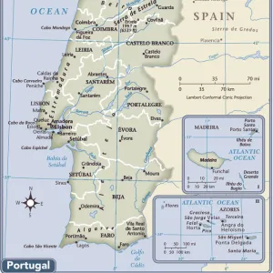
Photographic Print : Mercator Atlas Plate II Spain and Portugal


![]()
Photo Prints from Fine Art Storehouse
Mercator Atlas Plate II Spain and Portugal
Antique Maps, TR001708
Unleash your creativity and transform your space into a visual masterpiece!
Fototeca Gilardi
Media ID 18443301
10"x8" (25x20cm) Photo Print
Discover the rich history and intricate detail of the Iberian Peninsula with our exquisite Mercator Atlas Plate II Spain and Portugal print from Fototeca Gilardi, available in our Media Storehouse Fine Art collection. This antique map, originally published in 1578, showcases the meticulously hand-drawn borders, geographical features, and cartographic innovations of the time. Bring a piece of historical cartography into your home or office and transport yourself back to the age of exploration with this stunning work of art.
Printed on archival quality paper for unrivalled stable artwork permanence and brilliant colour reproduction with accurate colour rendition and smooth tones. Printed on professional 234gsm Fujifilm Crystal Archive DP II paper. 10x8 for landscape images, 8x10 for portrait images.
Our Photo Prints are in a large range of sizes and are printed on Archival Quality Paper for excellent colour reproduction and longevity. They are ideal for framing (our Framed Prints use these) at a reasonable cost. Alternatives include cheaper Poster Prints and higher quality Fine Art Paper, the choice of which is largely dependant on your budget.
Estimated Product Size is 25.4cm x 20.3cm (10" x 8")
These are individually made so all sizes are approximate
Artwork printed orientated as per the preview above, with landscape (horizontal) or portrait (vertical) orientation to match the source image.
FEATURES IN THESE COLLECTIONS
> Fine Art Storehouse
> Map
> Historical Maps
> Europe
> Portugal
> Related Images
> Europe
> Spain
> Related Images
> Maps and Charts
> Related Images
> Maps and Charts
> Spain
EDITORS COMMENTS
This print showcases the exquisite "Mercator Atlas Plate II Spain and Portugal" from the renowned collection of Antique Maps. With its intricate details and historical significance, this piece transports us back in time to an era when cartography was a true art form. The map, meticulously crafted by Gerardus Mercator himself, offers a fascinating glimpse into the geography of Spain and Portugal during the 16th century. Every contour line, river course, and city placement is expertly depicted with remarkable precision. As we gaze upon this masterpiece, we are reminded of how these maps were not only navigational tools but also works of beauty that captured the imagination of explorers and scholars alike. Fototeca Gilardi has skillfully preserved this rare gem for generations to come. The rich colors and fine details showcased in this print allow us to appreciate every nuance of Mercator's original creation. It serves as a testament to both his mastery as a cartographer and Fototeca Gilardi's commitment to preserving our cultural heritage. Whether displayed in a study or gallery space, this print invites viewers on an enchanting journey through time. It sparks curiosity about the past while reminding us of the importance of preserving historical artifacts like antique maps for future generations' appreciation
MADE IN THE UK
Safe Shipping with 30 Day Money Back Guarantee
FREE PERSONALISATION*
We are proud to offer a range of customisation features including Personalised Captions, Color Filters and Picture Zoom Tools
SECURE PAYMENTS
We happily accept a wide range of payment options so you can pay for the things you need in the way that is most convenient for you
* Options may vary by product and licensing agreement. Zoomed Pictures can be adjusted in the Basket.