Photo Mug > Europe > France > Paris > Maps
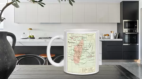
Photo Mug : Madagascar Comores Islands map 1887


![]()
Home Decor from Fine Art Storehouse
Madagascar Comores Islands map 1887
Map from La Premiere Annee de Geographie par P. Foncin - Paris 1887
Unleash your creativity and transform your space into a visual masterpiece!
THEPALMER
Media ID 20773123
© A 2014 Roberto Adrian Photography
Photo Mug
Bring a piece of historical cartography to your morning routine with our Media Storehouse Photo Mug featuring the stunning Madagascar Comores Islands map from 1887 by THEPALMER from the Fine Art Storehouse. This vintage map, taken from "La Premiere Annee de Geographie par P. Foncin - Paris 1887," adds an intriguing touch to your daily coffee or tea ritual. Embrace the rich history of cartography and transport yourself to a bygone era with each sip. Perfect for history enthusiasts, travelers, or anyone who appreciates the beauty of old maps. Order yours today and make every cup an adventure!
A personalised photo mug blends sentimentality with functionality, making an ideal gift for cherished loved ones, close friends, or valued colleagues. Preview may show both sides of the same mug.
Elevate your coffee or tea experience with our premium white ceramic mug. Its wide, comfortable handle makes drinking easy, and you can rely on it to be both microwave and dishwasher safe. Sold in single units, preview may show both sides of the same mug so you can see how the picture wraps around.
Mug Size is 9.5cm high x 8cm diameter (3.7" x 3.1")
These are individually made so all sizes are approximate
FEATURES IN THESE COLLECTIONS
> Africa
> Madagascar
> Maps
> Africa
> Madagascar
> Related Images
> Europe
> France
> Paris
> Maps
> Maps and Charts
> Related Images
EDITORS COMMENTS
This print showcases a historical gem, the "Madagascar Comores Islands map 1887" sourced from the esteemed collection of La Premiere Annee de Geographie par P. Foncin in Paris, 1887. The intricate details and vibrant colors of this vintage map transport us back to an era when cartography was both an art form and a scientific endeavor. The Madagascar Comores Islands map takes center stage, revealing the geographical wonders of these enchanting islands nestled in the Indian Ocean. Every contour line, coastal feature, and topographic element has been meticulously rendered with precision and care. It is as if we can almost feel the gentle breeze coming off the ocean while exploring this mesmerizing piece. The rich history behind this print adds another layer of fascination to its allure. As we gaze upon it, we are reminded of a time when explorers embarked on daring journeys to uncover new lands and chart uncharted territories. This map serves as a testament to their courage and curiosity. Expertly captured by THEPALMER's lens, this print effortlessly preserves every minute detail for posterity. Its high-quality reproduction allows us to appreciate not only the beauty but also the historical significance encapsulated within its frame. Whether you are an avid collector or simply captivated by history's mysteries, this Madagascar Comores Islands map will undoubtedly become a cherished addition to any space it graces – transporting you on an imaginary voyage through time itself.
MADE IN THE UK
Safe Shipping with 30 Day Money Back Guarantee
FREE PERSONALISATION*
We are proud to offer a range of customisation features including Personalised Captions, Color Filters and Picture Zoom Tools
SECURE PAYMENTS
We happily accept a wide range of payment options so you can pay for the things you need in the way that is most convenient for you
* Options may vary by product and licensing agreement. Zoomed Pictures can be adjusted in the Basket.