
Maps Collection
Maps of Papua New Guinea Oceania are a great resource for anyone looking to explore this beautiful region
Choose a picture from our Maps Collection for your Wall Art and Photo Gifts
46 items


All Professionally Made to Order for Quick Shipping
-
Maps Collection
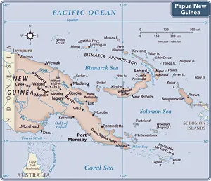
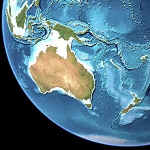
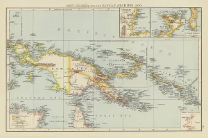
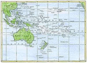
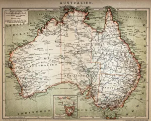
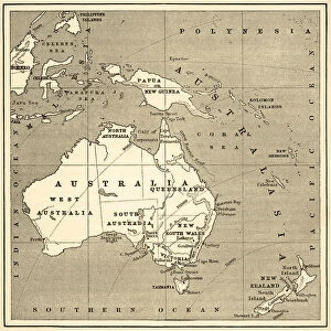
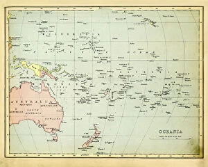
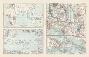
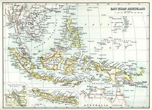
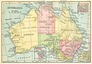
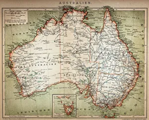
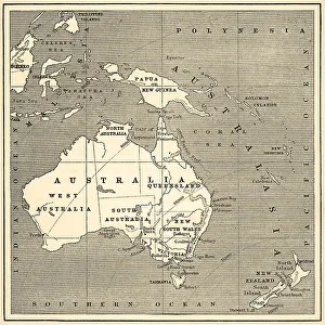
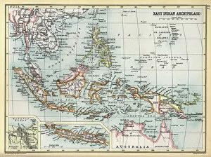
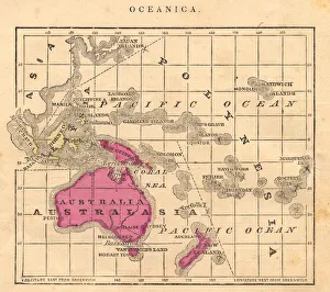
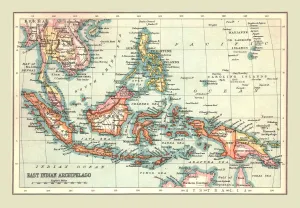
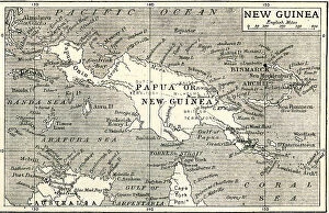
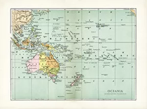
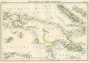
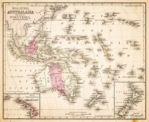
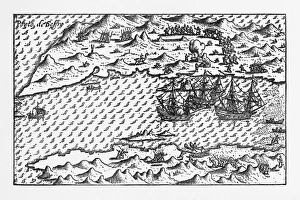
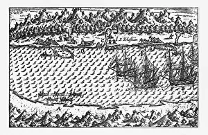
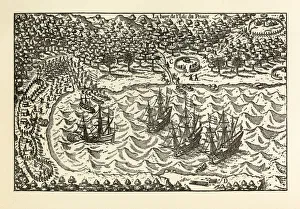
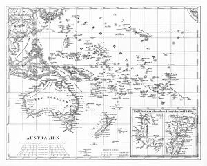
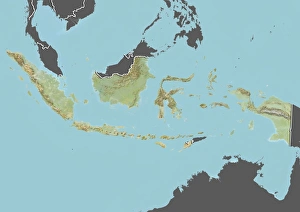
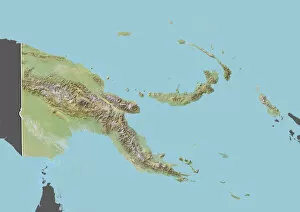
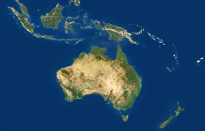
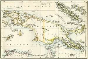
Maps of Papua New Guinea Oceania are a great resource for anyone looking to explore this beautiful region. The maps provide detailed information about the geography, including roads, rivers, lakes and other points of interest. They also show the political boundaries between provinces and districts. They can available in both physical and digital formats, making them easy to access for anyone with an internet connection or a printer. They provide an invaluable tool for travelers planning their trip as well as those who want to learn more about the area's history and culture. With these maps, visitors can easily find their way around Papua New Guinea Oceania with ease.
+
Our beautiful pictures are available as Framed Prints, Photos, Wall Art and Photo Gifts
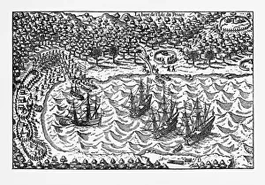
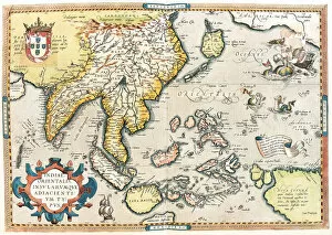
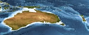
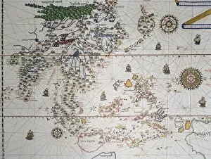
Media Storehouse offers a stunning collection of Maps of Papua New Guinea Oceania, which includes wall art and framed prints. Our collection features maps that showcase the geography, topography, and cultural diversity of Papua New Guinea in detail. These maps are perfect for those who want to explore the country's history or plan their travel itinerary. Our collection includes vintage maps from the 19th century as well as modern-day satellite imagery. The intricate details on these maps capture the rugged terrain, dense forests, winding rivers, and coral reefs that make up this beautiful island nation. These high-quality prints are available in various sizes and formats to suit different preferences. They can be used to decorate homes or offices with a unique touch of culture and history. Media Storehouse ensures that all its products meet strict quality standards so customers can enjoy them for years to come. Maps of Papua New Guinea Oceania is an excellent choice for anyone looking for visually appealing wall art or framed prints that celebrate this fascinating country's natural beauty and rich heritage.
+
What are Maps of Papua New Guinea Oceania art prints?
Maps of Papua New Guinea Oceania art prints are high-quality reproductions of maps that depict the geography and topography of Papua New Guinea, a country located in the southwestern Pacific Ocean. These art prints showcase the intricate details and unique features of this island nation, including its mountainous terrain, dense rainforests, and numerous rivers. These maps are not only aesthetically pleasing but also serve as educational tools for those interested in learning more about Papua New Guinea's history and culture. They can be used to decorate homes or offices while providing a glimpse into the rich diversity of this region. We offer a wide range of Maps of Papua New Guinea Oceania art prints in various sizes and styles to suit different preferences. You can choose from vintage-style maps or contemporary designs that incorporate vibrant colors and modern typography. Each print is produced using state-of-the-art printing technology to ensure exceptional quality and clarity.
+
What Maps of Papua New Guinea Oceania art prints can I buy from Media Storehouse?
We offer a wide range of Papua New Guinea Oceania art prints that are perfect for adding a touch of culture and history to your home or office. You can choose from various maps, including antique maps, topographic maps, political maps, and more. These maps showcase the diverse geography and rich cultural heritage of Papua New Guinea. The collection also includes vintage posters featuring traditional artwork and motifs from the region. These colorful prints capture the vibrant spirit of Papua New Guinea's people and their unique traditions. Whether you're looking for a stunning centerpiece for your living room or an inspiring addition to your workspace, we have something to suit every taste and style. With high-quality printing techniques used on premium paper stock, these art prints are sure to impress anyone who sees them. So why not explore our collection today? Whether you're an avid collector or just starting out, we have something special waiting for you.
+
How do I buy Maps of Papua New Guinea Oceania art prints?
To buy Maps of Papua New Guinea Oceania art prints from Media Storehouse, you can browse our collection online and select the print that catches your eye. Once you've found the artwork you want to purchase, simply add it to your cart and proceed to checkout. You will be prompted to enter your shipping information and payment details before finalizing the order. We offer a wide range of high-quality art prints featuring maps of Papua New Guinea in various styles, sizes, and formats. Whether you're looking for a vintage map or a contemporary design, there's something for everyone in their collection. Their prints are produced using state-of-the-art printing technology on premium paper stock, ensuring that each piece is vibrant and long-lasting. With our easy-to-use website and secure checkout process, buying Maps of Papua New Guinea Oceania art prints has never been easier.
+
How much do Maps of Papua New Guinea Oceania art prints cost?
As a provider of high-quality art prints, we offer a wide range of maps of Papua New Guinea Oceania. The cost of these prints may vary depending on the size and type of print that you choose. However, we can assure you that our prices are competitive and reasonable compared to other providers in the market. Our collection includes various designs and styles to cater to different preferences, from vintage maps to modern interpretations. We use only premium materials for printing, ensuring that each piece is vibrant and long-lasting. We take pride in our commitment to providing excellent customer service by responding promptly to inquiries and concerns. Our goal is not just to sell art but also to provide an enjoyable shopping experience for our customers. If you're looking for beautiful maps of Papua New Guinea Oceania at affordable prices without compromising quality, Media Storehouse is your go-to destination.
+
How will my Maps of Papua New Guinea Oceania art prints be delivered to me?
We take pride in delivering your Maps of Papua New Guinea Oceania art prints to you in a safe and secure manner. Your order will be carefully packaged and shipped using reliable shipping carriers to ensure that it arrives at your doorstep in perfect condition. We offer various delivery options, including standard and express shipping, depending on your location and urgency. Once your order is dispatched, you will receive an email notification with tracking information so that you can monitor the progress of your shipment. Our team is always available to assist you with any questions or concerns regarding the delivery of your artwork. We understand how important it is for our customers to receive their orders promptly and without any damages. That's why we go above and beyond to ensure that every package is handled with care from start to finish. You can trust us to deliver your Maps of Papua New Guinea Oceania art prints safely and efficiently.