
Maps Collection
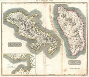
Maps of Dominica North America are detailed maps that show the geography of the island nation located in the Caribbean Sea
Choose a picture from our Maps Collection for your Wall Art and Photo Gifts
22 items


All Professionally Made to Order for Quick Shipping
-
Maps Collection
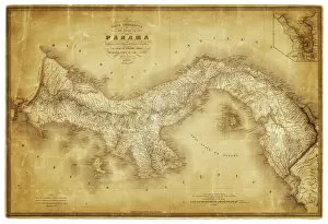
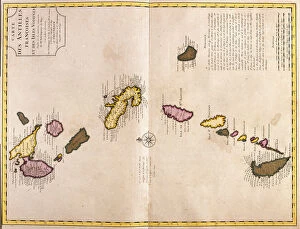
Maps of Dominica North America are detailed maps that show the geography of the island nation located in the Caribbean Sea. The maps include all major cities, towns, roads, rivers and other geographical features. They also provide information on elevation, population density and climate. The country is divided into ten parishes which are further divided into smaller districts. Maps of Dominica North America also show important landmarks such as national parks and protected areas as well as points of interest like beaches and resorts. Additionally, they provide information on transportation routes including airports, ports and ferry services that connect the island to other Caribbean countries. These maps offer a comprehensive view of Dominica's landscape for travelers looking to explore its unique beauty or for those who wish to learn more about this beautiful country.
+
Our beautiful pictures are available as Framed Prints, Photos, Wall Art and Photo Gifts
The Maps of Dominica North America collection from Media Storehouse is a unique and fascinating assortment of maps that showcase the geography, topography, and history of the Caribbean island nation. Our collection features a wide range of maps dating back to the 18th century, including antique maps, vintage prints, and modern-day cartographic representations. Each map offers a different perspective on Dominica's landscape and its place in the world. Some highlights from our collection include detailed topographical maps that show elevation changes across the island; historical maps that depict colonial-era settlements and trade routes; and colorful tourist maps that highlight popular attractions such as waterfalls, beaches, and hiking trails. Whether you're a history buff or simply interested in exploring new places through art, these stunning wall art pieces are sure to impress. With their high-quality printing techniques and durable framing options available at Media Storehouse, they make for an excellent addition to any home decor.
+
What are Maps of Dominica North America art prints?
Maps of Dominica North America art prints are high-quality reproductions of vintage and contemporary maps depicting the island nation of Dominica in the Caribbean. These art prints showcase the intricate details, topography, and geography of Dominica's landscape, including its rivers, mountains, forests, and coastlines. They also feature important landmarks such as cities, towns, ports, airports and other significant places. These maps are perfect for those who love history or have a special connection to this beautiful country. They can be used to decorate homes or offices with an elegant touch that reflects one's interests while adding a unique flair to any space. Whether you're looking for a gift for someone who loves travel or simply want to add some character to your walls with a stylish piece of artwork that tells a story about this fascinating place - Maps of Dominica North America art prints will not disappoint.
+
What Maps of Dominica North America art prints can I buy from Media Storehouse?
We offer a wide range of Maps of Dominica North America art prints that you can buy. These maps are available in various sizes and styles, including vintage, antique, and modern designs. You can choose from a variety of options such as framed or unframed prints, canvas prints, and posters. The Maps of Dominica North America art prints available at Media Storehouse showcase the beauty and diversity of this region. They feature detailed illustrations with accurate geographical information that will help you navigate through the area with ease. Whether you're looking for decorative pieces to add to your home or office space or educational resources for your classroom or library, we have got you covered. Our collection includes top-quality maps created by professional cartographers who have an eye for detail and accuracy. So if you're interested in purchasing high-quality Maps of Dominica North America art prints, head over to Media Storehouse today.
+
How do I buy Maps of Dominica North America art prints?
To buy maps of Dominica North America art prints from Media Storehouse, you can browse our extensive collection of artwork online. Once you have found the print that you want to purchase, simply add it to your cart and proceed to checkout. You will be prompted to enter your shipping information and payment details. We offer a variety of sizes for their prints, so make sure to select the size that best fits your needs. We also offer framing options if you prefer a ready-to-hang piece. If you have any questions or concerns about purchasing a map of Dominica North America art print from Media Storehouse, they have customer service representatives available via phone or email who can assist you with your order. With high-quality printing and fast turnaround times, buying an art print from Media Storehouse is easy and convenient.
+
How much do Maps of Dominica North America art prints cost?
We offer a wide range of art prints featuring maps of Dominica in North America. The cost of these prints may vary depending on the size, material, and framing options chosen by the customer. However, Media Storehouse strives to offer competitive prices for their high-quality products. You can choose from various sizes ranging from small to large formats that suit their preferences and budget. Additionally, they can select different materials such as paper or canvas to print their desired map artwork. Furthermore, customers have the option to frame their art prints with a variety of frames available at Media Storehouse. The cost of Maps of Dominica North America art prints is reasonable and affordable at Media Storehouse without compromising quality. You can enjoy beautiful pieces that add character and style to any room while staying within their budget constraints.
+
How will my Maps of Dominica North America art prints be delivered to me?
Your Maps of Dominica North America art prints will be delivered to you in a safe and secure manner. The prints are carefully packaged to ensure that they arrive at your doorstep in pristine condition. Media Storehouse uses high-quality packaging materials to protect the artwork during transit. The delivery process is handled by reliable shipping partners who have years of experience in handling delicate items such as art prints. You can rest assured that your order will be delivered on time and without any damage. Once your order has been dispatched, you will receive a tracking number which allows you to track the progress of your shipment online. This ensures that you are always aware of where your package is and when it will arrive. Media Storehouse takes great care in delivering its products to customers. Your Maps of Dominica North America art prints will be no exception, arriving safely and securely at your doorstep for you to enjoy for years to come.