
Maps Collection
Maps of Bermuda North America are a type of cartographic representation that depict the island nation located in the Atlantic Ocean
Choose a picture from our Maps Collection for your Wall Art and Photo Gifts
45 items


All Professionally Made to Order for Quick Shipping
-
Maps Collection
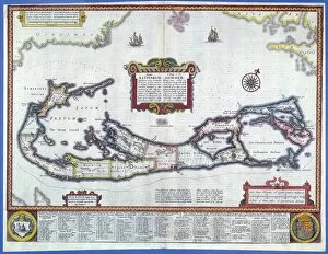
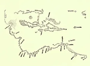
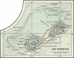
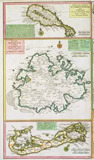
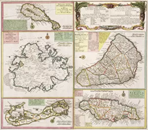
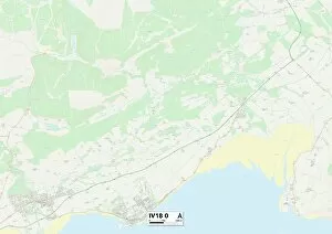
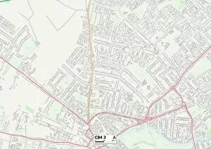
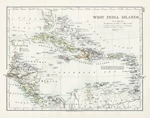
Maps of Bermuda North America are a type of cartographic representation that depict the island nation located in the Atlantic Ocean. The maps typically show the main island, as well as its surrounding smaller islands and cays. They also often include information about the country’s topography, including its highest point, Castle Harbour Hill at 76 metres above sea level. Other features such as roads, airports and marinas may also be included on some maps. Additionally, they often provide details about Bermuda’s capital city Hamilton and other major towns or settlements on the island. Maps of Bermuda North America can be useful for those planning to visit or move to this beautiful Caribbean destination.
+
Our beautiful Wall Art and Photo Gifts include Framed Prints, Photo Prints, Poster Prints, Canvas Prints, Jigsaw Puzzles, Metal Prints and so much more
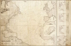
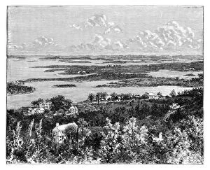
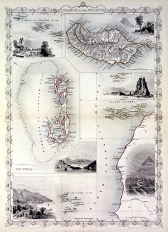
The Maps of Bermuda North America collection from Media Storehouse is a stunning assortment of vintage maps that showcase the beauty and history of this iconic island. Our collection features a wide range of maps, including antique charts, topographical surveys, and nautical maps that date back to the 17th century. These intricate pieces are perfect for anyone who loves history or wants to add some unique wall art to their home. Each map in our collection has been carefully restored and digitized using state-of-the-art technology, ensuring that every detail is preserved. Customers can choose from a variety of sizes and framing options to create a custom piece that fits their style and decor. Whether you're a collector looking for rare historical artifacts or simply want to add some character to your space, the Maps of Bermuda North America collection offers something for everyone. With its rich history and breathtaking scenery, Bermuda is truly one of North America's most captivating destinations – and these beautiful maps capture it all in stunning detail.
+
What are Maps of Bermuda North America art prints?
Maps of Bermuda North America art prints are high-quality reproductions of antique maps that depict the island of Bermuda and its surrounding areas in North America. These prints are created using advanced printing techniques, which ensure that every detail is captured with precision and accuracy. These art prints showcase the historical significance of Bermuda as a strategic location for trade and commerce during colonial times. They also provide a glimpse into the geography, topography, and natural features of this beautiful island. Whether you're a history buff or simply appreciate fine art, Maps of Bermuda North America art prints make an excellent addition to any home or office decor. They can be framed and displayed on walls or used as educational tools in classrooms or libraries. These art prints offer a unique perspective on one of the most fascinating places in North America and serve as a testament to the enduring legacy of cartography as an important cultural artifact.
+
What Maps of Bermuda North America art prints can I buy from Media Storehouse?
We offer a wide range of Maps of Bermuda North America art prints that you can purchase. These maps are available in various sizes and styles, including vintage and contemporary designs. You can choose from different types of maps, such as topographical, nautical charts, and street maps. The collection includes detailed maps that showcase the beauty and geography of Bermuda North America. Some popular options include antique-style world atlas maps with intricate details or modern satellite imagery for a more realistic view. Whether you're looking to decorate your home or office space or add to your map collection, we have something for everyone. With high-quality printing techniques used on premium materials like fine art paper or canvas, these prints will last for years to come. We provide an extensive selection of Maps of Bermuda North America art prints that cater to all tastes and preferences.
+
How do I buy Maps of Bermuda North America art prints?
To purchase Maps of Bermuda North America art prints from Media Storehouse, you can browse our online collection and select the print that catches your eye. Once you have found the perfect piece, simply add it to your cart and proceed to checkout. You will be prompted to enter your shipping information and payment details before finalizing the order. We offer a wide range of high-quality art prints featuring maps of Bermuda in North America. These prints are perfect for adding a touch of sophistication and elegance to any room in your home or office. Whether you're looking for a vintage map or a modern interpretation, there is something for everyone in their collection. When purchasing from Media Storehouse, you can rest assured that you are getting a top-quality product at an affordable price. Their team takes great care in ensuring that each print is produced with the utmost attention to detail and quality craftsmanship. So why wait? Start browsing today and find the perfect Maps of Bermuda North America art print for your space.
+
How much do Maps of Bermuda North America art prints cost?
The cost of Maps of Bermuda North America art prints varies depending on the size, quality, and framing options. We offer a wide range of maps from different artists and eras, including vintage and contemporary designs. The prices are competitive compared to other online retailers, but they do not disclose specific figures as they may vary over time due to market fluctuations or promotions. However, you can browse through our extensive collection and filter by price range to find the best option for their budget. Additionally, We provide a secure checkout process with various payment methods available for convenience. We also offer customer support services in case of any inquiries or issues related to orders or products. Maps of Bermuda North America art prints are an affordable way to decorate your home or office with historical or geographical themes that inspire curiosity and creativity.
+
How will my Maps of Bermuda North America art prints be delivered to me?
Your Maps of Bermuda North America art prints will be delivered to you in a safe and secure manner by Media Storehouse. We take great care in packaging your order so that it arrives at your doorstep in pristine condition. Your print will be carefully rolled and placed into a sturdy cardboard tube, which is then sealed with tape to prevent any damage during transit. We use reliable shipping companies to ensure that your package is delivered promptly and efficiently. You can track the progress of your delivery online using the tracking number provided once your order has been dispatched. We pride ourselves on delivering high-quality products and excellent customer service. If you have any questions or concerns about your order, please do not hesitate to contact us via email or phone, and our friendly team will be happy to assist you.