Mouse Mat > Europe > United Kingdom > England > London > Sights > Southwark Park
Mouse Mat : Plan of the Towns of London and Westminster, 1727 (hand-coloured engraving)
")


![]()
Home Decor from Fine Art Finder
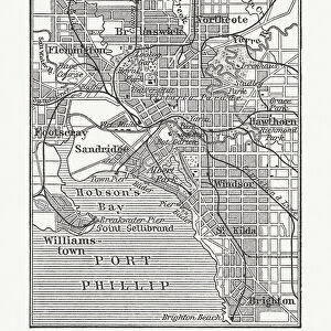
Plan of the Towns of London and Westminster, 1727 (hand-coloured engraving)
495413 Plan of the Towns of London and Westminster, 1727 (hand-coloured engraving) by Danet, Guillaume (c.1700-c.1772); Private Collection; (add.info.: With the borough of Southwark, their suburbs and surroundings. Plan de la Ville de Londres et de Westminster avec le Bourg de Southwark leurs faubourgs et leurs environs.); French, out of copyright
Media ID 18256303
© Private Collection / Bridgeman Images
Capital Hotels Parks Southwark Westminster
Mouse Mat
A high quality photographic print manufactured into a durable wipe clean mouse mat (27x22cm) with a non slip backing, which works with all mice.
Archive quality photographic print in a durable wipe clean mouse mat with non slip backing. Works with all computer mice
Estimated Image Size (if not cropped) is 25.4cm x 21.8cm (10" x 8.6")
Estimated Product Size is 26.9cm x 21.8cm (10.6" x 8.6")
These are individually made so all sizes are approximate
Artwork printed orientated as per the preview above, with landscape (horizontal) orientation to match the source image.
FEATURES IN THESE COLLECTIONS
> Fine Art Finder
> Maps (celestial & Terrestrial)
> Arts
> Landscape paintings
> Waterfall and river artworks
> River artworks
> Arts
> Portraits
> Pop art gallery
> Street art portraits
> Europe
> United Kingdom
> England
> London
> Boroughs
> City of Westminster
> Europe
> United Kingdom
> England
> London
> Boroughs
> Related Images
> Europe
> United Kingdom
> England
> London
> Boroughs
> Southwark
> Europe
> United Kingdom
> England
> London
> Related Images
> Europe
> United Kingdom
> England
> London
> River Thames
> Europe
> United Kingdom
> England
> London
> Sights
> Southwark Park
> Europe
> United Kingdom
> England
> Maps
EDITORS COMMENTS
This hand-coloured engraving, titled "Plan of the Towns of London and Westminster, 1727" takes us on a journey back in time to explore the bustling streets and grand architecture of England's capital city. Created by Guillaume Danet, a French cartographer known for his intricate maps, this print offers a detailed glimpse into the urban landscape of London during the early 18th century. The image showcases not only the towns of London and Westminster but also includes Southwark and its surrounding suburbs. The River Thames gracefully winds its way through the heart of the city, serving as both a vital transportation route and an emblematic feature that has shaped London's history. As we delve deeper into this historical map, our eyes are drawn to numerous landmarks dotting the landscape – majestic churches reaching towards the sky, elegant hotels lining busy streets, and verdant parks providing oases amidst urban chaos. Each element is meticulously depicted with vibrant colours that bring life to every corner of this ancient metropolis. Accompanied by a key that unlocks hidden details within this visual treasure trove, "Plan of the Towns of London and Westminster" invites us to immerse ourselves in centuries-old history. It serves as a testament to Danet's mastery in capturing not just geographical accuracy but also evoking an atmosphere that transports us back in time. This remarkable piece from Fine Art Finder allows us to appreciate how cities evolve over time while reminding us that even amidst progress and change, echoes from our
MADE IN THE UK
Safe Shipping with 30 Day Money Back Guarantee
FREE PERSONALISATION*
We are proud to offer a range of customisation features including Personalised Captions, Color Filters and Picture Zoom Tools
SECURE PAYMENTS
We happily accept a wide range of payment options so you can pay for the things you need in the way that is most convenient for you
* Options may vary by product and licensing agreement. Zoomed Pictures can be adjusted in the Basket.