Metal Print > North America > United States of America > California > Los Angeles
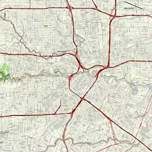
Metal Print : Los Angeles City Map


![]()
Metal Prints from Map Marketing
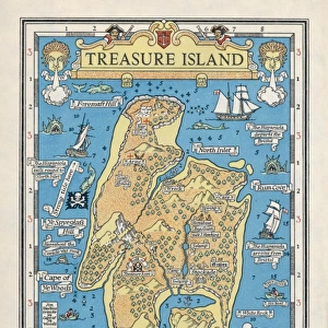
Los Angeles City Map
A street level map of central Los Angeles based on USGS topo map data. Covers from Atwater in the north to Clement Junction in the south and from Eastmont in the east to Hancock Park in the west
Media ID 19949669
© Map Marketing Ltd, Map Data courtesy of USGS
15"x10" (38x25cm) Metal Print
Your image is printed photographically and bonded to a 3.5mm thick, Dibond board (black polyethylene sandwiched between two sheets of white coated aluminium). The panel is then sealed with a gloss protective covering. Supplied complete with a wall mount which holds the print 10mm from the wall.
Made with durable metal and luxurious printing techniques, metal prints bring images to life and add a modern touch to any space
Estimated Product Size is 38.1cm x 25.4cm (15" x 10")
These are individually made so all sizes are approximate
Artwork printed orientated as per the preview above, with landscape (horizontal) or portrait (vertical) orientation to match the source image.
FEATURES IN THESE COLLECTIONS
> Animals
> Mammals
> Cricetidae
> California Mouse
> Maps and Charts
> Related Images
> North America
> United States of America
> California
> Los Angeles
MADE IN THE UK
Safe Shipping with 30 Day Money Back Guarantee
FREE PERSONALISATION*
We are proud to offer a range of customisation features including Personalised Captions, Color Filters and Picture Zoom Tools
SECURE PAYMENTS
We happily accept a wide range of payment options so you can pay for the things you need in the way that is most convenient for you
* Options may vary by product and licensing agreement. Zoomed Pictures can be adjusted in the Basket.