Metal Print > Europe > France > Canton > Landes
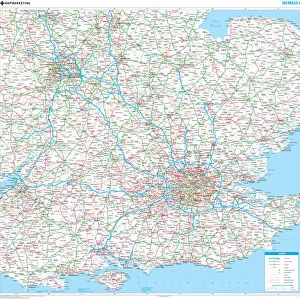
Metal Print : Childrens Political Europe Map


![]()
Metal Prints from Map Marketing
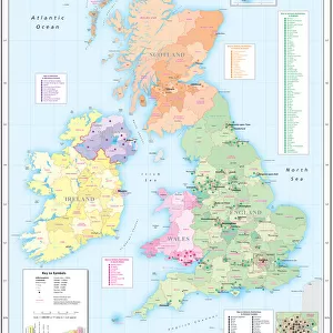
Childrens Political Europe Map
A Political map of Europe designed for school children. Based on the Lambert Conformal Conic projection, the Europe map covers the whole of the continent from northern Africa to Norwayaes North Cape and from the Azores to the Caspian Sea. The map clearly marks each country in a different colour and shows all capitals and major cities in five different population bands. It also includes a handy map insert detailing current and potential future EU member countries. The key features a useful graph detailing the top five European countries by population and by land mass
Media ID 19950521
© Map Marketing Ltd
20"x16" (51x41cm) Metal Print
Your image is printed photographically and bonded to a 3.5mm thick, Dibond board (black polyethylene sandwiched between two sheets of white coated aluminium). The panel is then sealed with a gloss protective covering. Supplied complete with a wall mount which holds the print 10mm from the wall.
Made with durable metal and luxurious printing techniques, metal prints bring images to life and add a modern touch to any space
Estimated Product Size is 50.8cm x 40.6cm (20" x 16")
These are individually made so all sizes are approximate
Artwork printed orientated as per the preview above, with landscape (horizontal) or portrait (vertical) orientation to match the source image.
FEATURES IN THESE COLLECTIONS
> Europe
> France
> Canton
> Landes
> Maps and Charts
> Related Images
MADE IN THE UK
Safe Shipping with 30 Day Money Back Guarantee
FREE PERSONALISATION*
We are proud to offer a range of customisation features including Personalised Captions, Color Filters and Picture Zoom Tools
SECURE PAYMENTS
We happily accept a wide range of payment options so you can pay for the things you need in the way that is most convenient for you
* Options may vary by product and licensing agreement. Zoomed Pictures can be adjusted in the Basket.