Metal Print > Popular Themes > Politics
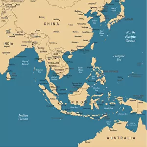
Metal Print : Political map of South East Asia


![]()
Metal Prints from Fine Art Storehouse
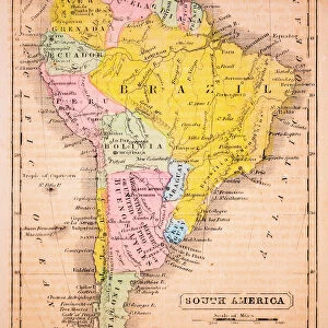
Political map of South East Asia
Vector illustration of the political map of South East Asia
Reference map was created by the US Central Intelligence Agency and is available as a public domain map at the University of Texas Libraries website
Unleash your creativity and transform your space into a visual masterpiece!
Media ID 15192872
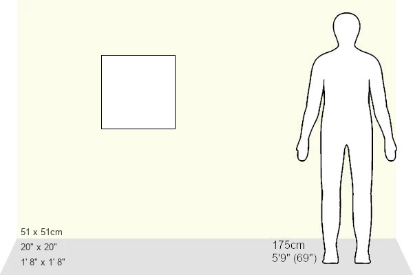
20"x20" (51x51cm) Metal Print
Discover the intricacies of South East Asia's political landscape with our stunning Metal Prints from Media Storehouse. This exquisite piece, sourced from our Fine Art Storehouse, features a detailed vector illustration of the political map of South East Asia, meticulously created by the US Central Intelligence Agency. Bring a touch of geography and worldly sophistication to your space with this captivating and high-quality Metal Print. Perfect for the globetrotter, history buff, or anyone with a curiosity for the world around them. Order yours today and let the conversation begin!
Your image is printed photographically and bonded to a 3.5mm thick, Dibond board (black polyethylene sandwiched between two sheets of white coated aluminium). The panel is then sealed with a gloss protective covering. Supplied complete with a wall mount which holds the print 10mm from the wall.
Made with durable metal and luxurious printing techniques, metal prints bring images to life and add a modern touch to any space
Estimated Product Size is 50.8cm x 50.8cm (20" x 20")
These are individually made so all sizes are approximate
Artwork printed orientated as per the preview above, with landscape (horizontal) or portrait (vertical) orientation to match the source image.
FEATURES IN THESE COLLECTIONS
> Fine Art Storehouse
> Map
> Reference Maps
> Asia
> Related Images
> Maps and Charts
> Related Images
EDITORS COMMENTS
This print showcases a meticulously detailed political map of South East Asia, rendered in stunning vector illustration. Every intricate border and geographical feature is expertly depicted, offering an immersive visual experience for any admirer of cartography. The reference map used as the basis for this artwork was originally created by the US Central Intelligence Agency and is now available as a public domain resource at the esteemed University of Texas Libraries website. This ensures its accuracy and reliability, making it an invaluable tool for scholars, researchers, or anyone with a keen interest in exploring the diverse nations that comprise this vibrant region. From Indonesia's sprawling archipelago to Vietnam's elongated coastline; from Thailand's lush jungles to Malaysia's modern metropolises - all are beautifully represented on this print. The delicate balance between land and sea is artfully captured, showcasing not only national boundaries but also major rivers, mountain ranges, and other natural landmarks that shape these countries' identities. Whether displayed in a classroom setting or proudly hung on your own wall at home, this print serves as both an educational resource and a striking piece of art. It invites viewers to embark on their own mental journey through South East Asia - unraveling its rich history, cultural diversity, and geopolitical dynamics one glance at a time.
MADE IN THE UK
Safe Shipping with 30 Day Money Back Guarantee
FREE PERSONALISATION*
We are proud to offer a range of customisation features including Personalised Captions, Color Filters and Picture Zoom Tools
SECURE PAYMENTS
We happily accept a wide range of payment options so you can pay for the things you need in the way that is most convenient for you
* Options may vary by product and licensing agreement. Zoomed Pictures can be adjusted in the Basket.