Metal Print > Europe > France > Maps
Metal Print : Map of Edward III route through France


![]()
Metal Prints from Fine Art Storehouse
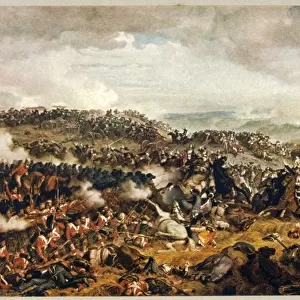
Map of Edward III route through France
Vintage engraving showing a Map of King Edward III route through France, from Barfleur to Calais in 1300. During the hundred years war
Unleash your creativity and transform your space into a visual masterpiece!
duncan1890
Media ID 18441345
© duncan1890
Historical War Event Physical Activity Edward Iii
20"x16" (51x41cm) Metal Print
Step back in time with our stunning Metal Print of a vintage engraving, showcasing the historic route of King Edward III through France. This intricately detailed map, sourced from the Fine Art Storehouse by duncan1890, illustrates Edward III's journey from Barfleur to Calais in 1300. Add an air of sophistication and history to any room with this unique, high-quality Metal Print. The vibrant colors and textures of the engraving are beautifully preserved, making it a captivating conversation starter. Order yours today and bring a piece of the past into your home.
Your image is printed photographically and bonded to a 3.5mm thick, Dibond board (black polyethylene sandwiched between two sheets of white coated aluminium). The panel is then sealed with a gloss protective covering. Supplied complete with a wall mount which holds the print 10mm from the wall.
Made with durable metal and luxurious printing techniques, metal prints bring images to life and add a modern touch to any space
Estimated Product Size is 50.8cm x 40.6cm (20" x 16")
These are individually made so all sizes are approximate
Artwork printed orientated as per the preview above, with landscape (horizontal) or portrait (vertical) orientation to match the source image.
FEATURES IN THESE COLLECTIONS
> Fine Art Storehouse
> Map
> Historical Maps
> Maps and Charts
> Early Maps
> Maps and Charts
> Related Images
EDITORS COMMENTS
This vintage engraving transports us back in time to the tumultuous era of the Hundred Years War. The intricate map showcases King Edward III's strategic route through France, from Barfleur to Calais, in the year 1300. As we trace the lines and study each detail, we can almost feel the weight of history upon our shoulders. Edward III's campaign was a pivotal moment in European history, marked by intense military clashes and political maneuvering. This print not only serves as a visual representation of his journey but also offers insights into cartography techniques prevalent during that period. The artist, duncan1890, has masterfully captured both the physical activity involved in such an expedition and its historical significance. The meticulous attention to detail brings this ancient map to life - every contour of land meticulously etched onto paper. As we gaze at this remarkable artwork, it is impossible not to be transported back in time; imagining soldiers marching across treacherous terrain or strategizing their next move on foreign soil. It reminds us that behind every war event lies countless stories waiting to be discovered and understood. In acquiring this print from Fine Art Storehouse, one becomes not just an owner of a beautiful piece but also a custodian of history itself – preserving memories for generations yet unborn.
MADE IN THE UK
Safe Shipping with 30 Day Money Back Guarantee
FREE PERSONALISATION*
We are proud to offer a range of customisation features including Personalised Captions, Color Filters and Picture Zoom Tools
SECURE PAYMENTS
We happily accept a wide range of payment options so you can pay for the things you need in the way that is most convenient for you
* Options may vary by product and licensing agreement. Zoomed Pictures can be adjusted in the Basket.