Metal Print > Europe > France > Canton > Ardennes
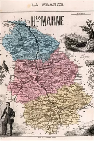
Metal Print : La Haute Marne (Haute-Marne, 52), Champagne-Ardennes (Champagne Ardennes) - France and its Colonies. Atlas illustrates one hundred and five maps from the maps of the depot of war, bridges and footwear and the Navy by M. VUILLEMIN. 1876
![]()

Metal Prints from Fine Art Finder
La Haute Marne (Haute-Marne, 52), Champagne-Ardennes (Champagne Ardennes) - France and its Colonies. Atlas illustrates one hundred and five maps from the maps of the depot of war, bridges and footwear and the Navy by M. VUILLEMIN. 1876
XEE4144506 La Haute Marne (Haute-Marne, 52), Champagne-Ardennes (Champagne Ardennes) - France and its Colonies. Atlas illustrates one hundred and five maps from the maps of the depot of war, bridges and footwear and the Navy by M. VUILLEMIN. 1876. by Vuillemin, Alexandre (1812-1886); Private Collection; (add.info.: La Haute Marne (Haute-Marne, 52), Champagne-Ardennes (Champagne Ardennes) - France and its Colonies. Atlas illustrates one hundred and five maps from the maps of the depot of war, bridges and footwear and the Navy by M. VUILLEMIN. 1876.); Stefano Bianchetti; French, out of copyright
Media ID 25153694
© Stefano Bianchetti / Bridgeman Images
Atlas Book Champagne Ardennes High Marl 52 Geographical Map
15"x10" (38x25cm) Metal Print
Discover the rich history of France and its colonies with our stunning Metal Print of La Haute Marne, Champagne-Ardennes region. This captivating piece features one hundred and five maps from the 1876 Atlas by M. Vuillemin, showcasing intricate details from the depots of war, bridges, and footwear, as well as naval charts. Bring history to life in your home or office with this unique and beautifully crafted Metal Print from the Media Storehouse collection by Fine Art Finder.
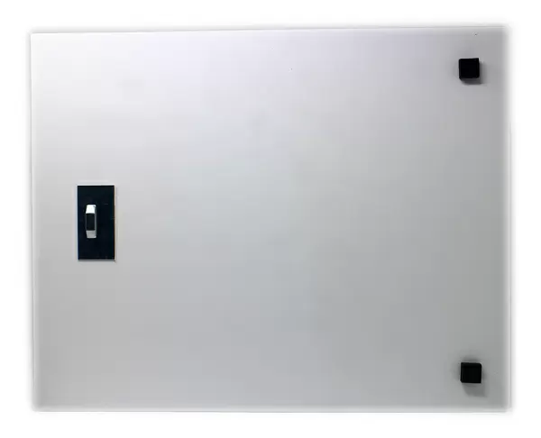
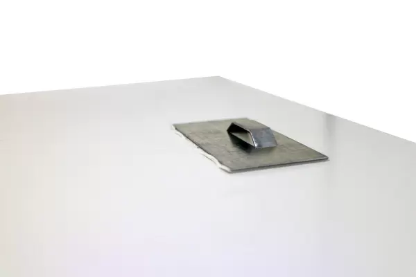
Your image is printed photographically and bonded to a 3.5mm thick, Dibond board (black polyethylene sandwiched between two sheets of white coated aluminium). The panel is then sealed with a gloss protective covering. Supplied complete with a wall mount which holds the print 10mm from the wall.
Made with durable metal and luxurious printing techniques, metal prints bring images to life and add a modern touch to any space
Estimated Product Size is 25.4cm x 38.1cm (10" x 15")
These are individually made so all sizes are approximate
Artwork printed orientated as per the preview above, with landscape (horizontal) or portrait (vertical) orientation to match the source image.
FEATURES IN THESE COLLECTIONS
> Fine Art Finder
> Artists
> Alexandre Vuillemin
> Europe
> France
> Canton
> Ardennes
> Europe
> France
> Canton
> Marne
> Maps and Charts
> Related Images
> Services
> Royal Navy
EDITORS COMMENTS
This print showcases a historical atlas titled "La Haute Marne (Haute-Marne, 52), Champagne-Ardennes (Champagne Ardennes) - France and its Colonies". Published in 1876 by M. VUILLEMIN, the atlas features an impressive collection of one hundred and five maps from various sources such as the depot of war, bridges and footwear, and the Navy. The image captures a glimpse of one particular map within this extensive atlas. The map depicts La Haute Marne region in Champagne-Ardennes, France along with its colonies. Created by Alexandre Vuillemin, a renowned cartographer of his time (1812-1886), this detailed geographical representation offers valuable insights into the area's topography. Stefano Bianchetti skillfully photographed this engraving from his private collection. The vibrant colors used to illustrate the map add depth and visual appeal to the print. This photograph not only serves as a testament to Bianchetti's passion for preserving historical artifacts but also highlights the beauty found within these meticulously crafted maps. As we gaze upon this remarkable piece of artistry, we are transported back in time to an era when cartography played an essential role in understanding our world. It reminds us of how far we have come in terms of mapping technology while appreciating the craftsmanship that went into creating these intricate works. Overall, this print is both visually stunning and historically significant – a true treasure for any enthusiast interested in geography
MADE IN THE UK
Safe Shipping with 30 Day Money Back Guarantee
FREE PERSONALISATION*
We are proud to offer a range of customisation features including Personalised Captions, Color Filters and Picture Zoom Tools
SECURE PAYMENTS
We happily accept a wide range of payment options so you can pay for the things you need in the way that is most convenient for you
* Options may vary by product and licensing agreement. Zoomed Pictures can be adjusted in the Basket.


