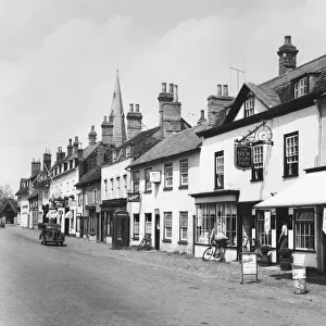
Home > Europe > United Kingdom > England > Cambridgeshire > Ramsey
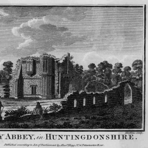
1840s Victorian Map of Huntingdonshire

![]()
Wall Art and Photo Gifts from Mary Evans Picture Library
1840s Victorian Map of Huntingdonshire
Mary Evans Picture Library makes available wonderful images created for people to enjoy over the centuries
Media ID 32350832
© The Keasbury-Gordon Photograph Archive / Mary Evans
1840s Cambridgeshire Huntingdon Huntingdonshire Railways Ramsey Kimbolton Neots Whittlesey
FEATURES IN THESE COLLECTIONS
> Europe
> United Kingdom
> England
> Cambridgeshire
> Huntingdon
> Europe
> United Kingdom
> England
> Cambridgeshire
> Kimbolton
> Europe
> United Kingdom
> England
> Cambridgeshire
> Ramsey
> Europe
> United Kingdom
> England
> Cambridgeshire
> St Neots
> Europe
> United Kingdom
> England
> Cambridgeshire
> Whittlesey
> Europe
> United Kingdom
> England
> Huntingdonshire
> Europe
> United Kingdom
> England
> Maps
> Europe
> United Kingdom
> England
> Railways
> Maps and Charts
> Early Maps
> Mary Evans Prints Online
> New Images July 2023
EDITORS COMMENTS
Step back in time with this stunning 1840s Victorian Map of Huntingdonshire, a vintage piece that captures the essence of a bygone era. This intricate map showcases the towns and villages of Huntingdon, St. Neots, Whittlesey, Ramsey, Kimbolton, and more in exquisite detail.
As you study the map closely, you can see the early railway lines crisscrossing through the county, a reminder of a time when travel was slower but no less enchanting. The Edwardian charm is evident in every corner of this map, transporting you to a simpler time when horse-drawn carriages ruled the roads.
The craftsmanship and attention to detail in this map are truly remarkable. Each line and symbol tells a story of life in 19th-century England, offering a glimpse into the past that is both educational and captivating.
Whether you have roots in Huntingdonshire or simply appreciate history and vintage aesthetics, this print is sure to be a cherished addition to your collection. Display it proudly on your wall or use it as inspiration for your own historical research - either way, this 1840s Victorian Map of Huntingdonshire is sure to spark curiosity and wonder for generations to come.
MADE IN THE UK
Safe Shipping with 30 Day Money Back Guarantee
FREE PERSONALISATION*
We are proud to offer a range of customisation features including Personalised Captions, Color Filters and Picture Zoom Tools
SECURE PAYMENTS
We happily accept a wide range of payment options so you can pay for the things you need in the way that is most convenient for you
* Options may vary by product and licensing agreement. Zoomed Pictures can be adjusted in the Basket.