Home > Europe > Russia > Maps
NORTHERN NAVIGATION
![]()

Wall Art and Photo Gifts from Mary Evans Picture Library
NORTHERN NAVIGATION
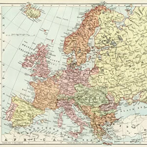
The Navigation of the Northern Seas showing Spitzbergen and the coasts of Scandinavia and Russia Date: circa 1700
Mary Evans Picture Library makes available wonderful images created for people to enjoy over the centuries
Media ID 20147367
© Bubblepunk
1700 Arctic Coasts Maps Navigation Scandinavia Seas Spitzbergen
FEATURES IN THESE COLLECTIONS
> Mary Evans Prints Online
> New Images July 2020
Northern Navigation
EDITORS COMMENTS
is an intriguing and historic map print dating back to circa 1700, showcasing the navigable seas in the Northern Hemisphere, with a particular focus on the Arctic regions, Spitzbergen, Scandinavia, and Russia. This detailed and captivating map offers a glimpse into the early exploration and cartographic understanding of these remote and often treacherous waters. The map is adorned with an abundance of geographical features, including the coastlines of Norway, Denmark, Sweden, and Russia, as well as numerous islands and archipelagos in the Arctic Ocean. The map's title, "Northern Navigation," is prominently displayed at the top, accompanied by the subtitle, "Showing Spitzbergen and the coasts of Scandinavia and Russia." One of the most striking features of this map is the depiction of Spitzbergen, a group of islands located in the Svalbard archipelago. The islands are shown with a remarkable level of detail, including the outlines of several bays, inlets, and mountains. The map also highlights various important locations, such as the Dutch settlement of Ny-Alesund and the Russian settlement of Bellsund. The map's cartouche, located at the bottom right, includes a charming illustration of a ship navigating through icy waters, surrounded by polar bears and other Arctic wildlife. The cartouche also includes a detailed key, which explains the various symbols and markings used on the map. "Northern Navigation" is a fascinating and historically significant map print that offers a unique perspective on the early exploration and cartographic understanding of the Northern Hemisphere's Arctic regions. Its intricate detail and captivating design make it a must-have for any collection focused on maritime history, cartography, or the Arctic.
MADE IN THE UK
Safe Shipping with 30 Day Money Back Guarantee
FREE PERSONALISATION*
We are proud to offer a range of customisation features including Personalised Captions, Color Filters and Picture Zoom Tools
SECURE PAYMENTS
We happily accept a wide range of payment options so you can pay for the things you need in the way that is most convenient for you
* Options may vary by product and licensing agreement. Zoomed Pictures can be adjusted in the Basket.


