Fraud Blocker Skip to main content

Home > Maps and Charts > World

World Collection (page 3)

World maps and charts are visual representations of the Earth's surface, showing geographical features such as continents, oceans, countries, cities

8,137 items

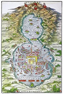
Background imageWorld Collection: TENOCHTITLAN (MEXICO CITY) at the time of the Spanish Conquest: colored woodcut, 1556

TENOCHTITLAN (MEXICO CITY) at the time of the Spanish Conquest: colored woodcut, 1556

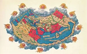
Background imageWorld Collection: Ptolemys Map of the World cA. D 150. (1912) Artist: Claudius Ptolemy

Ptolemys Map of the World cA. D 150. (1912) Artist: Claudius Ptolemy
Ptolemys Map of the World cA.D 150. The Ptolemy world map is a map of the known world to Hellenistic society in the 2nd century AD

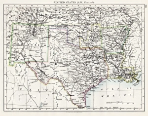
Background imageWorld Collection: United States South West Central map 1897

United States South West Central map 1897
The World-Wide Atlas of Modern Geography, Political and Physical W. & A.K. Johnston - London 1897

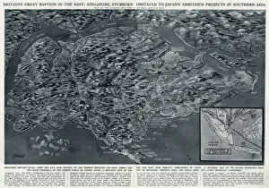
Background imageWorld Collection: Singapore, bastion in the East, by G. H. Davis

Singapore, bastion in the East, by G. H. Davis
Britains great bastion in the East: Singapore, stubborn obstacle to Japans ambitious projects in Southern Asia during the Second World War

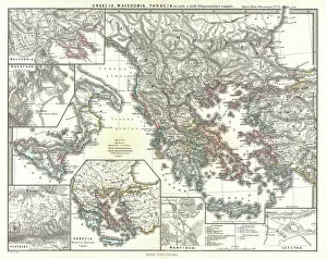
Background imageWorld Collection: 1865, Spruner Map of Greece, Macedonia and Thrace before the Peloponnesian War. topography

1865, Spruner Map of Greece, Macedonia and Thrace before the Peloponnesian War. topography
1865, Spruner Map of Greece, Macedonia and Thrace before the Peloponnesian War

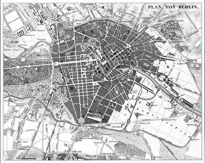
Background imageWorld Collection: Berlin, Germany Map

Berlin, Germany Map
Engraved illustrations of a Map of the City of Berlin, Germany from Iconographic Encyclopedia of Science, Literature and Art, Published in 1851. Copyright has expired on this artwork

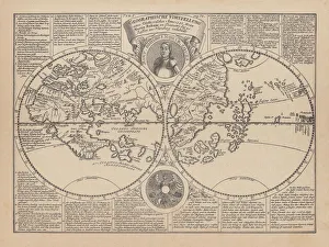
Background imageWorld Collection: World map by Martin Behaim, 1492, wood engraving, published 1884

World map by Martin Behaim, 1492, wood engraving, published 1884
World map by Martin Behaim, 1492. Woodcut engraving from my archive, published in 1884

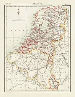
Background imageWorld Collection: Holland map 1881

Holland map 1881
Encyclopedia Britannica 9th Edition Vol XII Philadelphia j.M. Stoddart & Co 1881

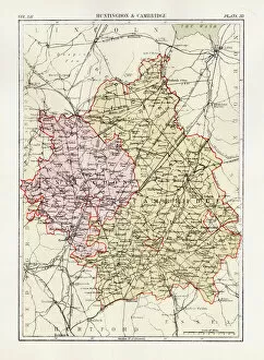
Background imageWorld Collection: Huntingdon and Cambridge map 1881

Huntingdon and Cambridge map 1881
Encyclopedia Britannica 9th Edition Vol XII Philadelphia j.M. Stoddart & Co 1881

Background imageWorld Collection: Buenos Aires map

Buenos Aires map
Antique engraving map of Buenos Aires

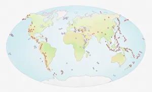
Background imageWorld Collection: Illustration of world map showing sites of volcanic activity

Illustration of world map showing sites of volcanic activity

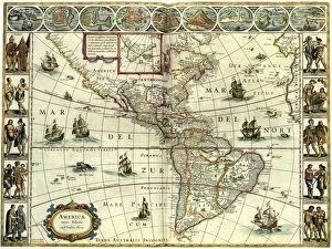
Background imageWorld Collection: MAP: AMERICAS, c1630. A map of North and South America created by Dutch cartographer

MAP: AMERICAS, c1630. A map of North and South America created by Dutch cartographer and atlas maker Willem Blaeu. Map, c1630

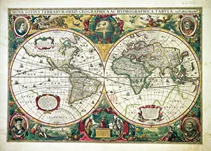
Background imageWorld Collection: Nova totius Terrarum Orbis Geographica ac hydrographica tabula, by Henricus Hondius, Amsterdam

Nova totius Terrarum Orbis Geographica ac hydrographica tabula, by Henricus Hondius, Amsterdam
Cartography, 17th century. Nova totius Terrarum Orbis Geographica ac hydrographica tabula, by Henricus Hondius, Amsterdam, 1630. Illustrated copperplate, 38 x 54 cm

Background imageWorld Collection: Continental drift maps

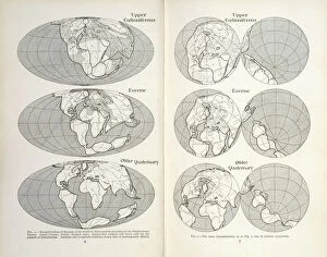
Continental drift maps
Reconstruction of the map of the world for three periods according to the Displacement Theory. Figs 1-2 from The Origin of Continents and Oceans (1924) by Alfred Wegener

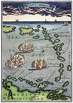
Background imageWorld Collection: CARIBBEAN MAP. A map of the Caribbean islands: woodcut, French, c. 1688

CARIBBEAN MAP. A map of the Caribbean islands: woodcut, French, c. 1688

Background imageWorld Collection: Pan American Airways route map

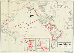
Pan American Airways route map
Pan American Airways System global route map of the Flying Clipper Ships (passengers, mail, express). circa 1938

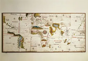
Background imageWorld Collection: CANTINO WORLD MAP, 1502. Western half of the Cantino map of the world

CANTINO WORLD MAP, 1502. Western half of the Cantino map of the world, 1502, showing (at left) the Tordesillas Treaty demarcation line of 1494 which divided the non-Christian (i.e)

Background imageWorld Collection: BERING STRAIT MAP, 1593. Cornelis de Jodes 1593 map of Western North America showing the fabled

BERING STRAIT MAP, 1593. Cornelis de Jodes 1593 map of Western North America showing the fabled province of Quivira in California and the Bering Strait (El Streto de Anian)

Background imageWorld Collection: TENOCHTITLAN (MEXICO CITY). Mexico City at the time of the Spanish Conquest

TENOCHTITLAN (MEXICO CITY). Mexico City at the time of the Spanish Conquest: colored woodcut from the Latin edition of Cortes Second Letter, Nuremberg, 1524

Background imageWorld Collection: 17th century map of the New World

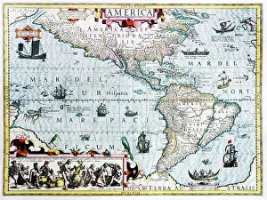
17th century map of the New World
Western Hemisphere, 17th century Dutch map. This shows the New World that was being discovered by Europeans exploring the Western Hemisphere of the Earth
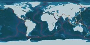
Background imageWorld Collection: Earths tectonic plates

Earths tectonic plates. Global map showing the boundaries of the tectonic plates that make up the Earths crust. The eight major plates are the: African Plate, Antarctic Plate, Indian Plate

Background imageWorld Collection: Continental drift, 100 million years ago

Continental drift, 100 million years ago. Map of the Earth showing the continents some 100 million years after the start of the break-up of the ancient supercontinent of Pangea

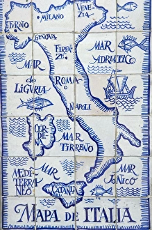
Background imageWorld Collection: Map of Italy and the Mediterranean made out of ceramic tiles on a street in Seville

Map of Italy and the Mediterranean made out of ceramic tiles on a street in Seville, Spain

Background imageWorld Collection: Historical World Events map 1919 UK version

Historical World Events map 1919 UK version
A world map originally published in 1919, reproduced from the internationally famousCollins Bartholomew World Through Timehistoric cartographic archive

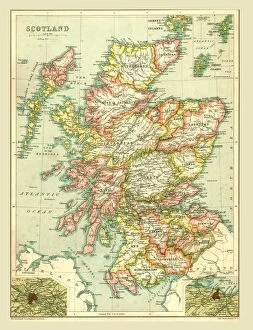
Background imageWorld Collection: Map of Scotland, 1902. Creator: Unknown

Map of Scotland, 1902. Creator: Unknown
Map of Scotland, 1902. Showing the various counties and islands including the Hebrides, the Shetlands and the Orkneys, and an inset of the rail networks of Glasgow and Edinburgh

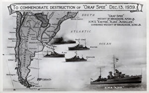
Background imageWorld Collection: Card commemorating Graf Spee destruction, WW2

Card commemorating Graf Spee destruction, WW2
Card commemorating the destruction of the German cruiser, Admiral Graf Spee, on 13 December 1939 by HMS Exeter, Ajax and Achilles following the Battle of the River Plate. Date: 1939

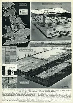
Background imageWorld Collection: Coal mining by G. H. Davis

Coal mining by G. H. Davis
Coal mine working and outcrop production: how coal, so vital to every form of war industry, can be won from opencast veins at shallow depths. Date: 1944

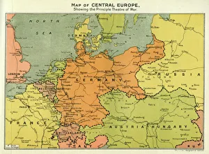
Background imageWorld Collection: Map of Central Europe, World War One

Map of Central Europe, World War One
Map of Central Europe in World War One, showing the Principal Theatre of War. Date: World War One

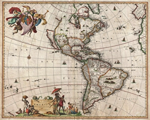
Background imageWorld Collection: 1658, Visscher Map of North America and South America, topography, cartography, geography

1658, Visscher Map of North America and South America, topography, cartography, geography
1658, Visscher Map of North America and South America

Background imageWorld Collection: Ocean currents off the Americas

Ocean currents off the Americas. Satellite-based graphic showing ocean currents (swirling coloured lines) on an Earth globe centred on the Americas

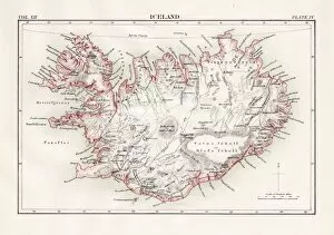
Background imageWorld Collection: Iceland map 1881

Iceland map 1881
Encyclopedia Britannica 9th Edition Vol XII Philadelphia j.M. Stoddart & Co 1881

Background imageWorld Collection: USA indian territories map 1881

USA indian territories map 1881
Encyclopedia Britannica 9th Edition Vol XII Philadelphia j.M. Stoddart & Co 1881

Background imageWorld Collection: Cantino planisphere by Alberto Cantino, 1502

Cantino planisphere by Alberto Cantino, 1502
Cartography, 16th century. Cantino planisphere, by Alberto Cantino, 1502

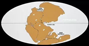
Background imageWorld Collection: Continental Drift

Continental Drift
The world 200 million years ago in Upper Triassic times, showing the single continent of Pangaea and the universal ocean, Panthalassa

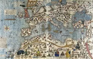
Background imageWorld Collection: CRESQUES, Jafuda (1350-1410); CRESQUES, Abraham

CRESQUES, Jafuda (1350-1410); CRESQUES, Abraham ( -1381). Catalan Atlas. 1375. Third and Fourth Leaves. Map of the world known in the 14th c. (Finisterre and the Mediterranean)

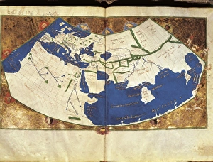
Background imageWorld Collection: PTOLEMY, Claudius Ptolemaeus ( c. AD 100 - c

PTOLEMY, Claudius Ptolemaeus ( c. AD 100 - c
" PTOLEMY, Claudius Ptolemaeus ( c. AD 100 - c. AD 170). Egyptian astronomer, mathematician and geographer. Map of the Ancient World. From the work " Ptolomeus Geographicorum Libri"

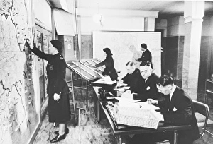
Background imageWorld Collection: NFS London Region control room and officers, WW2

NFS London Region control room and officers, WW2
With the Fire Service nationalised in 1941 the London Fire Brigade was combined with its surrounding Fire Brigades to form the London Region of the NFS

Background imageWorld Collection: FILM: CASABLANCA, 1942. Sidney Greenstreet and Ingrid Bergman in Casablanca directed by Michael

FILM: CASABLANCA, 1942. Sidney Greenstreet and Ingrid Bergman in Casablanca directed by Michael Curtiz, 1942

Background imageWorld Collection: The Plumb-pudding in danger, or, State epicures taking un pe

The Plumb-pudding in danger, or, State epicures taking un petit souper... William Pitt, wearing a regimental uniform and hat, sitting at a table with Napoleon

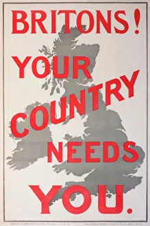
Background imageWorld Collection: Poster, Britons! Your Country Needs You

Poster, Britons! Your Country Needs You

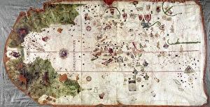
Background imageWorld Collection: NINA: WORLD MAP, 1500. World map, 1500, of Juan de la Cosa, navigator on the Nina on Christopher

NINA: WORLD MAP, 1500. World map, 1500, of Juan de la Cosa, navigator on the Nina on Christopher Columbus second voyage of 1493-94

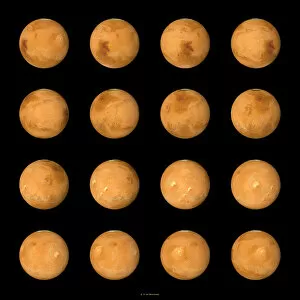
Background imageWorld Collection: Mars, composite satellite images

Mars, composite satellite images
Mars. Composite satellite images of the surface of Mars from multiple aspects. North is at top. Mars is the fourth planet from the Sun, and is a rocky desert world

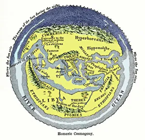
Background imageWorld Collection: Homeric cosmogony

Homeric cosmogony. Map of the Earth based on the myths and knowledge of the Ancient Greeks at the time of Homer (1st or 2nd millennium BC)

Background imageWorld Collection: 16th century world map

16th century world map made by Pierre Desceliers in 1546 on a commission by King Francis I for Henri II of France. Most noticeable is that the Northern hemisphere is upside-down

Background imageWorld Collection: WW1 naval blockades

WW1 naval blockades
Map of English and German naval blockades around Britain, France, Belgium, Germany, Denmark and Norway

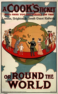
Background imageWorld Collection: A Cooks Ticket will take you anywhere

A Cooks Ticket will take you anywhere
A poster or handbill advertising the fact that a Cooks ticket will take you anywhere on the London, Brighton and South Coast Railway, or round the world

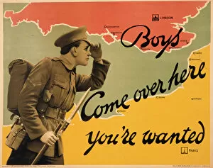
Background imageWorld Collection: World War I recruitment poster

World War I recruitment poster
Poster produced by the Parliamentary Recruiting Committee during World War I, depicting a typical British Tommy in uniform with bayonet fixed, calling across from France to England for more volunteers

Background imageWorld Collection: India at night, satellite image

India at night, satellite image
India at night, satellite view. This image is a composite showing the change in illumination over India from 1992-2003. Satellite data from 2003 is coloured red


All Professionally Made to Order for Quick Shipping


-

World Collection

World maps and charts are visual representations of the Earth's surface, showing geographical features such as continents, oceans, countries, cities, rivers and mountains. They have been used for centuries to aid navigation, exploration and education. Maps can be created using various techniques including satellite imagery or hand-drawn illustrations. Charts are graphical representations of data that help people understand complex information in a simplified manner. Examples include population growth rates or economic indicators by country. Both maps and charts are important tools for understanding our world and making informed decisions about global issues such as climate change or international trade policies.
+

Our beautiful pictures are available as Framed Prints, Photos, Wall Art and Photo Gifts

The World collection from Media Storehouse is a stunning array of wall art and framed prints that showcase the beauty and diversity of our planet. Featuring an extensive range of maps, charts, and diagrams, our collection offers something for everyone – from vintage world maps to modern satellite imagery. Each print is carefully crafted using high-quality materials to ensure that it looks great in any setting. Whether you're looking for a piece to decorate your home or office, or simply want to add some visual interest to your space, the World collection has something for you. With its wide variety of styles and subjects, our collection is perfect for anyone who loves travel, geography, history or science. So why not explore the world from the comfort of your own home with one of these beautiful prints?
+

What are World (Maps and Charts) art prints?

World maps and charts art prints are high-quality reproductions of historical or contemporary maps and charts that depict the geography, topography, political boundaries, and other features of different regions of the world. These prints can be used for decorative purposes in homes, offices, schools, museums, libraries or any other setting where a visual representation of global locations is needed. World maps and charts art prints come in various sizes to suit different spaces and preferences. They may feature antique designs from centuries ago or modern interpretations with updated information on countries' borders and names. Some popular styles include vintage world maps with sepia tones or muted colors; colorful political maps highlighting specific regions such as Europe or Africa; nautical charts showing ocean depths and currents; or satellite images displaying terrain details. Whether you're a history buff looking to decorate your study room with an old-world map print or a traveler seeking inspiration for your next adventure destination, World Maps & Charts Art Prints offer something for everyone's taste.
+

What World (Maps and Charts) art prints can I buy from Media Storehouse?

We offer a wide range of World Maps and Charts art prints that are perfect for decorating your home or office. You can choose from vintage maps, antique charts, modern world maps, satellite images of the earth, and many more options. These art prints come in various sizes to suit your needs and preferences. The collection includes detailed maps of different countries and continents such as Europe, Africa, Asia, North America, South America among others. The prints also feature famous landmarks like the Eiffel Tower in Paris or the Statue of Liberty in New York City. Moreover, you can find educational charts on topics like geography or astronomy that are ideal for classrooms. Our World Maps and Charts art prints are printed using high-quality materials to ensure they last a long time without fading or losing their vibrancy. They make great gifts for anyone who loves travel or wants to learn more about our planet's geography.
+

How do I buy World (Maps and Charts) art prints?

To purchase World art prints from Media Storehouse, you can browse our extensive collection of high-quality images online. Once you have found the print that you would like to buy, simply add it to your cart and proceed to checkout. At this point, you will be prompted to enter your shipping and payment information. We offer a variety of sizes for their art prints, so be sure to select the size that best fits your needs. You may also have the option to choose between different paper types or finishes. Once your order has been processed, Media Storehouse will carefully package your print and ship it directly to your doorstep. Whether you are looking for a unique piece of wall decor or a thoughtful gift for someone special, World art prints from Media Storehouse are an excellent choice for anyone who loves geography or history.
+

How much do World (Maps and Charts) art prints cost?

We offer a wide range of World Maps and Charts art prints that are available at varying prices. The cost of our World Maps and Charts art prints depends on the size, quality, and type of print you choose. We have different options such as canvas prints, framed prints, photographic prints, and poster prints. Our World Maps and Charts art prints come in various sizes ranging from small to large formats. The price also varies depending on whether you want a black-and-white or colored print. Our collection features vintage maps as well as contemporary designs that cater to different tastes. We take pride in providing high-quality products at affordable prices without compromising on the quality of our artwork. You can be sure that every piece is carefully crafted with attention to detail using premium materials. The cost of our World Maps and Charts art prints is reasonable considering their quality and uniqueness. Whether you're looking for a statement piece for your home or office space or an educational tool for your classroom, we have something for everyone's budget.
+

How will my World (Maps and Charts) art prints be delivered to me?

We take great care in delivering your World art prints to you. We use a trusted courier service to ensure that your order arrives safely and on time. Your print will be carefully packaged in protective materials to prevent any damage during transit. We offer a range of delivery options for our customers, including standard shipping and express delivery for those who need their order sooner. Once your order has been dispatched, you will receive an email with tracking information so that you can keep track of its progress. Our team is committed to providing excellent customer service, so if you have any questions or concerns about the delivery of your World art prints, please do not hesitate to get in touch with us. We are always happy to help.