Fraud Blocker Skip to main content

Tote Bag > Maps and Charts > Turkey

Turkey Tote Bag Collection (page 8)

Discover the world one adventure at a time with our Turkey collection of tote bags from Media Storehouse. Each bag showcases intricately detailed maps and charts of Turkey, adding a touch of wanderlust to your everyday essentials. Made from durable, eco-friendly materials, these totes are perfect for your next excursion or as a thoughtful gift for the traveler in your life. Embrace the spirit of exploration with these stylish and functional bags.
Turkey is a transcontinental country located in Southeast Europe and Southwest Asia and has a population of over 82 million people

524 Tote Bags

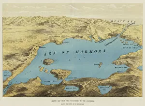
Background imageTurkey Tote Bag Collection: Sketch Map from the Dardanelles to the Bosphorus (chromolitho)

Sketch Map from the Dardanelles to the Bosphorus (chromolitho)
1590142 Sketch Map from the Dardanelles to the Bosphorus (chromolitho) by English School, (19th century); Private Collection; (add.info.: Sketch Map from the Dardanelles to the Bosphorus)

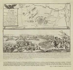
Background imageTurkey Tote Bag Collection: Map and illustration showing the Battle of Rymnik (engraving)

Map and illustration showing the Battle of Rymnik (engraving)
979817 Map and illustration showing the Battle of Rymnik (engraving) by German School, (18th century); Private Collection; (add.info.: Map and illustration showing the Battle of Rymnik)

Background imageTurkey Tote Bag Collection: Moennitarri Warrior in the Costume of the Dog Dance. Pehriska-Ruhpa

Moennitarri Warrior in the Costume of the Dog Dance. Pehriska-Ruhpa
3673648 Moennitarri Warrior in the Costume of the Dog Dance. Pehriska-Ruhpa by Bodmer, Karl (1809-93); Newberry Library, Chicago, Illinois

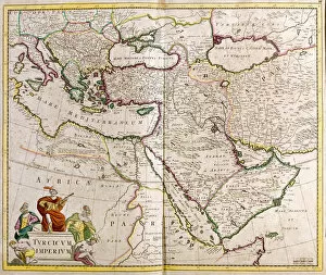
Background imageTurkey Tote Bag Collection: Map of the Turkish Empire (etching, 1671)

Map of the Turkish Empire (etching, 1671)
LRI4710648 Map of the Turkish Empire (etching, 1671) by Wit, Frederick de (1630-1706); Private Collection; (add.info.: Map of the Turkish Empire - Strong Water from " Theatrum Orbis", 1671)

Background imageTurkey Tote Bag Collection: Peutinger table representing the Roman ways in Egypt and Turkey

Peutinger table representing the Roman ways in Egypt and Turkey
JLJ4689311 Peutinger table representing the Roman ways in Egypt and Turkey. Road map of the 13th century based on a map of the Roman Empire of the 3rd century. Paris, BN

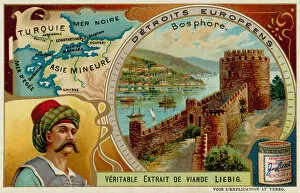
Background imageTurkey Tote Bag Collection: Straits on the Bosphorus (chromolitho)

Straits on the Bosphorus (chromolitho)
735385 Straits on the Bosphorus (chromolitho) by European School, (19th century); Private Collection; (add.info.: Straits on the Bosphorus)

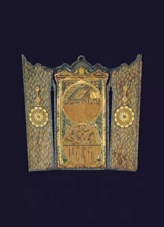
Background imageTurkey Tote Bag Collection: Qibla Compass, Constantinople, 1750-99 (wood)

Qibla Compass, Constantinople, 1750-99 (wood)
6192350 Qibla Compass, Constantinople, 1750-99 (wood) by Ottoman School, (18th century); 84.8x40.5 cm; Private Collection; (add.info.: Comprising a rectangular wooden panel with two printed roundels)

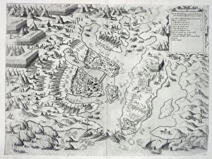
Background imageTurkey Tote Bag Collection: Malta besieged by the Infidel, from Della Architettura Militare

Malta besieged by the Infidel, from Della Architettura Militare
STC214677 Malta besieged by the Infidel, from Della Architettura Militare, published 1551 (engraving) by Marchi, Francesco de (1504-76); Private Collection; (add.info)

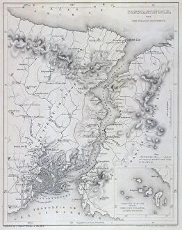
Background imageTurkey Tote Bag Collection: Constantinople and the Bosphorus, c. 1850 (engraving)

Constantinople and the Bosphorus, c. 1850 (engraving)
KW206612 Constantinople and the Bosphorus, c.1850 (engraving) by Hughes, W (fl. c.1850); Private Collection; British, out of copyright

Background imageTurkey Tote Bag Collection: Map of Raab, from Civitates Orbis Terrarum by Georg Braun (1541-1622

Map of Raab, from Civitates Orbis Terrarum by Georg Braun (1541-1622
STC138940 Map of Raab, from Civitates Orbis Terrarum by Georg Braun (1541-1622) and Frans Hogenberg (1535-90) 1597 (coloured engraving) by Hoefnagel

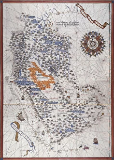
Background imageTurkey Tote Bag Collection: Map of the Arabian Peninsula, with wind rose and details of ports and sea coasts

Map of the Arabian Peninsula, with wind rose and details of ports and sea coasts
AIS5334416 Map of the Arabian Peninsula, with wind rose and details of ports and sea coasts, in Atlas de Joan Martines, 1587 (manuscript) by Martines, Joan (1556-1590); Biblioteca Nacional, Madrid

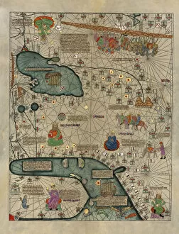
Background imageTurkey Tote Bag Collection: Cathay, China from the Catalan Atlas (reproduction)

Cathay, China from the Catalan Atlas (reproduction)
5054664 Cathay, China from the Catalan Atlas (reproduction) by Cresques, Abraham (1325-87) (after); (add.info.: Detail from the reproduction of 1375 World map made in Majorca)

Background imageTurkey Tote Bag Collection: Map of Western Bulgaria, with Sofia, and the Danube to the Austrian Frontier (engraving)

Map of Western Bulgaria, with Sofia, and the Danube to the Austrian Frontier (engraving)
1589772 Map of Western Bulgaria, with Sofia, and the Danube to the Austrian Frontier (engraving) by English School, (19th century); Private Collection; (add.info.: Map of Western Bulgaria)

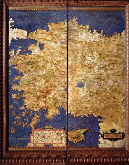
Background imageTurkey Tote Bag Collection: Map of Anatolia, c. 1567. (mural painting)

Map of Anatolia, c. 1567. (mural painting)
LRI4595540 Map of Anatolia, c.1567. (mural painting) by Danti, Egnazio (1536-86); Palazzo Vecchio, Florence, Italy; (add.info.: Anatolia Map made by Egnazio Danti (1536-1586) mathematician

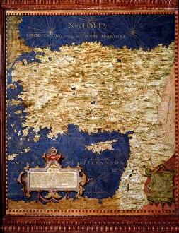
Background imageTurkey Tote Bag Collection: Map of Anatolia, c. 1567. (mural painting)

Map of Anatolia, c. 1567. (mural painting)
LRI4595527 Map of Anatolia, c.1567. (mural painting) by Danti, Egnazio (1536-86); Palazzo Vecchio, Florence, Italy; (add.info.: Anatolia Map made by Egnazio Danti (1536-1586) mathematician

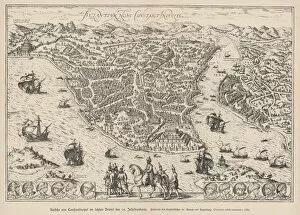
Background imageTurkey Tote Bag Collection: Map of Byzance (engraving, 16th century)

Map of Byzance (engraving, 16th century)
LRI4646924 Map of Byzance (engraving, 16th century) by Hogenberg, Franz (1540-c.1590); Private Collection; (add.info.: BYZANTIUM NUNC CONSTANTINOLLS Map of Byzantium - engraving from " Civitates)

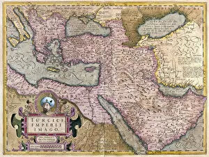
Background imageTurkey Tote Bag Collection: Turkey, Balkans, northeastern Africa, Arabia and the Middle East (engraving, 1596)

Turkey, Balkans, northeastern Africa, Arabia and the Middle East (engraving, 1596)
LRI4718667 Turkey, Balkans, northeastern Africa, Arabia and the Middle East (engraving, 1596) by Mercator, Gerardus (1512-94); Private Collection; (add.info.: Turkey Imperii Imago, 1630: Turkish)

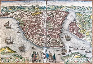
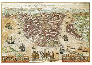
Background imageTurkey Tote Bag Collection: Plan of Byzantium, renamed Constantinople (Byzantium nunc Constantinopolis

Plan of Byzantium, renamed Constantinople (Byzantium nunc Constantinopolis
LRI4708534 Plan of Byzantium, renamed Constantinople (Byzantium nunc Constantinopolis) (present-day Istanbul), (Eastern Roman Empire and Ottoman Empire), Turkey (etching, 1572-1617) by Hogenberg

Background imageTurkey Tote Bag Collection: Map of the Middle East: Turkish Empire, Persia and Arabian Peninsula (etching, 1730)

Map of the Middle East: Turkish Empire, Persia and Arabian Peninsula (etching, 1730)
LRI4706712 Map of the Middle East: Turkish Empire, Persia and Arabian Peninsula (etching, 1730) by Delisle, Guillaume (1675-1726); Private Collection; (add.info.: Map of the Middle East)

Background imageTurkey Tote Bag Collection: Map of the Ottoman Empire, 1570 (engraving)

Map of the Ottoman Empire, 1570 (engraving)
LRI4704979 Map of the Ottoman Empire, 1570 (engraving) by Ortelius, Abraham (1527-98); Museo Navale di Pegli, Genoa, Italy; (add.info)

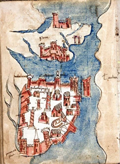
Background imageTurkey Tote Bag Collection: Constantinople, manuscript map of Venice of the 15th century

Constantinople, manuscript map of Venice of the 15th century
GIA4733563 Constantinople, manuscript map of Venice of the 15th century. by Unknown Artist, (15th century); Biblioteca Nazionale Marciana, Venice, Italy; (add.info.: Constantinople)

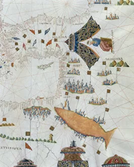
Background imageTurkey Tote Bag Collection: A Nautical Map, detail of the Gran Turco, 1564 (colour litho)

A Nautical Map, detail of the Gran Turco, 1564 (colour litho)
955466 A Nautical Map, detail of the Gran Turco, 1564 (colour litho) by Maggiolo, Giacomo (16th Century); Biblioteca Civica Bertoliana, Vicenza, Italy; Alinari

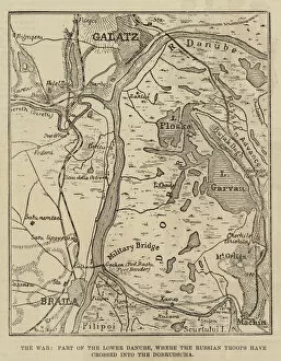
Background imageTurkey Tote Bag Collection: The War, Part of the Lower Danube, where the Russian Troops have crossed into the Dobrudscha

The War, Part of the Lower Danube, where the Russian Troops have crossed into the Dobrudscha (engraving)
1106407 The War, Part of the Lower Danube, where the Russian Troops have crossed into the Dobrudscha (engraving) by English School, (19th century); Private Collection; (add.info.: The War)

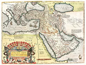
Background imageTurkey Tote Bag Collection: Map of the Turkish Empire, (hand-coloured engraving)

Map of the Turkish Empire, (hand-coloured engraving)
986158 Map of the Turkish Empire, (hand-coloured engraving) by Ortelius, Abraham (1527-98); 37x49 cm; Private Collection; (add.info.: Map of the Turkish Empire; Turcici Imperii Descriptio)

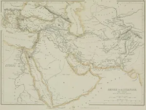
Background imageTurkey Tote Bag Collection: Antique map of the Empire of Alexander the Great

Antique map of the Empire of Alexander the Great
afghanistan, antique, arabia, arabian, azerbijan, black, border, cartography, caspian, coordinates, countries, document, empire of alexander the great, geography, historic, historical, iran, iraq

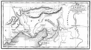
Background imageTurkey Tote Bag Collection: Map of Issus

Map of Issus
" Vintage map showing the area around Issus (Turkey) in ancient times showing the routes of Alexander the Great and Darius III King of Persia

Background imageTurkey Tote Bag Collection: A sketch map of the infamous Dardanelles Operations and Gallipoli Campaign

A sketch map of the infamous Dardanelles Operations and Gallipoli Campaign, an Allied expedition to gain control of the Dardanelles to open up a Black Sea route to Russia. Date: 1915

Background imageTurkey Tote Bag Collection: Map of the capture of the sea fortress Anapa by Russian troops on the Black Sea in June

Map of the capture of the sea fortress Anapa by Russian troops on the Black Sea in June 1791, 1791. Private Collection

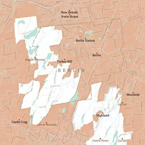
Background imageTurkey Tote Bag Collection: CT Hartford Berlin Vector Road Map

CT Hartford Berlin Vector Road Map. All source data is in the public domain. U.S. Census Bureau Census Tiger. Used Layers: areawater, linearwater, roads, rails, cousub, pointlm, uac10

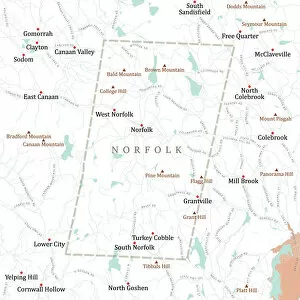
Background imageTurkey Tote Bag Collection: CT Litchfield Norfolk Vector Road Map

CT Litchfield Norfolk Vector Road Map. All source data is in the public domain. U.S. Census Bureau Census Tiger. Used Layers: areawater, linearwater, roads, rails, cousub, pointlm, uac10

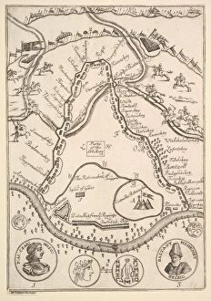
Background imageTurkey Tote Bag Collection: Parke of the Artillary (Aubry de La Mottrayes 'Travels throughout Europe

Parke of the Artillary (Aubry de La Mottrayes "Travels throughout Europe
Parke of the Artillary (Aubry de La Mottrayes " Travels throughout Europe, Asia and into Part of Africa... " London, 1724, vol. II, pl. 26B), 1723-24

Background imageTurkey Tote Bag Collection: Charles XII at Bender (Aubry de La Mottrayes 'Travels throughout Europe

Charles XII at Bender (Aubry de La Mottrayes "Travels throughout Europe
Charles XII at Bender (Aubry de La Mottrayes " Travels throughout Europe, Asia and into Part of Africa... " London, 1724, vol. II, pl. 30), 1723-24

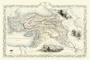
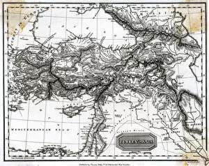
Background imageTurkey Tote Bag Collection: Turkey in Asia 1851

Turkey in Asia 1851
A fine facimile artworked from an antique original map of Turkey in Asia, issued as part of the 1851 edition of John Tallis and Companys " The Illustrated Atlas

Background imageTurkey Tote Bag Collection: Speculum Romanae Magnificentiae: Map of Greece, mid-16th century. mid-16th century

Speculum Romanae Magnificentiae: Map of Greece, mid-16th century. mid-16th century
Speculum Romanae Magnificentiae: Map of Greece, mid-16th century

Background imageTurkey Tote Bag Collection: MAP / TURKEY 1817

MAP / TURKEY 1817
Map of Turkey Date: 1817

Background imageTurkey Tote Bag Collection: Istanbul, Turkey - 16th century Plan

Istanbul, Turkey - 16th century Plan
Istanbul in the 16th century, after the Turks captured it. The map is entitled Byzantium, now Constantinople Date: 16th century

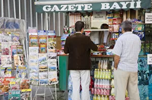
Background imageTurkey Tote Bag Collection: EyeUbiquitous_20101135

EyeUbiquitous_20101135
Turkey, Istanbul, Sultanahmet, Customers at newspaper kiosk with magazine stand and display of maps, postcards, snacks and soft drinks

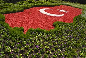
Background imageTurkey Tote Bag Collection: EyeUbiquitous_20098057

EyeUbiquitous_20098057
Turkey Cappadocia Ankara Anitkabir Mausoleum of Kemal Ataturk The Turkish flag as map of the country made of red and white pebblestones set amongst flowers

Background imageTurkey Tote Bag Collection: East Riding of Yorkshire YO16 4 Map

East Riding of Yorkshire YO16 4 Map
Postcode Sector Map of East Riding of Yorkshire YO16 4

Background imageTurkey Tote Bag Collection: North Yorkshire YO7 4 Map

North Yorkshire YO7 4 Map
Postcode Sector Map of North Yorkshire YO7 4

Background imageTurkey Tote Bag Collection: Rother TN39 5 Map

Rother TN39 5 Map
Postcode Sector Map of Rother TN39 5

Background imageTurkey Tote Bag Collection: Rother TN31 7 Map

Rother TN31 7 Map
Postcode Sector Map of Rother TN31 7

Background imageTurkey Tote Bag Collection: Croydon SE19 2 Map

Croydon SE19 2 Map
Postcode Sector Map of Croydon SE19 2

Background imageTurkey Tote Bag Collection: Fylde PR3 6 Map

Fylde PR3 6 Map
Postcode Sector Map of Fylde PR3 6

Background imageTurkey Tote Bag Collection: Norfolk NR24 2 Map

Norfolk NR24 2 Map
Postcode Sector Map of Norfolk NR24 2

Background imageTurkey Tote Bag Collection: Anglesey LL65 2 Map

Anglesey LL65 2 Map
Postcode Sector Map of Anglesey LL65 2

Background imageTurkey Tote Bag Collection: Gwynedd LL55 1 Map

Gwynedd LL55 1 Map
Postcode Sector Map of Gwynedd LL55 1

Background imageTurkey Tote Bag Collection: Leeds LS28 9 Map

Leeds LS28 9 Map
Postcode Sector Map of Leeds LS28 9


All Professionally Made to Order for Quick Shipping


-

Turkey Tote Bag Collection

Turkey is a transcontinental country located in Southeast Europe and Southwest Asia and has a population of over 82 million people, making it the world's 18th most populous country. The capital city is Ankara, while Istanbul is the largest city and economic center. A diverse economy with industries such as textiles, automotive, electronics, and tourism contributing significantly to its GDP. The country also boasts of rich cultural heritage evident in its architecture, cuisine, music, and festivals. Turkey shares borders with eight countries including Greece, Bulgaria, Georgia, Armenia among others and has access to two seas; the Black Sea and Mediterranean Sea.
+

Our beautiful Wall Art and Photo Gifts include Framed Prints, Photo Prints, Poster Prints, Canvas Prints, Jigsaw Puzzles, Metal Prints and so much more

The Turkey collection from Media Storehouse is a stunning selection of wall art and framed prints that showcase the beauty and history of Turkey. Our collection features a range of maps, charts, and illustrations that depict the country's geography, landmarks, cities, and historical events. The artwork in our collection is sourced from various archives around the world, including museums, libraries, and private collections. Each piece in our collection has been carefully curated to offer a unique perspective on Turkey's rich cultural heritage. From antique maps depicting Ottoman-era borders to modern-day satellite images showcasing Istanbul's bustling cityscape - there is something for everyone in this diverse collection. Whether you're looking to add some Turkish flair to your home or office decor or simply want to learn more about this fascinating country - the Turkey collection from Media Storehouse offers an unparalleled glimpse into its past and present.
+

What are Turkey (Maps and Charts) art prints?

Turkey art prints are high-quality reproductions of historical maps and charts depicting the country of Turkey. These prints showcase the intricate details, unique features, and geographical landmarks of Turkey that have been captured by skilled cartographers over time. These art prints offer a glimpse into the past, allowing viewers to explore how Turkey has evolved through history. They also serve as educational tools for students, historians, and geography enthusiasts who want to learn more about this fascinating country. Turkey art prints are available in various sizes and formats such as framed or unframed prints, canvas wraps or posters. They make great additions to any home or office decor with their vintage charm adding character to any space. Whether you're looking for a piece of artwork that celebrates your love for travel or simply want to add some cultural flair to your living space - these beautiful art pieces from Media Storehouse are sure to impress.
+

What Turkey (Maps and Charts) art prints can I buy from Media Storehouse?

We offer a wide range of Turkey art prints, including maps and charts. These prints showcase the beauty and diversity of Turkey's landscapes, cities, and historical sites. You can choose from vintage maps that highlight the country's geography or contemporary charts that depict its political boundaries. In addition to maps and charts, Media Storehouse also offers photographic prints featuring iconic landmarks such as Hagia Sophia in Istanbul or Cappadocia's unique rock formations. You can also find stunning images of Turkey's coastline, mountains, and countryside. Whether you're looking for a piece to decorate your home or office or a gift for someone who loves Turkey, we have something for everyone. With high-quality printing on premium paper stock, these art prints are sure to impress anyone who sees them.
+

How do I buy Turkey (Maps and Charts) art prints?

To buy Turkey art prints from Media Storehouse, you can browse our extensive collection of high-quality images online. Simply search for "Turkey Maps and Charts" in the search bar on our website to find a range of options available. Once you have found an image that you like, select the size and format that suits your needs. You can choose from a variety of print sizes, including small, medium, large or extra-large prints. After selecting your preferred size and format, add the item to your cart and proceed to checkout. You will be prompted to enter your shipping information as well as payment details. We offer secure payment methods such as credit card payments or PayPal transactions. Once your order is confirmed, they will process it promptly so that you receive your Turkey art print in no time.
+

How much do Turkey (Maps and Charts) art prints cost?

We offer a wide range of Turkey art prints at varying prices. Our collection includes high-quality prints that are perfect for adding a touch of elegance to any room in your home or office. The cost of our Turkey art prints depends on the size, framing options, and other customizations you choose. We have something for everyone's budget with affordable options as well as premium quality products. We take pride in offering exceptional value for money while maintaining the highest standards of quality. Our Turkey art prints come in various sizes ranging from small to large formats so that you can find the perfect fit for your space. Whether you're looking to decorate your living room, bedroom or office, our selection has got you covered.
+

How will my Turkey (Maps and Charts) art prints be delivered to me?

We take great care in delivering your Turkey art prints to you. Once you have placed your order with us, our team of professionals will carefully package your print to ensure it arrives safely at its destination. We use high-quality materials that are designed to protect the artwork during transit. Depending on the size of the print, we may roll it up and place it in a sturdy tube for shipping or pack it flat between two pieces of cardboard. Our delivery partners are trusted couriers who specialize in handling fragile items such as artwork. When your Turkey art print arrives, please inspect it carefully to ensure that there is no damage during transit. If you do find any issues with your order, please contact us immediately so that we can resolve them for you as quickly as possible. We hope that you enjoy your new artwork from Media Storehouse.