Fraud Blocker Skip to main content

Glass Frame > Maps and Charts > Turkey

Turkey Glass Frame Collection (page 7)

Discover the world through the unique lens of our Turkey Glass Frame Collection from Media Storehouse. These frames are not just decorative pieces, but a celebration of the rich history and culture of Turkey. Each frame showcases intricate maps and charts depicting the diverse geography and territories of this fascinating country. The clear glass design allows the detailed illustrations to take center stage, making for an engaging and educational addition to any room. Perfect for travel enthusiasts, history buffs, or anyone with a passion for exploration, these frames are sure to ignite curiosity and inspire wanderlust. Add a touch of adventure to your home decor with our Turkey Glass Frame Collection.

Turkey is a transcontinental country located in Southeast Europe and Southwest Asia and has a population of over 82 million people

523 Glass Frames

Background imageTurkey Glass Frame Collection: Catalan Atlas, Sheet 8 (pen with coloured inks on parchment)

Catalan Atlas, Sheet 8 (pen with coloured inks on parchment)
5054649 Catalan Atlas, Sheet 8 (pen with coloured inks on parchment) by Cresques, Abraham (1325-87); Bibliotheque Nationale, Paris, France; (add.info.: World map made in Majorca)

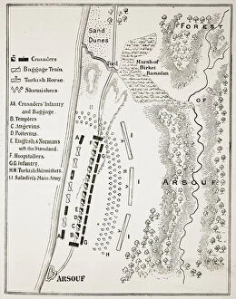
Background imageTurkey Glass Frame Collection: The Battle of Arsuf, 7th September 1191 (litho) (b / w photo)

The Battle of Arsuf, 7th September 1191 (litho) (b / w photo)
STC400587 The Battle of Arsuf, 7th September 1191 (litho) (b/w photo) by English School, (19th century); Private Collection; (add.info)

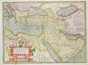
Background imageTurkey Glass Frame Collection: Map of the Turkish Empire, from the Mercator Atlas pub

Map of the Turkish Empire, from the Mercator Atlas pub
STC101840 Map of the Turkish Empire, from the Mercator Atlas pub. by Jodocus Hondius (1563-1612) Amsterdam, 1606 (engraving) by Dutch School

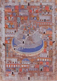
Background imageTurkey Glass Frame Collection: Map of Aleppo, c. 1600 (colour litho)

Map of Aleppo, c. 1600 (colour litho)
779776 Map of Aleppo, c.1600 (colour litho) by Ottoman School; Private Collection; (add.info.: Carte d Alep vers 1600. Karte von Aleppo Aober 1600. Illustration of the citadel and city walls)

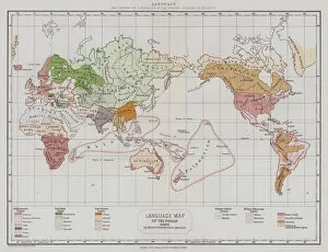
Background imageTurkey Glass Frame Collection: Language (colour litho)

Language (colour litho)
3650025 Language (colour litho) by English School, (19th century); Private Collection; (add.info.: Language. Map showing the distribution of the principal languages of the world)

Background imageTurkey Glass Frame Collection: Mato-Tope, Adorned with the insignia of his warlike deeds

Mato-Tope, Adorned with the insignia of his warlike deeds
3673619 Mato-Tope, Adorned with the insignia of his warlike deeds. by Bodmer, Karl (1809-93); Newberry Library, Chicago, Illinois

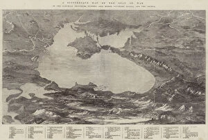
Background imageTurkey Glass Frame Collection: A Picturesque Map of the Seat of War, in the Danubian Provinces, Turkey, Asia Minor, Southern Russia

A Picturesque Map of the Seat of War, in the Danubian Provinces, Turkey, Asia Minor, Southern Russia
1607993 A Picturesque Map of the Seat of War, in the Danubian Provinces, Turkey, Asia Minor, Southern Russia, and the Crimea (engraving) by English School

Background imageTurkey Glass Frame Collection: The Black Sea (engraving)

The Black Sea (engraving)
1619136 The Black Sea (engraving) by English School, (19th century); Private Collection; (add.info.: The Black Sea. Illustration for The Illustrated London News, 1854)

Background imageTurkey Glass Frame Collection: Plan of the Destruction of the Turkish Squadron, at Sinope (engraving)

Plan of the Destruction of the Turkish Squadron, at Sinope (engraving)
1618678 Plan of the Destruction of the Turkish Squadron, at Sinope (engraving) by English School, (19th century); Private Collection; (add.info.: Plan of the Destruction of the Turkish Squadron)

Background imageTurkey Glass Frame Collection: Turkey in Europe (engraving)

Turkey in Europe (engraving)
1614316 Turkey in Europe (engraving) by English School, (19th century); Private Collection; (add.info.: Turkey in Europe. Illustration for The Illustrated London News, 31 October 1885)

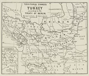
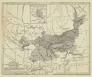
Background imageTurkey Glass Frame Collection: Territorial Changes in Turkey (engraving)

Territorial Changes in Turkey (engraving)
1621820 Territorial Changes in Turkey (engraving) by English School, (19th century); Private Collection; (add.info.: Territorial Changes in Turkey)

Background imageTurkey Glass Frame Collection: The French Naval Demonstration at Mitylene, Scenes in the Island (b / w photo)

The French Naval Demonstration at Mitylene, Scenes in the Island (b / w photo)
1628602 The French Naval Demonstration at Mitylene, Scenes in the Island (b/w photo) by English Photographer, (20th century); Private Collection; (add.info)

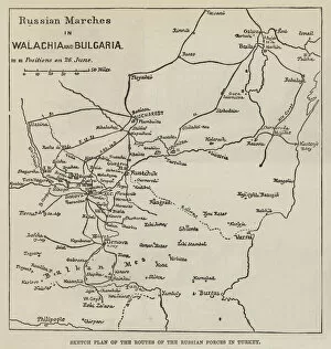
Background imageTurkey Glass Frame Collection: Sketch Plan of the Routes of the Russian Forces in Turkey (engraving)

Sketch Plan of the Routes of the Russian Forces in Turkey (engraving)
1589562 Sketch Plan of the Routes of the Russian Forces in Turkey (engraving) by English School, (19th century); Private Collection; (add.info)

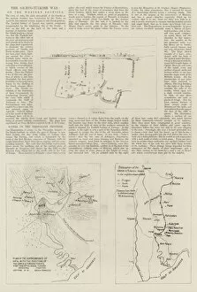
Background imageTurkey Glass Frame Collection: The Graeco-Turkish War, on the Western Frontier (engraving)

The Graeco-Turkish War, on the Western Frontier (engraving)
1597403 The Graeco-Turkish War, on the Western Frontier (engraving) by English School, (19th century); Private Collection; (add.info.: The Graeco-Turkish War, on the Western Frontier)

Background imageTurkey Glass Frame Collection: Map of the Danube and of the Passes of the Balkans (engraving)

Map of the Danube and of the Passes of the Balkans (engraving)
1106342 Map of the Danube and of the Passes of the Balkans (engraving) by English School, (19th century); Private Collection; (add.info.: Map of the Danube and of the Passes of the Balkans)

Background imageTurkey Glass Frame Collection: Map of the Delta of the Danube and the Dobrudscha (engraving)

Map of the Delta of the Danube and the Dobrudscha (engraving)
1106319 Map of the Delta of the Danube and the Dobrudscha (engraving) by English School, (19th century); Private Collection; (add.info.: Map of the Delta of the Danube and the Dobrudscha)

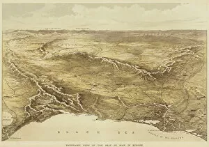
Background imageTurkey Glass Frame Collection: Panoramic View of the Seat of War in Europe (colour litho)

Panoramic View of the Seat of War in Europe (colour litho)
1106421 Panoramic View of the Seat of War in Europe (colour litho) by English School, (19th century); Private Collection; (add.info.: Panoramic View of the Seat of War in Europe)

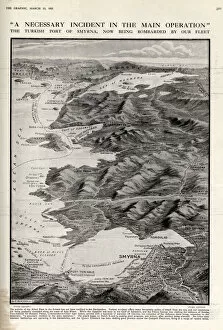
Background imageTurkey Glass Frame Collection: The Turkish Port of Smyrna Bombarded

The Turkish Port of Smyrna Bombarded
A necessary incident in the main operation. The Turkish port of Smyrna (now name Izmir) is bombarded by the Allied Fleet 1915

Background imageTurkey Glass Frame Collection: Constantinople and its Approaches (engraving)

Constantinople and its Approaches (engraving)
1053963 Constantinople and its Approaches (engraving) by English School, (19th century); Private Collection; (add.info.: Constantinople and its Approaches)

Background imageTurkey Glass Frame Collection: Map of Turkey (engraving)

Map of Turkey (engraving)
1059780 Map of Turkey (engraving) by English School, (19th century); Private Collection; (add.info.: Map of Turkey. Illustration for The Graphic)

Background imageTurkey Glass Frame Collection: The Impending War, Map of Turkey and Southern Russia, showing the Relative Positions of

The Impending War, Map of Turkey and Southern Russia, showing the Relative Positions of the Russian and Turkish Armies
1059577 The Impending War, Map of Turkey and Southern Russia, showing the Relative Positions of the Russian and Turkish Armies (engraving) by English School

Background imageTurkey Glass Frame Collection: The Military Positions in Bulgaria (engraving)

The Military Positions in Bulgaria (engraving)
1589782 The Military Positions in Bulgaria (engraving) by English School, (19th century); Private Collection; (add.info.: The Military Positions in Bulgaria)

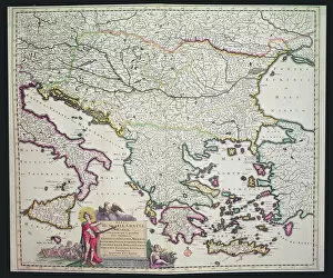
Background imageTurkey Glass Frame Collection: Map of Greece, Hungary and their surrounding countries (hand coloured engraving)

Map of Greece, Hungary and their surrounding countries (hand coloured engraving)
XCF306030 Map of Greece, Hungary and their surrounding countries (hand coloured engraving) by Dutch School; Private Collection; Dutch, out of copyright

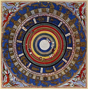
Background imageTurkey Glass Frame Collection: Macrocosm, from Zubdet ut Tevarih by Lokman, 1583 (vellum)

Macrocosm, from Zubdet ut Tevarih by Lokman, 1583 (vellum)
REV326111 Macrocosm, from Zubdet ut Tevarih by Lokman, 1583 (vellum) by Turkish School, (16th century); Topkapi Palace Museum, Istanbul, Turkey; (add.info.: the Epitome of Historical Works); Turkish

Background imageTurkey Glass Frame Collection: The Crisis in Egypt (engraving)

The Crisis in Egypt (engraving)
1621934 The Crisis in Egypt (engraving) by English School, (19th century); Private Collection; (add.info.: The Crisis in Egypt. Illustration for The Illustrated London News, 8 July 1882)

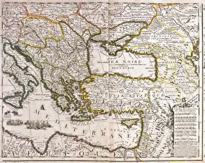
Background imageTurkey Glass Frame Collection: Map of the Eastern Mediterranean and Black Sea countries

Map of the Eastern Mediterranean and Black Sea countries
LRI4711272 Map of the Eastern Mediterranean and Black Sea countries, Turkey and the provinces of Asia Minor (etching, 1717) by Nolin

Background imageTurkey Glass Frame Collection: Turkey - Cyprus (engraving, 1596)

Turkey - Cyprus (engraving, 1596)
LRI4718694 Turkey - Cyprus (engraving, 1596) by Mercator, Gerardus (1512-94); Private Collection; (add.info.: Natoliae sive Asia minor (Asia minor)

Background imageTurkey Glass Frame Collection: Catalan Atlas, Sheet 7 and 8, 1375 (pen with coloured inks on parchment)

Catalan Atlas, Sheet 7 and 8, 1375 (pen with coloured inks on parchment)
5054639 Catalan Atlas, Sheet 7 and 8, 1375 (pen with coloured inks on parchment) by Cresques, Abraham (1325-87); Bibliotheque Nationale, Paris, France; (add.info.: World map made in Majorca)

Background imageTurkey Glass Frame Collection: Principal cities of the Old World (coloured engraving)

Principal cities of the Old World (coloured engraving)
6014063 Principal cities of the Old World (coloured engraving) by American School, (19th century); Private Collection; (add.info.: Principal cities of the Old World)

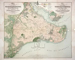
Background imageTurkey Glass Frame Collection: Map of Constantinople and surrounding areas, 1855-63 (engraving)

Map of Constantinople and surrounding areas, 1855-63 (engraving)
779771 Map of Constantinople and surrounding areas, 1855-63 (engraving) by Stolpe, C. (fl. 1860); Private Collection; (add.info)

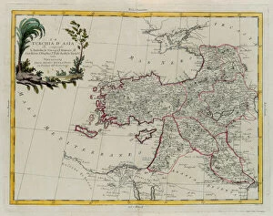
Background imageTurkey Glass Frame Collection: Asian Turkey, including Antolia, Georgia, Armenia, Kurdestan, Diarbec, Irak-Arabi, Syria

Asian Turkey, including Antolia, Georgia, Armenia, Kurdestan, Diarbec, Irak-Arabi, Syria, engraving by G
3572580 Asian Turkey, including Antolia, Georgia, Armenia, Kurdestan, Diarbec, Irak-Arabi, Syria, engraving by G. Zuliani taken from Tome IV of the " Newest Atlas" published in Venice in

Background imageTurkey Glass Frame Collection: Detail of Turkey from a Renaissance map of Europe, Jacopo Russo (after), 1528

Detail of Turkey from a Renaissance map of Europe, Jacopo Russo (after), 1528
2910983 Detail of Turkey from a Renaissance map of Europe, Jacopo Russo (after), 1528 by Russo, Jacopo (15th century); (add.info.: Renaissance map of Europe, Jacopo Russo, 1528)

Background imageTurkey Glass Frame Collection: Plan of the ruins at Sardis with vestiges of ancient buildings still existing in 1750, c

Plan of the ruins at Sardis with vestiges of ancient buildings still existing in 1750, c
XYC283584 Plan of the ruins at Sardis with vestiges of ancient buildings still existing in 1750, c.1750 (pen & ink with wash over graphite on paper) by Borra

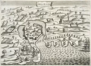
Background imageTurkey Glass Frame Collection: Italian soldiers marching into the fortified town on the Island of Chois

Italian soldiers marching into the fortified town on the Island of Chois
STC255672 Italian soldiers marching into the fortified town on the Island of Chois, illustration from Pregi della Toscana Nell Imprese piu Segnalate de Cavalieri di Santo Stefano by Fulvio Fontana

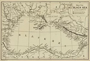
Background imageTurkey Glass Frame Collection: Map of the Black Sea (engraving)

Map of the Black Sea (engraving)
1106353 Map of the Black Sea (engraving) by English School, (19th century); Private Collection; (add.info.: Map of the Black Sea)

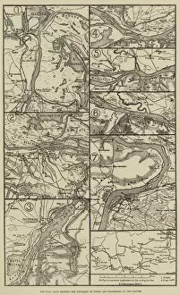
Background imageTurkey Glass Frame Collection: The War, Maps showing the Situation of Towns and Fortresses on the Danube (engraving)

The War, Maps showing the Situation of Towns and Fortresses on the Danube (engraving)
1106384 The War, Maps showing the Situation of Towns and Fortresses on the Danube (engraving) by English School, (19th century); Private Collection; (add.info.: The War)

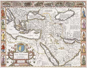
Background imageTurkey Glass Frame Collection: The Turkish Empire, 1626 (hand coloured engraving)

The Turkish Empire, 1626 (hand coloured engraving)
986162 The Turkish Empire, 1626 (hand coloured engraving) by Speed, John (1552-1629); 39.5x51 cm; Private Collection; (add.info.: The Turkish Empire. John Speed. Hand coloured engraving)

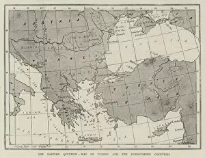
Background imageTurkey Glass Frame Collection: The Eastern Question, Map of Turkey and the Surrounding Countries (engraving)

The Eastern Question, Map of Turkey and the Surrounding Countries (engraving)
1053694 The Eastern Question, Map of Turkey and the Surrounding Countries (engraving) by English School, (19th century); Private Collection; (add.info.: The Eastern Question)

Background imageTurkey Glass Frame Collection: Map of the Scene of War on the Danube (engraving)

Map of the Scene of War on the Danube (engraving)
1097390 Map of the Scene of War on the Danube (engraving) by Dower, John (fl.c.1845-55); Private Collection; (add.info.: Map of the Scene of War on the Danube)

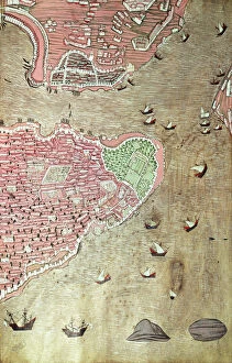
Background imageTurkey Glass Frame Collection: H 1523 fol. 159v View of the Topkapi Palace and the Bosphorus Straits, Istanbul

H 1523 fol. 159v View of the Topkapi Palace and the Bosphorus Straits, Istanbul
TPG181495 H 1523 fol.159v View of the Topkapi Palace and the Bosphorus Straits, Istanbul, from the Hunername by Lokman, 1558 (pen & ink and gouache on paper) (see also 229557) by Turkish School

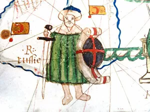
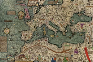
Background imageTurkey Glass Frame Collection: North Africa, Europe and the Middle East from the Catalan Atlas (reproduction)

North Africa, Europe and the Middle East from the Catalan Atlas (reproduction)
5054659 North Africa, Europe and the Middle East from the Catalan Atlas (reproduction) by Cresques, Abraham (1325-87) (after); (add.info)

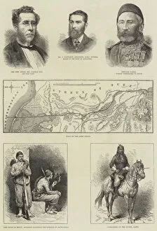
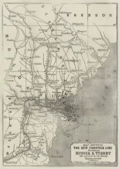
Background imageTurkey Glass Frame Collection: Map showing the New Frontier Line between Russia and Turkey as settled by the Treaty

Map showing the New Frontier Line between Russia and Turkey as settled by the Treaty, 30 March 1856 (engraving)
1608808 Map showing the New Frontier Line between Russia and Turkey as settled by the Treaty, 30 March 1856 (engraving) by Dower

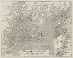
Background imageTurkey Glass Frame Collection: Plan of Constantinople and its Suburbs (engraving)

Plan of Constantinople and its Suburbs (engraving)
1608692 Plan of Constantinople and its Suburbs (engraving) by Dower, John (fl.c.1845-55); Private Collection; (add.info.: Plan of Constantinople and its Suburbs)

Background imageTurkey Glass Frame Collection: Map of the Shipka Pass over the Balkans (engraving)

Map of the Shipka Pass over the Balkans (engraving)
1589633 Map of the Shipka Pass over the Balkans (engraving) by English School, (19th century); Private Collection; (add.info.: Map of the Shipka Pass over the Balkans)

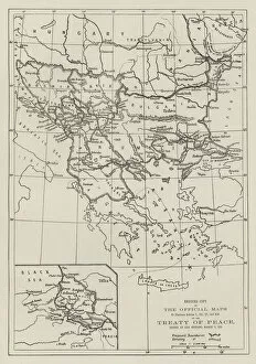
Background imageTurkey Glass Frame Collection: The Official Maps of the Treaty of Peace, signed at San Stefano, 3 March 1878 (engraving)

The Official Maps of the Treaty of Peace, signed at San Stefano, 3 March 1878 (engraving)
1589981 The Official Maps of the Treaty of Peace, signed at San Stefano, 3 March 1878 (engraving) by English School, (19th century); Private Collection; (add.info)

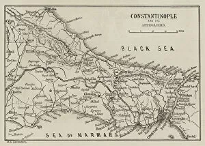
Background imageTurkey Glass Frame Collection: Constantinople and its Approaches (engraving)

Constantinople and its Approaches (engraving)
1589903 Constantinople and its Approaches (engraving) by English School, (19th century); Private Collection; (add.info.: Constantinople and its Approaches)

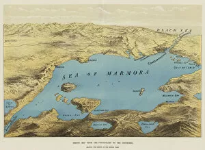
Background imageTurkey Glass Frame Collection: Sketch Map from the Dardanelles to the Bosphorus (chromolitho)

Sketch Map from the Dardanelles to the Bosphorus (chromolitho)
1590142 Sketch Map from the Dardanelles to the Bosphorus (chromolitho) by English School, (19th century); Private Collection; (add.info.: Sketch Map from the Dardanelles to the Bosphorus)

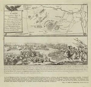
Background imageTurkey Glass Frame Collection: Map and illustration showing the Battle of Rymnik (engraving)

Map and illustration showing the Battle of Rymnik (engraving)
979817 Map and illustration showing the Battle of Rymnik (engraving) by German School, (18th century); Private Collection; (add.info.: Map and illustration showing the Battle of Rymnik)


All Professionally Made to Order for Quick Shipping


-

Turkey Glass Frame Collection

Turkey is a transcontinental country located in Southeast Europe and Southwest Asia and has a population of over 82 million people, making it the world's 18th most populous country. The capital city is Ankara, while Istanbul is the largest city and economic center. A diverse economy with industries such as textiles, automotive, electronics, and tourism contributing significantly to its GDP. The country also boasts of rich cultural heritage evident in its architecture, cuisine, music, and festivals. Turkey shares borders with eight countries including Greece, Bulgaria, Georgia, Armenia among others and has access to two seas; the Black Sea and Mediterranean Sea.
+

Our beautiful Wall Art and Photo Gifts include Framed Prints, Photo Prints, Poster Prints, Canvas Prints, Jigsaw Puzzles, Metal Prints and so much more

The Turkey collection from Media Storehouse is a stunning selection of wall art and framed prints that showcase the beauty and history of Turkey. Our collection features a range of maps, charts, and illustrations that depict the country's geography, landmarks, cities, and historical events. The artwork in our collection is sourced from various archives around the world, including museums, libraries, and private collections. Each piece in our collection has been carefully curated to offer a unique perspective on Turkey's rich cultural heritage. From antique maps depicting Ottoman-era borders to modern-day satellite images showcasing Istanbul's bustling cityscape - there is something for everyone in this diverse collection. Whether you're looking to add some Turkish flair to your home or office decor or simply want to learn more about this fascinating country - the Turkey collection from Media Storehouse offers an unparalleled glimpse into its past and present.
+

What are Turkey (Maps and Charts) art prints?

Turkey art prints are high-quality reproductions of historical maps and charts depicting the country of Turkey. These prints showcase the intricate details, unique features, and geographical landmarks of Turkey that have been captured by skilled cartographers over time. These art prints offer a glimpse into the past, allowing viewers to explore how Turkey has evolved through history. They also serve as educational tools for students, historians, and geography enthusiasts who want to learn more about this fascinating country. Turkey art prints are available in various sizes and formats such as framed or unframed prints, canvas wraps or posters. They make great additions to any home or office decor with their vintage charm adding character to any space. Whether you're looking for a piece of artwork that celebrates your love for travel or simply want to add some cultural flair to your living space - these beautiful art pieces from Media Storehouse are sure to impress.
+

What Turkey (Maps and Charts) art prints can I buy from Media Storehouse?

We offer a wide range of Turkey art prints, including maps and charts. These prints showcase the beauty and diversity of Turkey's landscapes, cities, and historical sites. You can choose from vintage maps that highlight the country's geography or contemporary charts that depict its political boundaries. In addition to maps and charts, Media Storehouse also offers photographic prints featuring iconic landmarks such as Hagia Sophia in Istanbul or Cappadocia's unique rock formations. You can also find stunning images of Turkey's coastline, mountains, and countryside. Whether you're looking for a piece to decorate your home or office or a gift for someone who loves Turkey, we have something for everyone. With high-quality printing on premium paper stock, these art prints are sure to impress anyone who sees them.
+

How do I buy Turkey (Maps and Charts) art prints?

To buy Turkey art prints from Media Storehouse, you can browse our extensive collection of high-quality images online. Simply search for "Turkey Maps and Charts" in the search bar on our website to find a range of options available. Once you have found an image that you like, select the size and format that suits your needs. You can choose from a variety of print sizes, including small, medium, large or extra-large prints. After selecting your preferred size and format, add the item to your cart and proceed to checkout. You will be prompted to enter your shipping information as well as payment details. We offer secure payment methods such as credit card payments or PayPal transactions. Once your order is confirmed, they will process it promptly so that you receive your Turkey art print in no time.
+

How much do Turkey (Maps and Charts) art prints cost?

We offer a wide range of Turkey art prints at varying prices. Our collection includes high-quality prints that are perfect for adding a touch of elegance to any room in your home or office. The cost of our Turkey art prints depends on the size, framing options, and other customizations you choose. We have something for everyone's budget with affordable options as well as premium quality products. We take pride in offering exceptional value for money while maintaining the highest standards of quality. Our Turkey art prints come in various sizes ranging from small to large formats so that you can find the perfect fit for your space. Whether you're looking to decorate your living room, bedroom or office, our selection has got you covered.
+

How will my Turkey (Maps and Charts) art prints be delivered to me?

We take great care in delivering your Turkey art prints to you. Once you have placed your order with us, our team of professionals will carefully package your print to ensure it arrives safely at its destination. We use high-quality materials that are designed to protect the artwork during transit. Depending on the size of the print, we may roll it up and place it in a sturdy tube for shipping or pack it flat between two pieces of cardboard. Our delivery partners are trusted couriers who specialize in handling fragile items such as artwork. When your Turkey art print arrives, please inspect it carefully to ensure that there is no damage during transit. If you do find any issues with your order, please contact us immediately so that we can resolve them for you as quickly as possible. We hope that you enjoy your new artwork from Media Storehouse.