Fraud Blocker Skip to main content

Postcard > Maps and Charts > Turkey

Turkey Postcard Collection (page 11)

Discover the wonders of Turkey with our exquisite collection of postcards featuring detailed maps and intricate charts. Each postcard showcases the rich history and diverse landscapes of this magnificent country. From ancient ruins to breathtaking coastlines, these postcards are the perfect way to explore Turkey's beauty and culture. Ideal for personal use, these high-quality postcards make thoughtful gifts for friends and family or a delightful addition to your own collection. Travel vicariously through the stunning visuals and transport yourself to the heart of Turkey.

Turkey is a transcontinental country located in Southeast Europe and Southwest Asia and has a population of over 82 million people

524 Postcards

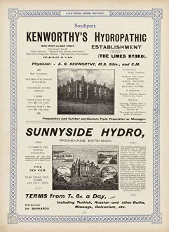
Background imageTurkey Postcard Collection: Page from the ABC Hotel Guide for Travellers and Tourists, 1901-2 (litho)

Page from the ABC Hotel Guide for Travellers and Tourists, 1901-2 (litho)
7183724 Page from the ABC Hotel Guide for Travellers and Tourists, 1901-2 (litho) by English School, (20th century); Private Collection; (add.info)

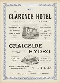
Background imageTurkey Postcard Collection: Page from the ABC Hotel Guide for Travellers and Tourists, 1901-2 (litho)

Page from the ABC Hotel Guide for Travellers and Tourists, 1901-2 (litho)
7183787 Page from the ABC Hotel Guide for Travellers and Tourists, 1901-2 (litho) by English School, (20th century); Private Collection; (add.info)

Background imageTurkey Postcard Collection: Page from The Little Folks Picture Natural History, c 1900 (chromolitho)

Page from The Little Folks Picture Natural History, c 1900 (chromolitho)
7182919 Page from The Little Folks Picture Natural History, c 1900 (chromolitho) by English School, (19th century); Private Collection; (add.info)

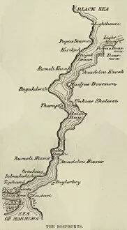
Background imageTurkey Postcard Collection: The Bosphorus (engraving)

The Bosphorus (engraving)
1106209 The Bosphorus (engraving) by English School, (19th century); Private Collection; (add.info.: The Bosphorus. Illustration for The Illustrated London News)

Background imageTurkey Postcard Collection: Grand Panorama of the Great Exhibition, North-East Portion of the Nave (engraving)

Grand Panorama of the Great Exhibition, North-East Portion of the Nave (engraving)
1102554 Grand Panorama of the Great Exhibition, North-East Portion of the Nave (engraving) by English School, (19th century); Private Collection; (add.info.: Grand Panorama of the Great Exhibition)

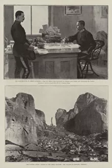
Background imageTurkey Postcard Collection: The Eastern Crisis (litho)

The Eastern Crisis (litho)
1597347 The Eastern Crisis (litho) by Wright, Henry Charles Seppings (1850-1937); Private Collection; (add.info.: The Eastern Crisis. Illustration for The Illustrated London News, 10 April 1897)

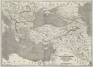
Background imageTurkey Postcard Collection: Map of the Ottoman Empire, Kingdom of Greece, and the Russian Provinces on the Black Sea (engraving)

Map of the Ottoman Empire, Kingdom of Greece, and the Russian Provinces on the Black Sea (engraving)
1607998 Map of the Ottoman Empire, Kingdom of Greece, and the Russian Provinces on the Black Sea (engraving) by English School

Background imageTurkey Postcard Collection: Antique Map of Turkey in Asia

Antique Map of Turkey in Asia
Vintage map of Turkey in Asia, Transcaucasia, Persia, Afghanistan, Biluchistan etc, from 1894

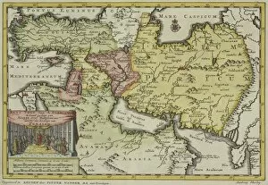
Background imageTurkey Postcard Collection: Map Of Turkey, Arabia And Persia By Guillaume De L isle, Revised By John Senex And Published In

Map Of Turkey, Arabia And Persia By Guillaume De L isle, Revised By John Senex And Published In The New General Atlas Of 1721 By Daniel Browne, Thomas Taylor, John Darby, John Senex

Background imageTurkey Postcard Collection: The Gallipoli Campaign. Map Illustrating Operations Of Allies Under Sir Ian Hamilton From The

The Gallipoli Campaign. Map Illustrating Operations Of Allies Under Sir Ian Hamilton From The Landing On April 25 To May 30 1915. From The Great World War A History Volume Iii, Published 1916

Background imageTurkey Postcard Collection: Partial Map Of Turkey Kurdistan Iraq Persia Middle East In 1890S From The Citizens Atlas Of The

Partial Map Of Turkey Kurdistan Iraq Persia Middle East In 1890S From The Citizens Atlas Of The World Published London Circa 1899

Background imageTurkey Postcard Collection: Partial Map Of Middle East In 1890S From The Citizens Atlas Of The World Published London Circa 1899

Partial Map Of Middle East In 1890S From The Citizens Atlas Of The World Published London Circa 1899

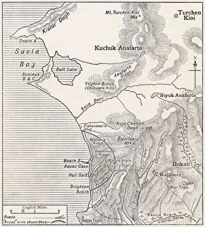
Background imageTurkey Postcard Collection: Map Showing Approximately The Semicircular Foothold Of Australians And New Zealanders Above Anzac

Map Showing Approximately The Semicircular Foothold Of Australians And New Zealanders Above Anzac Cove July 1915. From The Great World War A History Volume Iii, Published 1916

Background imageTurkey Postcard Collection: Plan Of Ephesus And Its Environs From Falkeners Ephesus With The Sites As Named By Edward Falkener

Plan Of Ephesus And Its Environs From Falkeners Ephesus With The Sites As Named By Edward Falkener From The Imperial Bible Dictionary Published By Blackie & Son Circa 1880S

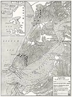
Background imageTurkey Postcard Collection: Detailed Map Of Gallipoli Peninsula And The Dardanelles Turkey In 1915 Showing British And Allied

Detailed Map Of Gallipoli Peninsula And The Dardanelles Turkey In 1915 Showing British And Allied Landing Beaches From The War Illustrated Album Deluxe Published London 1916

Background imageTurkey Postcard Collection: Map of the fortress of Bender. Artist: Wolff, Jeremias (1663-1724)

Map of the fortress of Bender. Artist: Wolff, Jeremias (1663-1724)
Map of the fortress of Bender. Private Collection

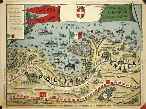
Background imageTurkey Postcard Collection: Italo-Turkish War or Libyan War, 1911-12, Map of battles from 20th October to 3rd November 1911

Italo-Turkish War or Libyan War, 1911-12, Map of battles from 20th October to 3rd November 1911, colour print
Cartography, Libya, 20th century. Italo-Turkish War or Libyan War (1911-12), map of battles from the 20th October to 3rd November 1911. Color print

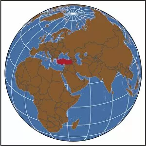
Background imageTurkey Postcard Collection: Turkey locator map

Turkey locator map
2012 edition

Background imageTurkey Postcard Collection: arabia, archival, asia, border, cartography, caspian sea, coordinates, document, geography

arabia, archival, asia, border, cartography, caspian sea, coordinates, document, geography, historic, historical, insets, iran, iraq, israel, jordan, latitude, legend, longitude, map, mediterranean

Background imageTurkey Postcard Collection: Turkey in Europe

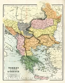
Turkey in Europe
Vintage map of Turkey in Europe.Engraved, Published and Edited in 1845in the Pictorial Sunday-Book by J.Morrison&CoRestored By PictoreVery high resolution ( XXXL)

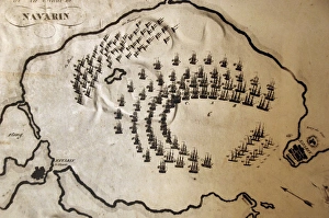
Background imageTurkey Postcard Collection: Battle of Navarino

Battle of Navarino
GREEK WAR OF INDEPENDENCE (1821-1830) The naval Battle of Navarino (October 20, 1827) in Navarino Bay (now Pylos), in the Peloponnese

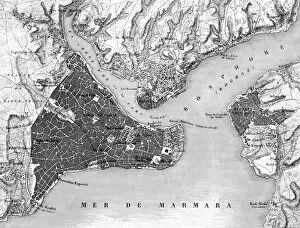
Background imageTurkey Postcard Collection: Turkey / Istanbul / Map 1835

Turkey / Istanbul / Map 1835
Map of Istanbul (Constantinople). Date: circa 1835

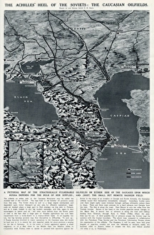
Background imageTurkey Postcard Collection: Caucasian oilfields by G. H. Davis

Caucasian oilfields by G. H. Davis
The Achilles Heel of the Soviets: the Caucasian oilfields. A pictorial map of the strategically vulnerable oilfields on either side of the Caucasus upon which Russia depends for the bulk of her

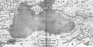
Background imageTurkey Postcard Collection: Map of the Black Sea and the Crimea, 1854

Map of the Black Sea and the Crimea, 1854
Engraving of a map of the area around the Black Sea with the borders between Turkey and Russia, showing the disputed Crimea region. Date: 1854

Background imageTurkey Postcard Collection: Plan of the Turkish, Swimming and other baths, Convent Walk, Sheffield; for sale, 1890

Plan of the Turkish, Swimming and other baths, Convent Walk, Sheffield; for sale, 1890
Surveyor: The Sheffield Bath Co Ltd.Scale: 10 feet : 1 inch.Original at Sheffield Local Studies Library:s (20) 57 L

Background imageTurkey Postcard Collection: Antique map of Persia and the Middle East

Antique map of Persia and the Middle East

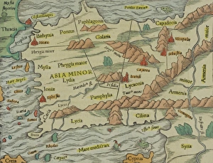
Background imageTurkey Postcard Collection: Antique map of Asia Minor, present day Turkey

Antique map of Asia Minor, present day Turkey

Background imageTurkey Postcard Collection: Seleucid Empire, 3rd to 2nd century BC, published in 1861

Seleucid Empire, 3rd to 2nd century BC, published in 1861
The Seleucid Empire was created after the death of Alexander the Great and dominated the Near East from the 3rd to 2nd century BC. Legend in Latin language

Background imageTurkey Postcard Collection: Ottoman Empire, 14th-19th century, lithograph, published in 1878

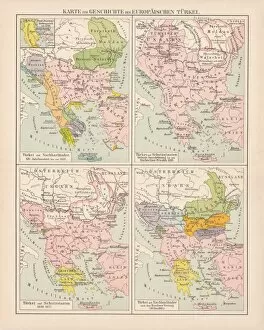
Ottoman Empire, 14th-19th century, lithograph, published in 1878
Ancient map of the history of European Turkey, 15th - 19th century. Lithograph, published in 1878

Background imageTurkey Postcard Collection: Antique Map of Greece

Antique Map of Greece
Antique map of Greece from 1867

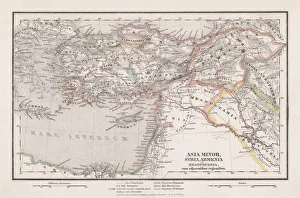
Background imageTurkey Postcard Collection: Map of Asia Minor in Ancient Times

Map of Asia Minor in Ancient Times
Vintage engraving of a Map of Asia Minor in Ancient Times

Background imageTurkey Postcard Collection: Historical map of the Oriental part of world

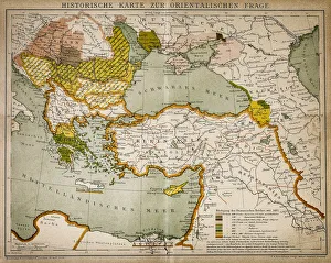
Historical map of the Oriental part of world
Antique illustration of a Historical map of the Oriental part of world

Background imageTurkey Postcard Collection: The Turkish Empire, from A Prospect of the Most Famous Parts of the World

The Turkish Empire, from A Prospect of the Most Famous Parts of the World
XYC289256 The Turkish Empire, from A Prospect of the Most Famous Parts of the World, printed by John Dawson for George Humble, 1627 (hand coloured engraving) by Speed

Background imageTurkey Postcard Collection: The Turkish Empire in Europe, Asia and Africa, 1736 (hand coloured print)

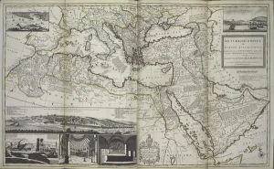
The Turkish Empire in Europe, Asia and Africa, 1736 (hand coloured print)
XOS1765727 The Turkish Empire in Europe, Asia and Africa, 1736 (hand coloured print) by Moll, Hermann (fl.1678-1732); 64x101 cm; New York Public Library

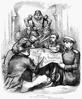
Background imageTurkey Postcard Collection: RUSSO-TURKISH WAR, 1877. Peace Rumors. American cartoon by Thomas Nast, 1877

RUSSO-TURKISH WAR, 1877. Peace Rumors. American cartoon by Thomas Nast, 1877, showing Britain, Germany, Austria-Hungary and Russia carving up the Ottoman Empire as a powerless Turkey looks on

Background imageTurkey Postcard Collection: SAN STEFANO TREATY MAP. The first publication of the map showing the territorial

SAN STEFANO TREATY MAP. The first publication of the map showing the territorial changes effected by the treaty between Russia and Turkey signed at San Stefano, 3 March 1878

Background imageTurkey Postcard Collection: WORLD WAR I: MIDDLE EAST. Map, 1919, of the Middle East and the lines of battle

WORLD WAR I: MIDDLE EAST. Map, 1919, of the Middle East and the lines of battle during World War I

Background imageTurkey Postcard Collection: MAP OF EUROPE, 1812-1815. An American map of 1905 comparing the political landscape

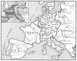
MAP OF EUROPE, 1812-1815. An American map of 1905 comparing the political landscape of Europe before and after the 1815 Congress of Vienna

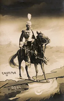
Background imageTurkey Postcard Collection: King Peter I of Serbia - capture of Durres from the Ottomans

King Peter I of Serbia - capture of Durres from the Ottomans
King Peter I of Serbia (1844-1921, reigned from 1903 - 1921) in all his regal finery on horseback astride the border of Serbia and Albania

Background imageTurkey Postcard Collection: Syria and Lebanon - Tourist Map

Syria and Lebanon - Tourist Map. Date: circa 1910s

Background imageTurkey Postcard Collection: Enver Pasha and General Winkler, Macedonian Front, WW1

Enver Pasha and General Winkler, Macedonian Front, WW1
Ismail Enver Pasha (1881-1922), Turkish leader, and General Arnold von Winkler (or Winckler, 1856-1945), German army officer, studying a map on the Macedonian Front during the First World War

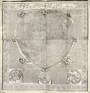
Background imageTurkey Postcard Collection: Haci Ahmeds world map, 1560

Haci Ahmeds world map, 1560
Haci Ahmeds world map. This map, based on Oronce Fines cordiform (heart-shaped) map of 1534, was translated into Turkish in the Islamic year 967 (October 1559 to September 1560)

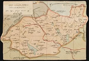
Background imageTurkey Postcard Collection: Map of the Trabzon Province

Map of the Trabzon Province
Map showing the Trabzon Province on the Black Sea coast in north-eastern Turkey. The capital of the Province, Trabzon was located on the historic silk road route and during the Ottoman period

Background imageTurkey Postcard Collection: Konya, Turkey - A Map of Konya Province

Konya, Turkey - A Map of Konya Province
A Map of Konya Province, marking Konya (also known as Koniah, Konieh, Konia, Qunia and Iconium) in Turkey. Dates from 3000 BC and successively came under the influence of the Hittites


All Professionally Made to Order for Quick Shipping


-

Turkey Postcard Collection

Turkey is a transcontinental country located in Southeast Europe and Southwest Asia and has a population of over 82 million people, making it the world's 18th most populous country. The capital city is Ankara, while Istanbul is the largest city and economic center. A diverse economy with industries such as textiles, automotive, electronics, and tourism contributing significantly to its GDP. The country also boasts of rich cultural heritage evident in its architecture, cuisine, music, and festivals. Turkey shares borders with eight countries including Greece, Bulgaria, Georgia, Armenia among others and has access to two seas; the Black Sea and Mediterranean Sea.
+

Our beautiful Wall Art and Photo Gifts include Framed Prints, Photo Prints, Poster Prints, Canvas Prints, Jigsaw Puzzles, Metal Prints and so much more

The Turkey collection from Media Storehouse is a stunning selection of wall art and framed prints that showcase the beauty and history of Turkey. Our collection features a range of maps, charts, and illustrations that depict the country's geography, landmarks, cities, and historical events. The artwork in our collection is sourced from various archives around the world, including museums, libraries, and private collections. Each piece in our collection has been carefully curated to offer a unique perspective on Turkey's rich cultural heritage. From antique maps depicting Ottoman-era borders to modern-day satellite images showcasing Istanbul's bustling cityscape - there is something for everyone in this diverse collection. Whether you're looking to add some Turkish flair to your home or office decor or simply want to learn more about this fascinating country - the Turkey collection from Media Storehouse offers an unparalleled glimpse into its past and present.
+

What are Turkey (Maps and Charts) art prints?

Turkey art prints are high-quality reproductions of historical maps and charts depicting the country of Turkey. These prints showcase the intricate details, unique features, and geographical landmarks of Turkey that have been captured by skilled cartographers over time. These art prints offer a glimpse into the past, allowing viewers to explore how Turkey has evolved through history. They also serve as educational tools for students, historians, and geography enthusiasts who want to learn more about this fascinating country. Turkey art prints are available in various sizes and formats such as framed or unframed prints, canvas wraps or posters. They make great additions to any home or office decor with their vintage charm adding character to any space. Whether you're looking for a piece of artwork that celebrates your love for travel or simply want to add some cultural flair to your living space - these beautiful art pieces from Media Storehouse are sure to impress.
+

What Turkey (Maps and Charts) art prints can I buy from Media Storehouse?

We offer a wide range of Turkey art prints, including maps and charts. These prints showcase the beauty and diversity of Turkey's landscapes, cities, and historical sites. You can choose from vintage maps that highlight the country's geography or contemporary charts that depict its political boundaries. In addition to maps and charts, Media Storehouse also offers photographic prints featuring iconic landmarks such as Hagia Sophia in Istanbul or Cappadocia's unique rock formations. You can also find stunning images of Turkey's coastline, mountains, and countryside. Whether you're looking for a piece to decorate your home or office or a gift for someone who loves Turkey, we have something for everyone. With high-quality printing on premium paper stock, these art prints are sure to impress anyone who sees them.
+

How do I buy Turkey (Maps and Charts) art prints?

To buy Turkey art prints from Media Storehouse, you can browse our extensive collection of high-quality images online. Simply search for "Turkey Maps and Charts" in the search bar on our website to find a range of options available. Once you have found an image that you like, select the size and format that suits your needs. You can choose from a variety of print sizes, including small, medium, large or extra-large prints. After selecting your preferred size and format, add the item to your cart and proceed to checkout. You will be prompted to enter your shipping information as well as payment details. We offer secure payment methods such as credit card payments or PayPal transactions. Once your order is confirmed, they will process it promptly so that you receive your Turkey art print in no time.
+

How much do Turkey (Maps and Charts) art prints cost?

We offer a wide range of Turkey art prints at varying prices. Our collection includes high-quality prints that are perfect for adding a touch of elegance to any room in your home or office. The cost of our Turkey art prints depends on the size, framing options, and other customizations you choose. We have something for everyone's budget with affordable options as well as premium quality products. We take pride in offering exceptional value for money while maintaining the highest standards of quality. Our Turkey art prints come in various sizes ranging from small to large formats so that you can find the perfect fit for your space. Whether you're looking to decorate your living room, bedroom or office, our selection has got you covered.
+

How will my Turkey (Maps and Charts) art prints be delivered to me?

We take great care in delivering your Turkey art prints to you. Once you have placed your order with us, our team of professionals will carefully package your print to ensure it arrives safely at its destination. We use high-quality materials that are designed to protect the artwork during transit. Depending on the size of the print, we may roll it up and place it in a sturdy tube for shipping or pack it flat between two pieces of cardboard. Our delivery partners are trusted couriers who specialize in handling fragile items such as artwork. When your Turkey art print arrives, please inspect it carefully to ensure that there is no damage during transit. If you do find any issues with your order, please contact us immediately so that we can resolve them for you as quickly as possible. We hope that you enjoy your new artwork from Media Storehouse.