Fraud Blocker Skip to main content

Home > Maps and Charts > Spain

Spain Collection (page 6)

Spain is a country located in southwestern Europe

1,434 items

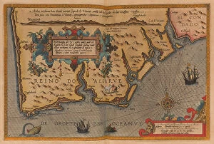
Background imageSpain Collection: Oversize atlas titled 'Speculum nauticum super navigatione maris occidentalis confectu

Oversize atlas titled 'Speculum nauticum super navigatione maris occidentalis confectu
7342714 Oversize atlas titled 'Speculum nauticum super navigatione maris occidentalis confectu, continens omnes oras maritimas Galliae, Hispaniae, and praecipuarum partium Angliae'

Background imageSpain Collection: Map of Smerwick, Ireland, showing the English earthwork with two guns for attacking the Spanish fort

Map of Smerwick, Ireland, showing the English earthwork with two guns for attacking the Spanish fort
7339829 Map of Smerwick, Ireland, showing the English earthwork with two guns for attacking the Spanish fort and English soldiers marching out of Castell More, 1580 (paper, linen) by Unknown Artist

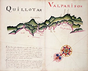
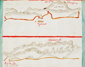
Background imageSpain Collection: Quillota and Valpariso, South American Pacific coast, 1685 (manuscript)

Quillota and Valpariso, South American Pacific coast, 1685 (manuscript)
7339772 Quillota and Valpariso, South American Pacific coast, 1685 (manuscript) by Hack, William (17th Century); 40x50 cm; National Maritime Museum, London

Background imageSpain Collection: St George, South American Pacific coast, 1685 (manuscript)

St George, South American Pacific coast, 1685 (manuscript)
7339767 St George, South American Pacific coast, 1685 (manuscript) by Hack, William (17th Century); 40x50 cm; National Maritime Museum, London

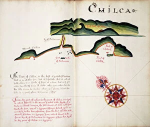
Background imageSpain Collection: Chilca, 1685 (bound sheet)

Chilca, 1685 (bound sheet)
7339762 Chilca, 1685 (bound sheet) by Hack, William (17th Century); 40x50 cm; National Maritime Museum, London, UK; (add.info.: Creator: William Hack South America, the Pacific Coast and Peru)

Background imageSpain Collection: Guacho, 1685 (bound sheet)

Guacho, 1685 (bound sheet)
7339756 Guacho, 1685 (bound sheet) by Hack, William (17th Century); 40x50 cm; National Maritime Museum, London, UK; (add.info.: Creator: William Hack South America, the Pacific Coast)

Background imageSpain Collection: Pacasmayo and Malabrigo, 1685 (bound sheet)

Pacasmayo and Malabrigo, 1685 (bound sheet)
7339742 Pacasmayo and Malabrigo, 1685 (bound sheet) by Hack, William (17th Century); 40x50 cm; National Maritime Museum, London, UK; (add.info.: Creator: William Hack South America)

Background imageSpain Collection: The Bay of Colan & Port of Paita, 1685 (bound sheet)

The Bay of Colan & Port of Paita, 1685 (bound sheet)
7339735 The Bay of Colan & Port of Paita, 1685 (bound sheet) by Hack, William (17th Century); 40x50 cm; National Maritime Museum, London, UK; (add.info.: Creator: William Hack South America)

Background imageSpain Collection: St Lorenzo, 1685 (bound sheet)

St Lorenzo, 1685 (bound sheet)
7339728 St Lorenzo, 1685 (bound sheet) by Hack, William (17th Century); 40x50 cm; National Maritime Museum, London, UK; (add.info.: Creator: William Hack South America, the Pacific Coast, Ecuador)

Background imageSpain Collection: Rosario, 1685 (bound sheet)

Rosario, 1685 (bound sheet)
7339721 Rosario, 1685 (bound sheet) by Hack, William (17th Century); 40x50 cm; National Maritime Museum, London, UK; (add.info.: Creator: William Hack South America, the Pacific Coast)

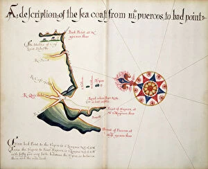
Background imageSpain Collection: A description of the Sea Coast from Mta. Puercos to Bad Point, 1685 (bound sheet)

A description of the Sea Coast from Mta. Puercos to Bad Point, 1685 (bound sheet)
7339707 A description of the Sea Coast from Mta. Puercos to Bad Point, 1685 (bound sheet) by Hack, William (17th Century); 40x50 cm; National Maritime Museum, London

Background imageSpain Collection: The Point of Meriato, 1685 (bound sheet)

The Point of Meriato, 1685 (bound sheet)
7339706 The Point of Meriato, 1685 (bound sheet) by Hack, William (17th Century); 40x50 cm; National Maritime Museum, London, UK; (add.info.: Creator: William Hack North America, the Pacific Coast)

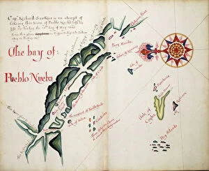
Background imageSpain Collection: The Bay of Pueblo Nueba, 1685 (bound sheet)

The Bay of Pueblo Nueba, 1685 (bound sheet)
7339704 The Bay of Pueblo Nueba, 1685 (bound sheet) by Hack, William (17th Century); 40x50 cm; National Maritime Museum, London, UK; (add.info.: Creator: William Hack North America)

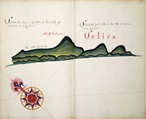
Background imageSpain Collection: Telica, 1685 (bound sheet)

Telica, 1685 (bound sheet)
7339693 Telica, 1685 (bound sheet) by Hack, William (17th Century); 40x50 cm; National Maritime Museum, London, UK; (add.info.: Creator: William Hack North America, the Pacific Coast and Nicaragua)

Background imageSpain Collection: A description of the Plantations in the Valley of Paneca, 1685 (bound sheet)

A description of the Plantations in the Valley of Paneca, 1685 (bound sheet)
7339686 A description of the Plantations in the Valley of Paneca, 1685 (bound sheet) by Hack, William (17th Century); 40x50 cm; National Maritime Museum, London

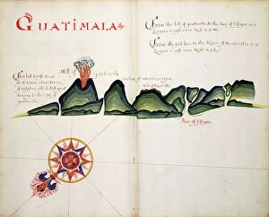
Background imageSpain Collection: Guatimala, 1685 (bound sheet)

Guatimala, 1685 (bound sheet)
7339683 Guatimala, 1685 (bound sheet) by Hack, William (17th Century); 40x50 cm; National Maritime Museum, London, UK; (add.info.: Creator: William Hack North America, the Pacific Coast)

Background imageSpain Collection: Arauco, 1682 (manuscript)

Arauco, 1682 (manuscript)
7339612 Arauco, 1682 (manuscript) by Ringrose, Basil (c.1653-83); 16x20 cm; National Maritime Museum, London, UK; (add.info.: Creator)

Background imageSpain Collection: Rio Guayas, 1682 (coloured manuscript)

Rio Guayas, 1682 (coloured manuscript)
7339608 Rio Guayas, 1682 (coloured manuscript) by Ringrose, Basil (c.1653-83); 16x20 cm; National Maritime Museum, London, UK; (add.info.: Creator: Basil Ringrose Bound sheet. Col. ms)

Background imageSpain Collection: Isla Salanga and Santa Elena, 1682 (coloured manuscript)

Isla Salanga and Santa Elena, 1682 (coloured manuscript)
7339605 Isla Salanga and Santa Elena, 1682 (coloured manuscript) by Ringrose, Basil (c.1653-83); 16x20 cm; National Maritime Museum, London, UK; (add.info.: Creator: Basil Ringrose Bound sheet. Col)

Background imageSpain Collection: Punta Borrachos, Cabo Pasado and Bahia de Caraquez, 1682 (coloured manuscript)

Punta Borrachos, Cabo Pasado and Bahia de Caraquez, 1682 (coloured manuscript)
7339602 Punta Borrachos, Cabo Pasado and Bahia de Caraquez, 1682 (coloured manuscript) by Ringrose, Basil (c.1653-83); 16x20 cm; National Maritime Museum, London

Background imageSpain Collection: Cojimies, 1682 (coloured manuscript)

Cojimies, 1682 (coloured manuscript)
7339601 Cojimies, 1682 (coloured manuscript) by Ringrose, Basil (c.1653-83); 16x20 cm; National Maritime Museum, London, UK; (add.info.: Creator: Basil Ringrose Bound sheet. Col. ms)

Background imageSpain Collection: Bahia San Mateo, 1682 (coloured manuscript)

Bahia San Mateo, 1682 (coloured manuscript)
7339600 Bahia San Mateo, 1682 (coloured manuscript) by Ringrose, Basil (c.1653-83); 16x20 cm; National Maritime Museum, London, UK; (add.info.: Creator: Basil Ringrose Bound sheet. Col. ms)

Background imageSpain Collection: Map of Florida, 1775 (print)

Map of Florida, 1775 (print)
7339547 Map of Florida, 1775 (print) by Jefferys, Thomas (c.1719-71); 27x37 cm; National Maritime Museum, London, UK; (add.info.: Creator: Thomas Jefferys; Robert Sayer Map on three sheets)

Background imageSpain Collection: Map of the west coast of Africa and the Canary islands, 1787 (engraving)

Map of the west coast of Africa and the Canary islands, 1787 (engraving)
7339377 Map of the west coast of Africa and the Canary islands, 1787 (engraving) by Varelay Ulloa, Joseph (18th century); 65x104 cm; National Maritime Museum, London

Background imageSpain Collection: Chart of the English coast, Isle of Wight and Portsmouth harbour, 1693 (coloured engraving)

Chart of the English coast, Isle of Wight and Portsmouth harbour, 1693 (coloured engraving)
7339372 Chart of the English coast, Isle of Wight and Portsmouth harbour, 1693 (coloured engraving) by Jaillot, Alexis-Hubert (1632-1712); 64x97 cm; National Maritime Museum, London

Background imageSpain Collection: Chart of Gibraltar, 1761 (engraving)

Chart of Gibraltar, 1761 (engraving)
7339358 Chart of Gibraltar, 1761 (engraving) by Bellin, Jacques Nicolas (1703-72) ; 61x91 cm; National Maritime Museum, London, UK; (add.info.: Creator: Jacques Nicolas Bellin Single sheet. Engr)

Background imageSpain Collection: The island of Chiloe, 1685 (bound sheet)

The island of Chiloe, 1685 (bound sheet)
7339331 The island of Chiloe, 1685 (bound sheet) by Hack, William (17th Century); 40x50 cm; National Maritime Museum, London, UK; (add.info.: Creator: William Hack South America)

Background imageSpain Collection: Hydrographic chart of the Bay of Cadiz, 1762 (engraving)

Hydrographic chart of the Bay of Cadiz, 1762 (engraving)
7339383 Hydrographic chart of the Bay of Cadiz, 1762 (engraving) by Bellin, Jacques Nicolas (1703-72) ; 61x93 cm; National Maritime Museum, London

Background imageSpain Collection: Island of Minorca, 1798 (print)

Island of Minorca, 1798 (print)
7339856 Island of Minorca, 1798 (print) by Unknown artist, (18th century); 79x12.9 cm; National Maritime Museum, London, UK; (add.info.: Creator: unknown Scale: 1:76 000)

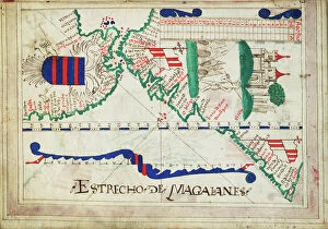
Background imageSpain Collection: Bound in an atlas of twenty-five charts with diagrams and tables

Bound in an atlas of twenty-five charts with diagrams and tables. Portuguese or Spanish., 1550-60 (bound sheet)
7339617 Bound in an atlas of twenty-five charts with diagrams and tables. Portuguese or Spanish., 1550-60 (bound sheet) by Unknown Artist, (16th century); 2.4x17 cm; National Maritime Museum, London

Background imageSpain Collection: Sapoticlan and Sacatepeque, 1685 (bound sheet)

Sapoticlan and Sacatepeque, 1685 (bound sheet)
7339681 Sapoticlan and Sacatepeque, 1685 (bound sheet) by Hack, William (17th Century); 40x50 cm; National Maritime Museum, London, UK; (add.info.: Creator: William Hack North America)

Background imageSpain Collection: Iquique, Chile, 1682 (manuscript)

Iquique, Chile, 1682 (manuscript)
7339606 Iquique, Chile, 1682 (manuscript) by Ringrose, Basil (c.1653-83); 16x20 cm; National Maritime Museum, London, UK; (add.info.: Creator)

Background imageSpain Collection: A chart of the sea coasts of New England, New Jersey, Virginia

A chart of the sea coasts of New England, New Jersey, Virginia, Maryland and Carolina from Cape Cod to Cape Hatteras
7337587 A chart of the sea coasts of New England, New Jersey, Virginia, Maryland and Carolina from Cape Cod to Cape Hatteras, 1675 (engraving) by Seller

Background imageSpain Collection: Reconquista: siege of Seville by Ferdinand III of Castile in 1248

Reconquista: siege of Seville by Ferdinand III of Castile in 1248, from "El Fernando o Sevilla restaurada" by
AIS5377945 Reconquista: siege of Seville by Ferdinand III of Castile in 1248, from "El Fernando o Sevilla restaurada" by Juan Antonio de Vera y Figueroa, 1632 (engraving); © Iberfoto

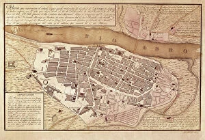
Background imageSpain Collection: Spanish War of Independence (1808-1814): map of Zaragoza after second seat

Spanish War of Independence (1808-1814): map of Zaragoza after second seat (December 1808 - February 1809)
AIS5353201 Spanish War of Independence (1808-1814): map of Zaragoza after second seat (December 1808 - February 1809),in "Atlas of the Guerra de Independencia" (1868) (engraving)

Background imageSpain Collection: Cartography, 17th century. map of the Mediterranean Sea Nautical Atlas by Francesco Oliva

Cartography, 17th century. map of the Mediterranean Sea Nautical Atlas by Francesco Oliva, 1658 (map)
AIS5350421 Cartography, 17th century. map of the Mediterranean Sea Nautical Atlas by Francesco Oliva, 1658 (map); Museu Maritim Atarazanas, Barcelona, Catalunya, Spain; © Iberfoto

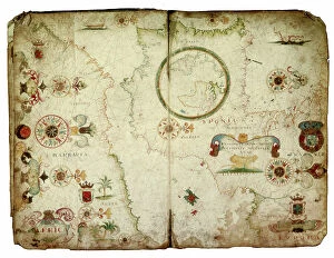
Background imageSpain Collection: Cartography, 16th century. Map of the Mediterranean Sea, from a portolan chart by Pietro Russo

Cartography, 16th century. Map of the Mediterranean Sea, from a portolan chart by Pietro Russo, Messina, 1508 (map)
AIS5350346 Cartography, 16th century. Map of the Mediterranean Sea, from a portolan chart by Pietro Russo, Messina, 1508 (map); Museu Maritim Atarazanas, Barcelona, Catalunya, Spain; © Iberfoto

Background imageSpain Collection: Representation du monde selon Claude Ptoleme (Claudius Ptolemaeus (vers 100-170)

Representation du monde selon Claude Ptoleme (Claudius Ptolemaeus (vers 100-170)
AIS5331520 Representation du monde selon Claude Ptoleme (Claudius Ptolemaeus (vers 100-170). Gravure extraite de "Atlas Coelestis seu Harmonia Macrocosmica" (1661)

Background imageSpain Collection: Map of the itinerary of the Spanish expedition of Hernando De Soto (1500-1542)

Map of the itinerary of the Spanish expedition of Hernando De Soto (1500-1542)
NWI4850788 Map of the itinerary of the Spanish expedition of Hernando De Soto (1500-1542) through the southeast of the United States, North America, 1539-1542

Background imageSpain Collection: BRAUN, George (1541-1622). ORTELIUS, Abraham (1527-1598). HOGENBERG, Franz (1535-1590)

BRAUN, George (1541-1622). ORTELIUS, Abraham (1527-1598). HOGENBERG, Franz (1535-1590)
CUL4853482 BRAUN, George (1541-1622). ORTELIUS, Abraham (1527-1598). HOGENBERG, Franz (1535-1590). Civitatis Orbis Terrarum (Theatrum orbis terrarum). 1572-1617. Paris (1572). Volume I. Etching

Background imageSpain Collection: Map of the United States in 1819 showing the territory under occupation of the Spanish

Map of the United States in 1819 showing the territory under occupation of the Spanish
NWI4846207 Map of the United States in 1819 showing the territory under occupation of the Spanish and English colonial populations

Background imageSpain Collection: Map illustrating the conflicts between Spain and Great Britain disputing the borders of the States

Map illustrating the conflicts between Spain and Great Britain disputing the borders of the States of America
NWI4846409 Map illustrating the conflicts between Spain and Great Britain disputing the borders of the States of America, 1810-1812

Background imageSpain Collection: Geography map: representation of part of the territories of New Spain (Florida, Mexico)

Geography map: representation of part of the territories of New Spain (Florida, Mexico)
VEN5030337 Geography map: representation of part of the territories of New Spain (Florida, Mexico, Central America) and taken from an Atlas by Willem Janszoon Blaeu (1571-1638), approximately 1630

Background imageSpain Collection: MAROTO, Rafael (1783-1847). English military man who fought in the First Carlist War. Spain

MAROTO, Rafael (1783-1847). English military man who fought in the First Carlist War. Spain. First Carlist War
CUL4874872 MAROTO, Rafael (1783-1847). English military man who fought in the First Carlist War. Spain. First Carlist War

Background imageSpain Collection: Frontispice of 'Harmonia Macrocosmica' or 'Celestial Atlas' by Andreas Cellarius, 1661 (engraving)

Frontispice of 'Harmonia Macrocosmica' or 'Celestial Atlas' by Andreas Cellarius, 1661 (engraving)
CUL4933069 Frontispice of 'Harmonia Macrocosmica' or 'Celestial Atlas' by Andreas Cellarius, 1661 (engraving); Biblioteca Nacional, Madrid, Spain; (add.info.: CELLARIUS, Andreas (1596-1665)

Background imageSpain Collection: Map of the world showing the colonial possessions, England, France, Portugal

Map of the world showing the colonial possessions, England, France, Portugal
ELD4932191 Map of the world showing the colonial possessions, England, France, Portugal, Spain and their colonies Engraving from "History of the world" by Ridpath 1885 Private collection;

Background imageSpain Collection: Claudis Ptolomaeus, 100-170

Claudis Ptolomaeus, 100-170
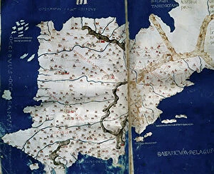
3499627 Claudis Ptolomaeus, 100-170; Biblioteca Universidad, Salamanca, Spain; (add.info.: Claudis Ptolomaeus (100-170). Cosmographia, map of The Hispanias. Manuscript of 1456. XV Century

Background imageSpain Collection: Claudis Ptolomaeus

Claudis Ptolomaeus
3499626 Claudis Ptolomaeus; (add.info.: Claudis Ptolomaeus. Cosmographia, map of the Iberian Peninsula. XV Century. Library of the University of Salamanca. Castile and Lion, Spain.); PHAS/UIG


All Professionally Made to Order for Quick Shipping


-

Spain Collection

Spain is a country located in southwestern Europe, bordered by Portugal to the west and France to the northeast and has a population of approximately 47 million people and its capital city is Madrid. Spain's geography includes mountain ranges such as the Pyrenees and Sierra Nevada, as well as coastal regions along both the Mediterranean Sea and Atlantic Ocean. The country has a diverse economy with industries including tourism, agriculture, manufacturing, and services. Spain is known for its rich history and culture, including famous landmarks like La Sagrada Familia in Barcelona and flamenco dancing in Andalusia.
+

Our beautiful pictures are available as Framed Prints, Photos, Wall Art and Photo Gifts

The Spain collection from Media Storehouse is a stunning assortment of wall art and framed prints that showcase the beauty, history, and culture of Spain. Our collection features an array of maps and charts that depict different regions, cities, landmarks, and historical events in Spain. These pieces are perfect for those who love to travel or have a passion for geography. From vintage-style maps to contemporary designs, the Spain collection offers something for everyone's taste. Each piece is printed on high-quality paper using archival inks to ensure long-lasting color vibrancy. The frames are made with premium materials such as wood or metal to provide durability while complementing the artwork. Whether you're looking for a unique gift or want to add some character to your home decor, our collection has plenty of options. With its rich history and diverse landscapes, Spain is truly a country worth exploring - let these beautiful maps and charts take you there.
+

What are Spain (Maps and Charts) art prints?

Spain art prints are a collection of high-quality, visually stunning prints that showcase the beauty and intricacies of Spain's geography. These prints feature detailed maps and charts that highlight the country's diverse regions, cities, landmarks, and topography. They are perfect for anyone who loves to explore new places or has an interest in history, geography or travel. These art prints are created using state-of-the-art printing technology on premium quality paper to ensure their longevity and durability. They come in various sizes to suit different preferences and can be framed or mounted according to individual taste. Whether you're looking for a unique piece of wall decor for your home or office space or want to gift someone with a special memento from Spain, these art prints offer something for everyone. With their intricate details and vibrant colors, they capture the essence of this beautiful country like no other medium can.
+

What Spain (Maps and Charts) art prints can I buy from Media Storehouse?

We offer a wide variety of Spain art prints for purchase. These prints range from vintage maps of Spain to modern charts depicting the country's geography, landmarks, and attractions. Some popular options include antique city plans of Madrid or Barcelona, detailed topographical maps highlighting the Pyrenees Mountains or Andalusian coastlines, and colorful illustrations showcasing Spanish culture such as flamenco dancing or bullfighting. In addition to traditional paper prints, Media Storehouse also offers canvas and framed options for many of their Spain pieces. You can choose from a range of sizes to fit their space needs, whether they are looking for a small accent piece or a large statement print. We provide an extensive selection of high-quality Spain art prints that cater to various tastes and preferences.
+

How do I buy Spain (Maps and Charts) art prints?

To buy Spain art prints from Media Storehouse, you can browse our extensive collection of artwork online. Simply search for "Spain Maps and Charts" in the search bar on our website to find a range of options available. Once you have found the print that you like, select the size and format that suits your needs. We offer a variety of printing options including canvas, framed prints, posters, and photographic prints. You can choose between different sizes as well as finishes such as gloss or matte. Once you have made your selection, add it to your cart and proceed to checkout where you will be prompted to enter your payment details. After completing the purchase process, your order will be processed by our team who will ensure that it is printed according to your specifications before being shipped out for delivery. Buying Spain art prints from Media Storehouse is an easy process with plenty of options available for customization so that you can get exactly what you want.
+

How much do Spain (Maps and Charts) art prints cost?

We offer a wide range of Spain art prints at varying prices. Our collection includes vintage maps, antique charts, and contemporary designs that capture the beauty and history of this fascinating country. The cost of our Spain art prints depends on various factors such as size, framing options, and printing materials. We use high-quality paper stock to ensure that our prints are long-lasting and vibrant in color. Our you can choose from different sizes ranging from small to large formats depending on their preferences. We also offer custom framing services for those who want to display their artwork in style. Our Spain art prints are perfect for home or office decor, gifts for friends or family members who love travel or history buffs interested in exploring the rich cultural heritage of Spain. With our extensive collection of Spain art prints available at affordable prices, you're sure to find something that suits your taste.
+

How will my Spain (Maps and Charts) art prints be delivered to me?

Your Spain art prints will be delivered to you in a secure and protective packaging. We take great care in ensuring that your artwork arrives at your doorstep in perfect condition. We use high-quality materials for our packaging to prevent any damage during transit. The delivery method may vary depending on your location and the size of the print(s). For smaller prints, we usually ship them via standard mail or courier service. Larger prints may require special handling and will be shipped using a different carrier. Once your order is dispatched, you will receive an email notification with tracking information so that you can monitor its progress until it reaches you. If there are any issues with delivery, please do not hesitate to contact us as we are always happy to assist our customers. Rest assured that your Spain art prints will be delivered safely and securely to your chosen address.