Fraud Blocker Skip to main content

Home > Maps and Charts > Netherlands

Netherlands Collection (page 9)

Netherlands is a country located in Western Europe, bordered by Germany to the east and Belgium to the south

549 items

Background imageNetherlands Collection: Map of Belgium (Engraving, 1717)

Map of Belgium (Engraving, 1717)
LRI4712230 Map of Belgium (Engraving, 1717) by Nolin, Jean-Baptiste (c.1657-1708); Private Collection; (add.info.: Map of the meridional part of the Netherlands or Flanders (Belgium)

Background imageNetherlands Collection: Map of the Duche of Brabant (Belgium, Netherlands) (etching, 1671)

Map of the Duche of Brabant (Belgium, Netherlands) (etching, 1671)
LRI4711081 Map of the Duche of Brabant (Belgium, Netherlands) (etching, 1671) by Wit, Frederick de (1630-1706); Private Collection; (add.info.: Map of the Duche of Brabant (Belgium)

Background imageNetherlands Collection: View of Kampen (Campensis), Netherlands (etching, 1572-1617)

View of Kampen (Campensis), Netherlands (etching, 1572-1617)
LRI4709149 View of Kampen (Campensis), Netherlands (etching, 1572-1617) by Hogenberg, Franz (1540-c.1590); Private Collection; (add.info.: View of Kampen (Campensis)

Background imageNetherlands Collection: Plan of Haarlem (Harlemum), Netherlands (etching, 1572-1617)

Plan of Haarlem (Harlemum), Netherlands (etching, 1572-1617)
LRI4709095 Plan of Haarlem (Harlemum), Netherlands (etching, 1572-1617) by Hogenberg, Franz (1540-c.1590); Private Collection; (add.info.: Plan of Haarlem (Harlemum)

Background imageNetherlands Collection: Plan of Leiden (Leyden), Netherlands (etching, 1572-1617)

Plan of Leiden (Leyden), Netherlands (etching, 1572-1617)
LRI4709077 Plan of Leiden (Leyden), Netherlands (etching, 1572-1617) by Hogenberg, Franz (1540-c.1590); Private Collection; (add.info.: Plan of Leiden (Leyden)

Background imageNetherlands Collection: View of Mstricht (Trajectum ad Mosam), Netherlands (etching, 1572-1617)

View of Mstricht (Trajectum ad Mosam), Netherlands (etching, 1572-1617)
LRI4709024 View of Mstricht (Trajectum ad Mosam), Netherlands (etching, 1572-1617) by Hogenberg, Franz (1540-c.1590); Private Collection; (add.info.: View of Mstricht (Trajectum ad Mosam)

Background imageNetherlands Collection: The Hague, Netherlands (engraving, 1572-1617)

The Hague, Netherlands (engraving, 1572-1617)
LRI4715942 The Hague, Netherlands (engraving, 1572-1617) by Braun, Georg (1541-1622) and Hogenberg, Franz (1535-90); Private Collection; (add.info.: The Hague, Netherlands - Hagae comitis (Hague)

Background imageNetherlands Collection: Plan of Amsterdam (Amstelredamum), Netherlands (etching, 1572-1617)

Plan of Amsterdam (Amstelredamum), Netherlands (etching, 1572-1617)
LRI4707973 Plan of Amsterdam (Amstelredamum), Netherlands (etching, 1572-1617) by Hogenberg, Franz (1540-c.1590); Private Collection; (add.info.: Plan of Amsterdam (Amstelredamum)

Background imageNetherlands Collection: Map of Catholic Netherlands (Belgium and Luxembourg) (etching, 1730)

Map of Catholic Netherlands (Belgium and Luxembourg) (etching, 1730)
LRI4706519 Map of Catholic Netherlands (Belgium and Luxembourg) (etching, 1730) by Delisle, Guillaume (1675-1726); Private Collection; (add.info)

Background imageNetherlands Collection: Gelderland and Overijssel, Netherlands (engraving, 1596)

Gelderland and Overijssel, Netherlands (engraving, 1596)
LRI4717665 Gelderland and Overijssel, Netherlands (engraving, 1596) by Mercator, Gerardus (1512-94); Private Collection; (add.info.: Geldria and Transysulana)

Background imageNetherlands Collection: Untitled map of Brabant: Belgium and Netherlands (engraving, 1596)

Untitled map of Brabant: Belgium and Netherlands (engraving, 1596)
LRI4717565 Untitled map of Brabant: Belgium and Netherlands (engraving, 1596) by Mercator, Gerardus (1512-94); Private Collection; (add.info.: Untitled map of Brabant, 1610: Belgium end Netherlands)

Background imageNetherlands Collection: Map of Flissinga, from Civitates Orbis Terrarum

Map of Flissinga, from Civitates Orbis Terrarum
STC138924 Map of Flissinga, from Civitates Orbis Terrarum by Georg Braun (1541-1622) and Frans Hogenberg (1535-90) c.1572-1617 (coloured engraving) by Hoefnagel

Background imageNetherlands Collection: Map of Nijmegen, from Civitates Orbis Terrarum

Map of Nijmegen, from Civitates Orbis Terrarum
STC138910 Map of Nijmegen, from Civitates Orbis Terrarum by Georg Braun (1541-1622) and Frans Hogenberg (1535-90) c.1572-1617 (coloured engraving) by Hoefnagel

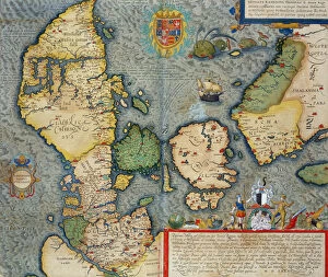
Background imageNetherlands Collection: Map of Northern Europe, from Civitates Orbis Terrarum

Map of Northern Europe, from Civitates Orbis Terrarum
STC138976 Map of Northern Europe, from Civitates Orbis Terrarum by Georg Braun (1541-1622) and Frans Hogenberg (1535-90) c.1572-1617 (coloured engraving) by Hoefnagel

Background imageNetherlands Collection: The history of Belgium (coloured engraving)

The history of Belgium (coloured engraving)
3646248 The history of Belgium (coloured engraving) by European School, (19th century); Private Collection; (add.info.: The history of Belgium)

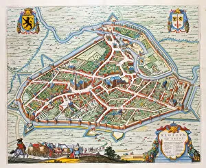
Background imageNetherlands Collection: Aalst, 1649 (hand-coloured engraving)

Aalst, 1649 (hand-coloured engraving)
478387 Aalst, 1649 (hand-coloured engraving) by Blaeu, Joan (1596-1673); Private Collection; (add.info.: Aalst, a town in Flanders)

Background imageNetherlands Collection: Vanitas Still Life par Edwaert Collier (1642-1708), 1662 - Oil on canvas, 98x129

Vanitas Still Life par Edwaert Collier (1642-1708), 1662 - Oil on canvas, 98x129
FIA5402900 Vanitas Still Life par Edwaert Collier (1642-1708), 1662 - Oil on canvas, 98x129, 7 - Private Collection by Colyer or Collier

Background imageNetherlands Collection: Portolan Chart of Western Europe and North Africa, c. 1580 (sepia ink and colour on vellum

Portolan Chart of Western Europe and North Africa, c. 1580 (sepia ink and colour on vellum
986016 Portolan Chart of Western Europe and North Africa, c.1580 (sepia ink and colour on vellum) by Dutch School, (16th century); 89x73 cm; Private Collection; (add.info)

Background imageNetherlands Collection: Map of the Marquisates of the Holy Germanic Empire and the Lordship of Mechelen

Map of the Marquisates of the Holy Germanic Empire and the Lordship of Mechelen
LRI4709617 Map of the Marquisates of the Holy Germanic Empire and the Lordship of Mechelen (Netherlands) (etching, 1671) by Wit

Background imageNetherlands Collection: View of Limburg (Lympurch), Netherlands (etching, 1572-1617)

View of Limburg (Lympurch), Netherlands (etching, 1572-1617)
LRI4708971 View of Limburg (Lympurch), Netherlands (etching, 1572-1617) by Hogenberg, Franz (1540-c.1590); Private Collection; (add.info.: View of Limburg (Lympurch)

Background imageNetherlands Collection: Plan of Mstricht (Traiectum), Netherlands (etching, 1572-1617)

Plan of Mstricht (Traiectum), Netherlands (etching, 1572-1617)
LRI4707966 Plan of Mstricht (Traiectum), Netherlands (etching, 1572-1617) by Hogenberg, Franz (1540-c.1590); Private Collection; (add.info.: Plan of Mstricht (Traiectum)

Background imageNetherlands Collection: Views of Groningen (Groeninga), Brouwershaven (Broversavia) and Gorinchem (Goricum)

Views of Groningen (Groeninga), Brouwershaven (Broversavia) and Gorinchem (Goricum)
LRI4708013 Views of Groningen (Groeninga), Brouwershaven (Broversavia) and Gorinchem (Goricum), in the Netherlands (etching, 1572-1617) by Hogenberg

Background imageNetherlands Collection: Map of the Netherlands, 1570 (engraving)

Map of the Netherlands, 1570 (engraving)
LRI4704413 Map of the Netherlands, 1570 (engraving) by Ortelius, Abraham (1527-98); Museo Navale di Pegli, Genoa, Italy; (add.info)

Background imageNetherlands Collection: Gouda, Netherlands (engraving, 1572-1617)

Gouda, Netherlands (engraving, 1572-1617)
LRI4714027 Gouda, Netherlands (engraving, 1572-1617) by Hogenberg, Franz (1540-c.1590); Private Collection; (add.info.: Gouda (Goude)

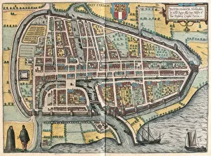
Background imageNetherlands Collection: Rotterdam, Netherlands (engraving, 1572-1617)

Rotterdam, Netherlands (engraving, 1572-1617)
LRI4714007 Rotterdam, Netherlands (engraving, 1572-1617) by Hogenberg, Franz (1540-c.1590); Private Collection; (add.info.: Roterodamum (Rotterdam)

Background imageNetherlands Collection: Map of Dutch Brabant (or North Brabant) and part of the County of Holland (Netherlands

Map of Dutch Brabant (or North Brabant) and part of the County of Holland (Netherlands
LRI4712249 Map of Dutch Brabant (or North Brabant) and part of the County of Holland (Netherlands) (Engraving, 1717) by Nolin

Background imageNetherlands Collection: Map of Netherlands (Engraving, 1717)

Map of Netherlands (Engraving, 1717)
LRI4712217 Map of Netherlands (Engraving, 1717) by Nolin, Jean-Baptiste (c.1657-1708); Private Collection; (add.info.: Map of the United Provinces or Northern Part of the Netherlands or Holland)

Background imageNetherlands Collection: Dordrecht, Netherlands (engraving, 1572-1617)

Dordrecht, Netherlands (engraving, 1572-1617)
LRI4713434 Dordrecht, Netherlands (engraving, 1572-1617) by Hogenberg, Franz (1540-c.1590); Private Collection; (add.info.: Dordrecht (Dordrecht)

Background imageNetherlands Collection: Sluys, Netherlands, 1575 (engraving, 1572-1617)

Sluys, Netherlands, 1575 (engraving, 1572-1617)
LRI4713321 Sluys, Netherlands, 1575 (engraving, 1572-1617) by Hogenberg, Franz (1540-c.1590); Private Collection; (add.info.: Slusa Teutonicae Flandriae OPP)

Background imageNetherlands Collection: Berg Op Zoom, Netherlands (engraving, 1572-1617)

Berg Op Zoom, Netherlands (engraving, 1572-1617)
LRI4713248 Berg Op Zoom, Netherlands (engraving, 1572-1617) by Hogenberg, Franz (1540-c.1590); Private Collection; (add.info.: Berga (Bergen Op Zoom)

Background imageNetherlands Collection: Mstricht, Netherlands (engraving, 1572-1617)

Mstricht, Netherlands (engraving, 1572-1617)
LRI4713243 Mstricht, Netherlands (engraving, 1572-1617) by Hogenberg, Franz (1540-c.1590); Private Collection; (add.info.: Traiectum ad Mosam (Mstricht)

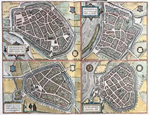
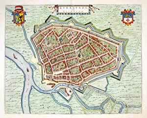
Background imageNetherlands Collection: Arnhem and Venlo, Netherlands - Geldern, Germany and Ruermonde, Netherlands (engraving

Arnhem and Venlo, Netherlands - Geldern, Germany and Ruermonde, Netherlands (engraving
LRI4713238 Arnhem and Venlo, Netherlands - Geldern, Germany and Ruermonde, Netherlands (engraving, 1572-1617) by Hogenberg

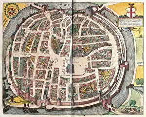
Background imageNetherlands Collection: Zwolle, Netherlands (engraving, 1572-1617)

Zwolle, Netherlands (engraving, 1572-1617)
LRI4713527 Zwolle, Netherlands (engraving, 1572-1617) by Hogenberg, Franz (1540-c.1590); Private Collection; (add.info.: Swolla/Swol (Zwolle)

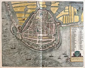
Background imageNetherlands Collection: Enkhuizen, Netherlands (engraving, 1572-1617)

Enkhuizen, Netherlands (engraving, 1572-1617)
LRI4713462 Enkhuizen, Netherlands (engraving, 1572-1617) by Hogenberg, Franz (1540-c.1590); Private Collection; (add.info)

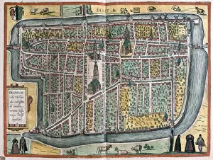
Background imageNetherlands Collection: Delft, Netherlands (engraving, 1572-1617)

Delft, Netherlands (engraving, 1572-1617)
LRI4713411 Delft, Netherlands (engraving, 1572-1617) by Hogenberg, Franz (1540-c.1590); Private Collection; (add.info.: Delphum urbs Hollandiae cultissima, ab eiusdem nominis fossa, vulgo)

Background imageNetherlands Collection: Sneek, Dokkum, Sloten, Ijlst, Netherlands (engraving, 1572-1617)

Sneek, Dokkum, Sloten, Ijlst, Netherlands (engraving, 1572-1617)
LRI4714109 Sneek, Dokkum, Sloten, Ijlst, Netherlands (engraving, 1572-1617) by Hogenberg, Franz (1540-c.1590); Private Collection; (add.info.: Sneecha, DocCum, Sloten, Ylstae (Sneek, Dokkum, Sloten)

Background imageNetherlands Collection: Dendermonde, 1649 (hand-coloured engraving)

Dendermonde, 1649 (hand-coloured engraving)
478400 Dendermonde, 1649 (hand-coloured engraving) by Blaeu, Joan (1596-1673); Private Collection; (add.info.: Dendermonde, a small town on the River Schelde, now in Belgium)

Background imageNetherlands Collection: Roermond, 1649 (hand-coloured engraving)

Roermond, 1649 (hand-coloured engraving)
478390 Roermond, 1649 (hand-coloured engraving) by Blaeu, Joan (1596-1673); Private Collection; (add.info.: Roermond, a town in Flanders)

Background imageNetherlands Collection: Rodolphus Agricola, 1650 (engraving)

Rodolphus Agricola, 1650 (engraving)
6040010 Rodolphus Agricola, 1650 (engraving) by Bry, Theodor de (1528-98); Private Collection; (add.info.: Rodolphus Agricola (c.1443-1485), Netherlandish pre humanist, educator, musician

Background imageNetherlands Collection: Map of Nijmegen, from Civitates Orbis Terrarum

Map of Nijmegen, from Civitates Orbis Terrarum
STC121009 Map of Nijmegen, from Civitates Orbis Terrarum by Georg Braun (1541-1622) and Frans Hogenburg (1535-90), c.1572 (coloured engraving) by Hoefnagel

Background imageNetherlands Collection: Amsterdam, Netherlands (engraving, 1572-1617)

Amsterdam, Netherlands (engraving, 1572-1617)
LRI4715962 Amsterdam, Netherlands (engraving, 1572-1617) by Braun, Georg (1541-1622) and Hogenberg, Franz (1535-90); Private Collection; (add.info.: Amsterdam, Netherlands - Amstelodamum (Amsterdam)

Background imageNetherlands Collection: Zeeland, Netherlands (engraving, 1596)

Zeeland, Netherlands (engraving, 1596)
LRI4717621 Zeeland, Netherlands (engraving, 1596) by Mercator, Gerardus (1512-94); Private Collection; (add.info.: Zelandia comitatus, 1613: Zeeland (Zelande)

Background imageNetherlands Collection: Vlissingen, Netherlands (engraving, 1598)

Vlissingen, Netherlands (engraving, 1598)
LRI4715191 Vlissingen, Netherlands (engraving, 1598) by Hogenberg, Franz (1540-c.1590); Private Collection; (add.info.: Flissinga munitissimu Zelandiae oppidum)

Background imageNetherlands Collection: Kampen and the river IJssel or Yssel, Netherlands (engraving, 1572-1617)

Kampen and the river IJssel or Yssel, Netherlands (engraving, 1572-1617)
LRI4713499 Kampen and the river IJssel or Yssel, Netherlands (engraving, 1572-1617) by Hogenberg, Franz (1540-c.1590); Private Collection; (add.info.: Campen/Urbis Campensis. ad Isalam fluvium)

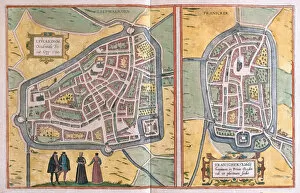
Background imageNetherlands Collection: Franeker, Netherlands (engraving, 1572-1617)

Franeker, Netherlands (engraving, 1572-1617)
LRI4713524 Franeker, Netherlands (engraving, 1572-1617) by Hogenberg, Franz (1540-c.1590); Private Collection; (add.info.: Lewardum occidentalis Frisiae opp)

Background imageNetherlands Collection: Map of West Germany and Netherlands, 1702 (Engraving, 1717)

Map of West Germany and Netherlands, 1702 (Engraving, 1717)
LRI4712354 Map of West Germany and Netherlands, 1702 (Engraving, 1717) by Nolin, Jean-Baptiste (c.1657-1708); Private Collection; (add.info.: Map of West Germany and the Netherlands)

Background imageNetherlands Collection: Map of the Province of Groningen (Netherlands) (etching, 1671)

Map of the Province of Groningen (Netherlands) (etching, 1671)
LRI4710807 Map of the Province of Groningen (Netherlands) (etching, 1671) by Wit, Frederick de (1630-1706); Private Collection; (add.info)

Background imageNetherlands Collection: Map of the United Provinces of the Netherlands (etching, 1730)

Map of the United Provinces of the Netherlands (etching, 1730)
LRI4706560 Map of the United Provinces of the Netherlands (etching, 1730) by Delisle, Guillaume (1675-1726); Private Collection; (add.info)


All Professionally Made to Order for Quick Shipping


-

Netherlands Collection

Netherlands is a country located in Western Europe, bordered by Germany to the east and Belgium to the south. The country has a population of approximately 17 million people and covers an area of 41,543 square kilometers. Amsterdam is its capital city, while Rotterdam is the largest port in Europe. Netherlands boasts of a highly developed economy with agriculture being one of its main industries. The country's topography comprises low-lying flatlands that are prone to flooding; hence it has invested heavily in water management infrastructure such as dikes and dams. Maps and charts provide detailed information about the geography, demographics, transportation networks, land use patterns among other aspects of this beautiful nation.
+

Our beautiful Wall Art and Photo Gifts include Framed Prints, Photo Prints, Poster Prints, Canvas Prints, Jigsaw Puzzles, Metal Prints and so much more

The Netherlands collection from Media Storehouse offers a wide range of wall art and framed prints that depict the geography, history, and culture of this European country. Our collection features vintage maps, charts, and illustrations that showcase the intricate canal system, windmills, tulip fields, iconic landmarks such as the Rijksmuseum and Anne Frank House in Amsterdam. These artworks also provide an insight into Dutch maritime history with depictions of famous ships like VOC or East India Company vessels. Our collection is curated to cater to diverse tastes with various styles ranging from antique engravings to modern digital designs. The high-quality prints are available in different sizes making them suitable for any room decor. Whether you're looking for a unique gift or want to add some character to your home or office space, the Netherlands collection has something for everyone who appreciates Dutch heritage.
+

What are Netherlands (Maps and Charts) art prints?

Netherlands art prints are a collection of high-quality, visually stunning images that showcase the geography and history of the Netherlands. These prints feature detailed maps and charts that highlight various regions, cities, rivers, canals, and landmarks throughout the country. The artwork is created using advanced printing techniques to ensure vibrant colors and crisp details. These art prints are perfect for anyone who loves Dutch culture or wants to learn more about the country's rich history. They make great additions to any home or office decor, adding a touch of sophistication and elegance to any space. Whether you're looking for a unique gift idea or want to decorate your own walls with beautiful artwork, these Netherlands art prints are sure to impress. We offer a wide variety of sizes and framing options so you can customize your print exactly how you want it. With fast shipping times and excellent customer service, ordering from Media Storehouse is easy and hassle-free.
+

What Netherlands (Maps and Charts) art prints can I buy from Media Storehouse?

We offer a wide range of Netherlands art prints in the form of maps and charts. These prints showcase the beauty and history of this European country, with stunning depictions of its cities, landmarks, and landscapes. Some popular options include antique maps that show the layout and geography of different regions within the Netherlands, as well as vintage charts that highlight important historical events or cultural traditions. In addition to traditional paper prints, Media Storehouse also offers canvas prints that can be stretched over a frame for easy display on your wall. These high-quality reproductions are perfect for adding a touch of Dutch charm to any room in your home or office. Whether you're looking for a unique gift or simply want to decorate your own space with beautiful artwork inspired by the Netherlands, we have something for everyone. With our extensive collection of maps and charts from this fascinating country, you're sure to find just what you're looking for.
+

How do I buy Netherlands (Maps and Charts) art prints?

To buy Netherlands art prints from Media Storehouse, you can browse through our extensive collection of artwork online. Once you have found the print that you like, simply add it to your cart and proceed to checkout. You will be prompted to enter your shipping and payment information before finalizing your purchase. We offer a variety of sizes for their prints, so make sure to select the size that best fits your needs. We also offer different framing options if you prefer a framed print. If you have any questions or concerns about purchasing Netherlands art prints from Media Storehouse, they have a customer service team available to assist you. Simply reach out to them via email or phone for help with your order. Buying Netherlands art prints from Media Storehouse is easy and convenient thanks to their user-friendly website and helpful customer service team.
+

How much do Netherlands (Maps and Charts) art prints cost?

We offer a wide range of Netherlands art prints at varying prices. Our collection includes high-quality reproductions of vintage maps and charts depicting the geography, topography, and history of the Netherlands. The cost of each print depends on several factors such as its size, quality, and rarity. We have options for every budget ranging from affordable posters to premium giclee prints that are perfect for collectors or those who want museum-quality artwork in their homes or offices. Our prints are available in different sizes to suit your needs and preferences. Whether you're looking for a unique gift or want to add some character to your space, our Netherlands art prints are an excellent choice. With our extensive selection of designs at various price points, you're sure to find something that fits your style and budget.
+

How will my Netherlands (Maps and Charts) art prints be delivered to me?

Your Netherlands art prints will be delivered to you in a safe and secure manner. We take great care in ensuring that your artwork arrives at your doorstep in pristine condition. We use high-quality packaging materials to protect your prints during transit. Your order will be shipped using reliable shipping carriers who have a proven track record of delivering packages on time. You can rest assured that your package will arrive on schedule. We offer various delivery options depending on the size and weight of your order. Our standard delivery option is available for most orders, while expedited shipping is available for those who need their prints sooner. Once your order has been dispatched, we will send you an email with tracking information so you can keep an eye on its progress as it makes its way to you. We guarantee that your Netherlands art prints will be delivered safely and securely right to your door.