Fraud Blocker Skip to main content

Home > Maps and Charts > Netherlands

Netherlands Collection (page 3)

Netherlands is a country located in Western Europe, bordered by Germany to the east and Belgium to the south

549 items

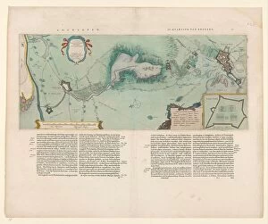
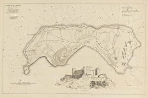
Background imageNetherlands Collection: Map of the area between Bergen op Zoom and Steenbergen, 1630. Creator: Franciscus van Schooten

Map of the area between Bergen op Zoom and Steenbergen, 1630. Creator: Franciscus van Schooten
Map of the area between Bergen op Zoom and Steenbergen, 1630. Tabula Bergarum ad Zomam Stenbergae'. Showing fortresses, trees, hills, harbours, areas susceptible to flooding

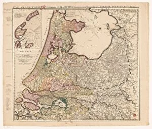
Background imageNetherlands Collection: Map of Holland, Utrecht and part of Gelderland, 1726-1727. Creator: Caspar Specht

Map of Holland, Utrecht and part of Gelderland, 1726-1727. Creator: Caspar Specht
Map of Holland, Utrecht and part of Gelderland, 1726-1727. Map of the county of Holland, the seigneury of Utrecht and most of the Duchy of Gelderland. Texel and Vlieland in the top left

Background imageNetherlands Collection: Map of Africa, c.1690. Creator: Carel Allard

Map of Africa, c.1690. Creator: Carel Allard
Map of Africa, c.1690. Novissima et perfectissima Africae descriptio'. Compass rose bottom left the cartouche with title and allegorical figures

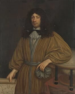
Background imageNetherlands Collection: Portrait of Petrus Bertius, Professor at Leiden, 1700-1732. Creator: Arnoud van Halen

Portrait of Petrus Bertius, Professor at Leiden, 1700-1732. Creator: Arnoud van Halen
Portrait of Petrus Bertius, Professor at Leiden, 1700-1732

Background imageNetherlands Collection: Map of the southern (Austrian) Netherlands, 1719. Creator: Joachim Ottens

Map of the southern (Austrian) Netherlands, 1719. Creator: Joachim Ottens
Map of the southern (Austrian) Netherlands, 1719. Novissima et accuratissima decem Austriacarum in Belgio provinciarum tabula, ut sunt ducatus Brabantiae, Luxembergensis, Limburgensis, et Geldriae

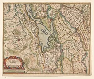
Background imageNetherlands Collection: Map of parts of North Brabant, South Holland and Gelderland, 1629. Creator: Balthasar Florisz

Map of parts of North Brabant, South Holland and Gelderland, 1629. Creator: Balthasar Florisz. van Berckenrode
Map of parts of North Brabant, South Holland and Gelderland, 1629. The surroundings of the Bies Bos, sailing ship. Bottom left a cartouche with the title with the scale in German miles (1: 100, 000)

Background imageNetherlands Collection: Figurative map, giving an indication of the main dike breaches, etc.: along the Rivers, 1809

Figurative map, giving an indication of the main dike breaches, etc.: along the Rivers, 1809. Creator: Antoni Zürcher
Figurative map, giving an indication of the main dike breaches, etc.: along the Rivers, 1809. The area affected by flooding between the large rivers

Background imageNetherlands Collection: Plan of Fort Victoria, Ambon, 1718. Creator: Anon

Plan of Fort Victoria, Ambon, 1718. Creator: Anon
Plan of Fort Victoria, Ambon, 1718. Scale of 30 Rijnlandse rods, with a compass rose underneath

Background imageNetherlands Collection: Map of Antwerp during the siege by the French, 1832, (1832-1833)

Map of Antwerp during the siege by the French, 1832, (1832-1833). Creators: Anon, Johannes Paulus Houtman
Plan showing Schelde and Antwerp with the location of the forts in Dutch hands, during the siege of the Citadel by the French, 1832, (1832-1833). Dutch gunboats on the Scheldt

Background imageNetherlands Collection: Map of Noord-Holland and part of Friesland, 1726-1750. Creator: Anon

Map of Noord-Holland and part of Friesland, 1726-1750. Creator: Anon
Map of Noord-Holland and part of Friesland, 1726-1750. At the bottom right the title cartouche with figures around it including a man with a horse, satyrs, putti

Background imageNetherlands Collection: Map of a part of the head of North Holland, c.1620-c.1699. Creator: Anon

Map of a part of the head of North Holland, c.1620-c.1699. Creator: Anon
Map of a part of the head of North Holland, southern Texel and the surrounding sandbanks, c.1620-c.1699

Background imageNetherlands Collection: Vlieland map, Terschelling, part of Friesland and the surrounding sandbanks, c.1620-c.1699

Vlieland map, Terschelling, part of Friesland and the surrounding sandbanks, c.1620-c.1699. Creator: Anon
Vlieland map, Terschelling, part of Friesland and the surrounding sandbanks, c.1620-c.1699

Background imageNetherlands Collection: Portrait of Carel Quina (1622-89), Knight of the Holy Sepulchre and Amsterdam-born explorer of Asia

Portrait of Carel Quina (1622-89), Knight of the Holy Sepulchre and Amsterdam-born explorer of Asia, 1669

Background imageNetherlands Collection: Map of the island of Dieuw or DieWij on the Coromandel coast, India, 1675-1725. Creator: Anon

Map of the island of Dieuw or DieWij on the Coromandel coast, India, 1675-1725. Creator: Anon
Map of the island of Dieuw or DieWij on the Coromandel coast, India, 1675-1725. River delta and various settlements with names

Background imageNetherlands Collection: Portrait of an Officer at Sea with Coastal Map and Binoculars in his Hand, 1760

Portrait of an Officer at Sea with Coastal Map and Binoculars in his Hand, 1760. Creator: John Greenwood
Portrait of an Officer at Sea with Coastal Map and Binoculars in his Hand, 1760

Background imageNetherlands Collection: Map of Vlieland, Terschelling and the surrounding sandbanks, 1708 or later. Creator: Isaak de Graaf

Map of Vlieland, Terschelling and the surrounding sandbanks, 1708 or later. Creator: Isaak de Graaf
Map of Vlieland, Terschelling and the surrounding sandbanks, 1708 or later. At top left the title: Flie en Schellinger stroom [stream], and a comment: Note the cyffers with black

Background imageNetherlands Collection: Map of Noord-Holland, Texel, Vlieland, Terschelling, part of Friesland... 1712

Map of Noord-Holland, Texel, Vlieland, Terschelling, part of Friesland... 1712. Creator: Isaak de Graaf
Map of Noord-Holland, Texel, Vlieland, Terschelling, part of Friesland and the surrounding sandbanks, 1712. Top left, cartouche with the title Texel en Flie-stroom (Texel and the Flie-stream)

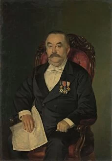
Background imageNetherlands Collection: Johan François Adriaan Cateau van Rosevelt... 1885. Creator: Lovera

Johan François Adriaan Cateau van Rosevelt... 1885. Creator: Lovera
Johan Francois Adriaan Cateau van Rosevelt, Chief of the Construction Department and Agent General of Immigration in Suriname, 1885

Background imageNetherlands Collection: Map of a part of the Gooi, 1636-1799. Creator: Cornelis Danckerts de Ry

Map of a part of the Gooi, 1636-1799. Creator: Cornelis Danckerts de Ry
Map of a part of the Gooi, 1636-1799. Hand-drawn map showing the course of the Vecht from Vreeland to Weesp, the Naardermeerpolder, the Hostermeerpolder and surrounding areas

Background imageNetherlands Collection: Map of the East Bijlmer and Gein and Gaasperpolder, 1650-1750. Creator: Anon

Map of the East Bijlmer and Gein and Gaasperpolder, 1650-1750. Creator: Anon
Map of the East Bijlmer and Gein and Gaasperpolder, 1650-1750. Manuscript map. At the bottom right the title

Background imageNetherlands Collection: Map of Eierland and West-Vlieland, 1688 or later. Creator: Anon

Map of Eierland and West-Vlieland, 1688 or later. Creator: Anon
Map of Eierland and West-Vlieland, 1688 or later. At the top right: scale of 800 rods Rijnlantsche size. At the bottom right the title

Background imageNetherlands Collection: Map of East-Vlieland and West-Terschelling, 1688 or later. Creator: Anon

Map of East-Vlieland and West-Terschelling, 1688 or later. Creator: Anon
Map of East-Vlieland and West-Terschelling, 1688 or later. At the bottom right the title with a scale of 900 Rijnlantse rods above it

Background imageNetherlands Collection: Map of Den Helder and part of Texel with the intervening Marsdiep, in or after 1688. Creator: Anon

Map of Den Helder and part of Texel with the intervening Marsdiep, in or after 1688. Creator: Anon
Map of Den Helder and part of Texel with the intervening Marsdiep, in or after 1688. Scale of 500 Rijnlantse rods. Orientation: the north left

Background imageNetherlands Collection: Hattem fortress map, c.1650-c.1799. Creator: Anon

Hattem fortress map, c.1650-c.1799. Creator: Anon
Hattem fortress map, c.1650-c.1799. Key on the right; underneath a scale: range of 50 rods

Background imageNetherlands Collection: Map of Elburg, c.1650-c.1799. Creator: Anon

Map of Elburg, c.1650-c.1799. Creator: Anon
Map of Elburg, c.1650-c.1799. Key on the right; underneath a scale: range of 50 rods

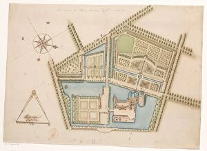
Background imageNetherlands Collection: Map of Rosendael Castle, c.1650-before 1722. Creator: Anon

Map of Rosendael Castle, c.1650-before 1722. Creator: Anon
Map of Rosendael Castle, c.1650-before 1722. Map of the castle and the gardens. Bottom left a compass with a scale: Rijnlande rods

Background imageNetherlands Collection: Plan of Harderwijk Fortress, c.1650-c.1799. Creator: Anon

Plan of Harderwijk Fortress, c.1650-c.1799. Creator: Anon
Plan of Harderwijk Fortress, c.1650-c.1799. On the left a scale: range of 50 rods

Background imageNetherlands Collection: Map of Steenwijk Fortress, c.1650-c.1799. Creator: Anon

Map of Steenwijk Fortress, c.1650-c.1799. Creator: Anon
Map of Steenwijk Fortress, c.1650-c.1799. Bottom left a scale: range of 50 rods. At the top right an inscription

Background imageNetherlands Collection: Map of Kuinre Fortification, c.1650-c.1799. Creator: Anon

Map of Kuinre Fortification, c.1650-c.1799. Creator: Anon
Map of Kuinre Fortification, c.1650-c.1799. Key bottom left; at bottom right a scale: range of 30 rods

Background imageNetherlands Collection: Map of Zwartsluis Fortification, c.1650-c.1799. Creator: Anon

Map of Zwartsluis Fortification, c.1650-c.1799. Creator: Anon
Map of Zwartsluis Fortification, c.1650-c.1799. On the right a scale: range of 30 rods

Background imageNetherlands Collection: Map of Hasselt fortress, c.1650-c.1799. Creator: Anon

Map of Hasselt fortress, c.1650-c.1799. Creator: Anon
Map of Hasselt fortress, c.1650-c.1799. Bottom left a scale: range of 80 rods. At the bottom right an inscription

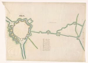
Background imageNetherlands Collection: Map of Zwolle fortress, c.1650-c.1799. Creator: Anon

Map of Zwolle fortress, c.1650-c.1799. Creator: Anon
Map of Zwolle fortress, c.1650-c.1799. In the centre a scale: range of 80 rods. Below that an inscription

Background imageNetherlands Collection: Map of the Mastenbroek polder, 1650-1750. Creator: Anon

Map of the Mastenbroek polder, 1650-1750. Creator: Anon
Map of the Mastenbroek polder, 1650-1750. Drawn on a grid

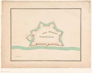
Background imageNetherlands Collection: Map of Thionville, c.1710. Creator: Anon

Map of Thionville, c.1710. Creator: Anon
Map of Thionville, c.1710. Map of the Fortress of Thionville (here spelled Theonville) on the Moselle. A scale at the bottom left

Background imageNetherlands Collection: Map of Avesnes, c.1710. Creator: Anon

Map of Avesnes, c.1710. Creator: Anon
Map of Avesnes, c.1710

Background imageNetherlands Collection: Map of Sint-Omaars, 1650-1700. Creator: Anon

Map of Sint-Omaars, 1650-1700. Creator: Anon
Map of Sint-Omaars, 1650-1700

Background imageNetherlands Collection: Longwy fortress map, 1686. Creator: Anon

Longwy fortress map, 1686. Creator: Anon
Longwy fortress map, 1686

Background imageNetherlands Collection: Map of the south coast of South Africa between Cape Agulhas and the Sundays River, after 1789-1790

Map of the south coast of South Africa between Cape Agulhas and the Sundays River, after 1789-1790

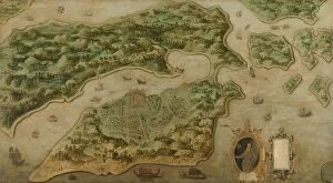
Background imageNetherlands Collection: View of Ambon, c.1617. Creator: Anon

View of Ambon, c.1617. Creator: Anon
View of Ambon, c.1617. Other Title(s): Bird's-eye View of Ambon, with a Portrait of Frederik Houtman (1571-1627) in a Cartouche

Background imageNetherlands Collection: Amsterdam as the Centre of World Trade, c.1604-c.1607. Creator: Pieter Isaacsz

Amsterdam as the Centre of World Trade, c.1604-c.1607. Creator: Pieter Isaacsz
Amsterdam as the Centre of World Trade, c.1604-c.1607. Other Title(s): Painting on a harpsichord lid with an Allegory of Amsterdam as the center of world trade

Background imageNetherlands Collection: Young Man in a Study, 1640-1650. Creator: Adriaen van Gaesbeeck

Young Man in a Study, 1640-1650. Creator: Adriaen van Gaesbeeck
Young Man in a Study, 1640-1650

Background imageNetherlands Collection: Conquest of Banda by the English on August 9, 1810, (1811). Creator: M. Graham

Conquest of Banda by the English on August 9, 1810, (1811). Creator: M. Graham
Conquest of Banda by the English on August 9, 1810, (1811). lllustrative account of Captain Cole's splendid achievement in the capture of the island of Banda

Background imageNetherlands Collection: Jonkheer Theodorus Frederik van Capellen (1762-1824), Vice Admiral, 1817

Jonkheer Theodorus Frederik van Capellen (1762-1824), Vice Admiral, 1817. Creator: Cornelis van Cuylenburg
Jonkheer Theodorus Frederik van Capellen (1762-1824), Vice Admiral, 1817

Background imageNetherlands Collection: Johan Boudaen Courten (1635-1716), Lord of St Laurens, Schellach and Popkensburg, 1668

Johan Boudaen Courten (1635-1716), Lord of St Laurens, Schellach and Popkensburg, 1668
Johan Boudaen Courten (1635-1716), Lord of St Laurens, Schellach and Popkensburg. Councillor of Middelburg and Director of the East India Company, 1668

Background imageNetherlands Collection: Map of the Holy Land Divided into the Twelve Tribes of Israel, 1580s. Creator: Adrichem

Map of the Holy Land Divided into the Twelve Tribes of Israel, 1580s. Creator: Adrichem
Map of the Holy Land Divided into the Twelve Tribes of Israel, 1580s. Private Collection

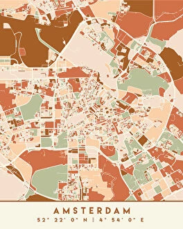
Background imageNetherlands Collection: Old map of the Netherlands, steel engraving, published 1857

Old map of the Netherlands, steel engraving, published 1857
Old map of the Netherlands and Amsterdam. Steel engraving with hand coloured borderlines, published in 1857

Background imageNetherlands Collection: Black Maps Earth Tones 03

Black Maps Earth Tones 03
Emiliano Deificus

Background imageNetherlands Collection: 1 Maps 35

1 Maps 35
Emiliano Deificus


All Professionally Made to Order for Quick Shipping


-

Netherlands Collection

Netherlands is a country located in Western Europe, bordered by Germany to the east and Belgium to the south. The country has a population of approximately 17 million people and covers an area of 41,543 square kilometers. Amsterdam is its capital city, while Rotterdam is the largest port in Europe. Netherlands boasts of a highly developed economy with agriculture being one of its main industries. The country's topography comprises low-lying flatlands that are prone to flooding; hence it has invested heavily in water management infrastructure such as dikes and dams. Maps and charts provide detailed information about the geography, demographics, transportation networks, land use patterns among other aspects of this beautiful nation.
+

Our beautiful Wall Art and Photo Gifts include Framed Prints, Photo Prints, Poster Prints, Canvas Prints, Jigsaw Puzzles, Metal Prints and so much more

The Netherlands collection from Media Storehouse offers a wide range of wall art and framed prints that depict the geography, history, and culture of this European country. Our collection features vintage maps, charts, and illustrations that showcase the intricate canal system, windmills, tulip fields, iconic landmarks such as the Rijksmuseum and Anne Frank House in Amsterdam. These artworks also provide an insight into Dutch maritime history with depictions of famous ships like VOC or East India Company vessels. Our collection is curated to cater to diverse tastes with various styles ranging from antique engravings to modern digital designs. The high-quality prints are available in different sizes making them suitable for any room decor. Whether you're looking for a unique gift or want to add some character to your home or office space, the Netherlands collection has something for everyone who appreciates Dutch heritage.
+

What are Netherlands (Maps and Charts) art prints?

Netherlands art prints are a collection of high-quality, visually stunning images that showcase the geography and history of the Netherlands. These prints feature detailed maps and charts that highlight various regions, cities, rivers, canals, and landmarks throughout the country. The artwork is created using advanced printing techniques to ensure vibrant colors and crisp details. These art prints are perfect for anyone who loves Dutch culture or wants to learn more about the country's rich history. They make great additions to any home or office decor, adding a touch of sophistication and elegance to any space. Whether you're looking for a unique gift idea or want to decorate your own walls with beautiful artwork, these Netherlands art prints are sure to impress. We offer a wide variety of sizes and framing options so you can customize your print exactly how you want it. With fast shipping times and excellent customer service, ordering from Media Storehouse is easy and hassle-free.
+

What Netherlands (Maps and Charts) art prints can I buy from Media Storehouse?

We offer a wide range of Netherlands art prints in the form of maps and charts. These prints showcase the beauty and history of this European country, with stunning depictions of its cities, landmarks, and landscapes. Some popular options include antique maps that show the layout and geography of different regions within the Netherlands, as well as vintage charts that highlight important historical events or cultural traditions. In addition to traditional paper prints, Media Storehouse also offers canvas prints that can be stretched over a frame for easy display on your wall. These high-quality reproductions are perfect for adding a touch of Dutch charm to any room in your home or office. Whether you're looking for a unique gift or simply want to decorate your own space with beautiful artwork inspired by the Netherlands, we have something for everyone. With our extensive collection of maps and charts from this fascinating country, you're sure to find just what you're looking for.
+

How do I buy Netherlands (Maps and Charts) art prints?

To buy Netherlands art prints from Media Storehouse, you can browse through our extensive collection of artwork online. Once you have found the print that you like, simply add it to your cart and proceed to checkout. You will be prompted to enter your shipping and payment information before finalizing your purchase. We offer a variety of sizes for their prints, so make sure to select the size that best fits your needs. We also offer different framing options if you prefer a framed print. If you have any questions or concerns about purchasing Netherlands art prints from Media Storehouse, they have a customer service team available to assist you. Simply reach out to them via email or phone for help with your order. Buying Netherlands art prints from Media Storehouse is easy and convenient thanks to their user-friendly website and helpful customer service team.
+

How much do Netherlands (Maps and Charts) art prints cost?

We offer a wide range of Netherlands art prints at varying prices. Our collection includes high-quality reproductions of vintage maps and charts depicting the geography, topography, and history of the Netherlands. The cost of each print depends on several factors such as its size, quality, and rarity. We have options for every budget ranging from affordable posters to premium giclee prints that are perfect for collectors or those who want museum-quality artwork in their homes or offices. Our prints are available in different sizes to suit your needs and preferences. Whether you're looking for a unique gift or want to add some character to your space, our Netherlands art prints are an excellent choice. With our extensive selection of designs at various price points, you're sure to find something that fits your style and budget.
+

How will my Netherlands (Maps and Charts) art prints be delivered to me?

Your Netherlands art prints will be delivered to you in a safe and secure manner. We take great care in ensuring that your artwork arrives at your doorstep in pristine condition. We use high-quality packaging materials to protect your prints during transit. Your order will be shipped using reliable shipping carriers who have a proven track record of delivering packages on time. You can rest assured that your package will arrive on schedule. We offer various delivery options depending on the size and weight of your order. Our standard delivery option is available for most orders, while expedited shipping is available for those who need their prints sooner. Once your order has been dispatched, we will send you an email with tracking information so you can keep an eye on its progress as it makes its way to you. We guarantee that your Netherlands art prints will be delivered safely and securely right to your door.