Fraud Blocker Skip to main content

Home > Maps and Charts > Hungary

Hungary Collection (page 3)

Hungary is a landlocked country located in Central Europe, bordered by Austria, Slovakia, Ukraine, Romania, Serbia, Croatia and Slovenia

201 items

Background imageHungary Collection: Victorious Christian troops of the Holy League recapturing the fortress of Buda, Hungary

Victorious Christian troops of the Holy League recapturing the fortress of Buda, Hungary, Great Turkish War
7148103 Victorious Christian troops of the Holy League recapturing the fortress of Buda, Hungary, Great Turkish War, 1686 (engraving) by Benczur

Background imageHungary Collection: On the Hungarian plain (litho)

On the Hungarian plain (litho)
7171119 On the Hungarian plain (litho) by American School, (20th century); Private Collection; (add.info.: On the Hungarian plain)

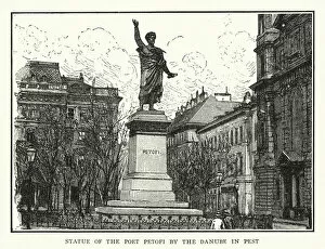
Background imageHungary Collection: Statue of the Poet Petofi by the Danube in Pest (litho)

Statue of the Poet Petofi by the Danube in Pest (litho)
7171117 Statue of the Poet Petofi by the Danube in Pest (litho) by American School, (20th century); Private Collection; (add.info.: Statue of the Poet Petofi by the Danube in Pest)

Background imageHungary Collection: Members of the League of Nations (colour litho)

Members of the League of Nations (colour litho)
7163177 Members of the League of Nations (colour litho) by English School, (20th century); Private Collection; (add.info.: Members of the League of Nations)

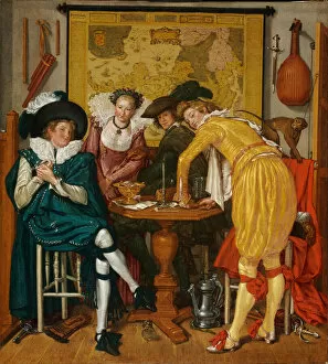
Background imageHungary Collection: Merry company - Buytewech, Willem Pietersz. (1591 / 92-1624) - 1620 - Oil on canvas - 72, 6x65

Merry company - Buytewech, Willem Pietersz. (1591 / 92-1624) - 1620 - Oil on canvas - 72, 6x65
FIA5399524 Merry company - Buytewech, Willem Pietersz. (1591/92-1624) - 1620 - Oil on canvas - 72, 6x65, 4 - Szepmuveszeti Muzeum, Budapest by Buytewech

Background imageHungary Collection: Studies of Horses Leg, 1485-95 (black chalk on paper)

Studies of Horses Leg, 1485-95 (black chalk on paper)
FIA5399500 Studies of Horses Leg, 1485-95 (black chalk on paper) by Vinci, Leonardo da (1452-1519); 21, 3x14, 5 cm; Museum of Fine Arts (Szepmuveszeti) Budapest

Background imageHungary Collection: Une scene de la guerre d independance de Hongrie en 1849. (A Scene of The War of Independence in)

Une scene de la guerre d independance de Hongrie en 1849. (A Scene of The War of Independence in Hungary on 1849)
FIA5367439 Une scene de la guerre d independance de Hongrie en 1849. (A Scene of The War of Independence in Hungary on 1849)

Background imageHungary Collection: Eastern Europe and Balkans 1575

Eastern Europe and Balkans 1575
7143240 Eastern Europe and Balkans 1575 by Munster, Sebastian (1589-1552); Private Collection; (add.info.: Geography. Hungary Map of Eastern Europe and Balkans with Hungary, Wallachia, Bosnia)

Background imageHungary Collection: Map of Hungary 1616

Map of Hungary 1616
7143244 Map of Hungary 1616 by Bertius, Petrus (1565-1629); Private Collection; (add.info.: Geography. Hungary. Pannonia (Hungary) and Illyria (Balkans) in the Ancient Rome

Background imageHungary Collection: Hungary map, 1680

Hungary map, 1680
7143238 Hungary map, 1680 by Morden, Robert (fl.1682-1703); Private Collection; (add.info.: Geography. Hungary. Map of Hungary, by Robert Morden, England, 1680.); Photo: eArchives Charmet; English

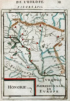
Background imageHungary Collection: Map of Hungary 1683

Map of Hungary 1683
7143243 Map of Hungary 1683 by Mallet, Alain Manesson (1630-1706); Private Collection; (add.info.: Geography. Map of Hungary and Transylvania, at the south the Balkans are mentionned as Turkey)

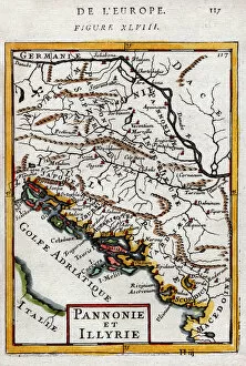
Background imageHungary Collection: Map of Hungary and Balkans 1683

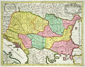
Map of Hungary and Balkans 1683
7143242 Map of Hungary and Balkans 1683 by Mallet, Alain Manesson (1630-1706); Private Collection; (add.info.: Geography. Hungary. Pannonia (Hungary) and Illyria (Balkans) in the Ancient Rome

Background imageHungary Collection: Map city of Budapest Hungary 1898

Map city of Budapest Hungary 1898 Original edition from my own archives Source : Brockhaus 1898

Background imageHungary Collection: Nove Zamky, Slovakia and Visegrad, Hungary, 1595 (engraving, 1598)

Nove Zamky, Slovakia and Visegrad, Hungary, 1595 (engraving, 1598)
LRI4715650 Nove Zamky, Slovakia and Visegrad, Hungary, 1595 (engraving, 1598) by Hogenberg, Franz (1540-c.1590); Private Collection; (add.info.: Ovar Germanice Nieuhuisel/Vizzegrad)

Background imageHungary Collection: Map of the north-western part of the Kingdom of Hungary (Engraving, 1717)

Map of the north-western part of the Kingdom of Hungary (Engraving, 1717)
LRI4712554 Map of the north-western part of the Kingdom of Hungary (Engraving, 1717) by Nolin, Jean-Baptiste (c.1657-1708); Private Collection; (add.info)

Background imageHungary Collection: Map of the north oriental part of the Kingdom of Hungary (Engraving, 1717)

Map of the north oriental part of the Kingdom of Hungary (Engraving, 1717)
LRI4712544 Map of the north oriental part of the Kingdom of Hungary (Engraving, 1717) by Nolin, Jean-Baptiste (c.1657-1708); Private Collection; (add.info)

Background imageHungary Collection: Map of the oriental part of the Kingdom of Hungary (Engraving, 1717)

Map of the oriental part of the Kingdom of Hungary (Engraving, 1717)
LRI4712515 Map of the oriental part of the Kingdom of Hungary (Engraving, 1717) by Nolin, Jean-Baptiste (c.1657-1708); Private Collection; (add.info)

Background imageHungary Collection: Map of the Kingdom of Hungary (Engraving, 1717)

Map of the Kingdom of Hungary (Engraving, 1717)
LRI4712510 Map of the Kingdom of Hungary (Engraving, 1717) by Nolin, Jean-Baptiste (c.1657-1708); Private Collection; (add.info.: Map of the Kingdom of Hungary, with Slavonia (Slavonia)

Background imageHungary Collection: Geographical Map of the Theatre of War, showing the Kingdom of Hungary in the main

Geographical Map of the Theatre of War, showing the Kingdom of Hungary in the main
986323 Geographical Map of the Theatre of War, showing the Kingdom of Hungary in the main, 1771 (hand-coloured engraving.) by German School

Background imageHungary Collection: The palace of peace. Illustration for Le Rire (colour litho)

The palace of peace. Illustration for Le Rire (colour litho)
2786581 The palace of peace. Illustration for Le Rire (colour litho) by French School, (20th century); Private Collection; (add.info.: The palace of peace)

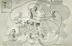
Background imageHungary Collection: Family connections between European monarchs (litho)

Family connections between European monarchs (litho)
3094403 Family connections between European monarchs (litho) by French School, (20th century); Private Collection; (add.info.: Family connections between European monarchs)

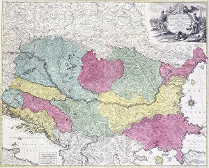
Background imageHungary Collection: Map of the Kingdom of Hungary and the States which are United to its Crown, pub

Map of the Kingdom of Hungary and the States which are United to its Crown, pub
STC101845 Map of the Kingdom of Hungary and the States which are United to its Crown, pub. by Jan Barend Elwe, Amsterdam, 1742 (engraving) by Dutch School

Background imageHungary Collection: Map of Szolnok, from Civitates Orbis Terrarum by Georg Braun (1541-1622

Map of Szolnok, from Civitates Orbis Terrarum by Georg Braun (1541-1622
STC138934 Map of Szolnok, from Civitates Orbis Terrarum by Georg Braun (1541-1622) and Frans Hogenberg (1535-90) 1617 (coloured engraving) by Hoefnagel

Background imageHungary Collection: Map showing the new frontiers of Central Europe following the removal of

Map showing the new frontiers of Central Europe following the removal of
XEE4188271 Map showing the new frontiers of Central Europe following the removal of the Austro-Hungarian Empire (Austro-Hungarian) during the Treaty of Saint Germain en Laye

Background imageHungary Collection: Torokszentmiklos, Hungary (engraving, 1572-1617)

Torokszentmiklos, Hungary (engraving, 1572-1617)
LRI4716276 Torokszentmiklos, Hungary (engraving, 1572-1617) by Braun, Georg (1541-1622) and Hogenberg, Franz (1535-90); Private Collection; (add.info.: Torokszentmiklos, Hungary - Sanctonicolaum)

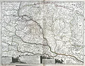
Background imageHungary Collection: Map of the Kingdom of Hungary (etching, 1730)

Map of the Kingdom of Hungary (etching, 1730)
LRI4706632 Map of the Kingdom of Hungary (etching, 1730) by Delisle, Guillaume (1675-1726); Private Collection; (add.info)

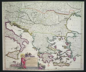
Background imageHungary Collection: Map of Greece, Hungary and their surrounding countries (hand coloured engraving)

Map of Greece, Hungary and their surrounding countries (hand coloured engraving)
XCF306030 Map of Greece, Hungary and their surrounding countries (hand coloured engraving) by Dutch School; Private Collection; Dutch, out of copyright

Background imageHungary Collection: Map of animals in Europe, ( colour engraving)

Map of animals in Europe, ( colour engraving)
CHT184930 Map of animals in Europe, ( colour engraving) by Balint, Janos (19th century); Private Collection; eArchives Charmet; Hungarian, out of copyright

Background imageHungary Collection: Papa, Hungary (engraving, 1572-1617)

Papa, Hungary (engraving, 1572-1617)
LRI4716278 Papa, Hungary (engraving, 1572-1617) by Braun, Georg (1541-1622) and Hogenberg, Franz (1535-90); Private Collection; (add.info.: Papa, Hungary - Papa, inferioris Hungaria oppidum (Papa)

Background imageHungary Collection: Views of Vienna (Vienna), Austria and Budapest (Buda), Hungary (etching, 1572-1617)

Views of Vienna (Vienna), Austria and Budapest (Buda), Hungary (etching, 1572-1617)
LRI4708356 Views of Vienna (Vienna), Austria and Budapest (Buda), Hungary (etching, 1572-1617) by Hogenberg, Franz (1540-c.1590); Private Collection; (add.info.: Views of Vienna (Vienna)

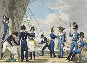
Background imageHungary Collection: The new Imperial Royal Austrian Navy after the Napoleonic Wars, c. 1820 (colour litho)

The new Imperial Royal Austrian Navy after the Napoleonic Wars, c. 1820 (colour litho)
STC227357 The new Imperial Royal Austrian Navy after the Napoleonic Wars, c.1820 (colour litho) by Stubenrauch, Phillip von (1784-1848) (after)

Background imageHungary Collection: Map of the Austro-Hungarian empire, illustration from a French geography school textbook

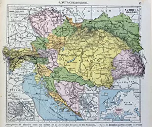
Map of the Austro-Hungarian empire, illustration from a French geography school textbook
CHT220347 Map of the Austro-Hungarian empire, illustration from a French geography school textbook, 1905 (colour litho) by French School

Background imageHungary Collection: Map of Chinese Turkestan, from On Ancient Central-Asian Tracks by Stein

Map of Chinese Turkestan, from On Ancient Central-Asian Tracks by Stein
TRV230456 Map of Chinese Turkestan, from On Ancient Central-Asian Tracks by Stein, published 1933 (engraving) (b/w photo) by Stein

Background imageHungary Collection: Map of Claudiopolis, from Civitates Orbis Terrarum

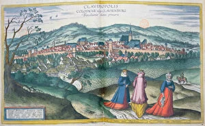
Map of Claudiopolis, from Civitates Orbis Terrarum
BMR289152 Map of Claudiopolis, from Civitates Orbis Terrarum by Georg Braun (1541-1622) and Frans Hogenberg (1535-90) Brussels, 1574 (coloured engraving) by Hoefnagel

Background imageHungary Collection: Map of animals in Africa (colour engraving) Sf

Map of animals in Africa (colour engraving) Sf
CHT184928 Map of animals in Africa (colour engraving) Sf by Balint, Janos (19th century); Private Collection; (add.info.: Carte des animaux en Afrique; ); eArchives Charmet; Hungarian

Background imageHungary Collection: Map of animals in North America, (colour engraving)

Map of animals in North America, (colour engraving)
CHT184929 Map of animals in North America, (colour engraving) by Balint, Janos (19th century); Private Collection; (add.info.: carte des animaux en Amerique; ); eArchives Charmet; Hungarian

Background imageHungary Collection: Map of Hungary (engraving)

Map of Hungary (engraving)
1096322 Map of Hungary (engraving) by English School, (19th century); Private Collection; (add.info.: Map of Hungary. Illustration for The Illustrated London News)

Background imageHungary Collection: Szolnok, Hungary (engraving, 1572-1617)

Szolnok, Hungary (engraving, 1572-1617)
LRI4716251 Szolnok, Hungary (engraving, 1572-1617) by Braun, Georg (1541-1622) and Hogenberg, Franz (1535-90); Private Collection; (add.info.: Szolnok, Hungary - Zolnock (Szolnok)

Background imageHungary Collection: Map of the Kingdom of Hungary (etching, 1671)

Map of the Kingdom of Hungary (etching, 1671)
LRI4710682 Map of the Kingdom of Hungary (etching, 1671) by Wit, Frederick de (1630-1706); Private Collection; (add.info)

Background imageHungary Collection: Javarinum or Gyor, Hungary, 1594 (engraving, 1598)

Javarinum or Gyor, Hungary, 1594 (engraving, 1598)
LRI4715595 Javarinum or Gyor, Hungary, 1594 (engraving, 1598) by Hogenberg, Franz (1540-c.1590); Private Collection; (add.info.: Iaverinum vulgo Rab Anno 1594 (Javarinum or Gyor)

Background imageHungary Collection: Map of Central Europe, from Cosmographia Universalis

Map of Central Europe, from Cosmographia Universalis
CHT242493 Map of Central Europe, from Cosmographia Universalis, published in 1555 (colour woodcut) by Munster, Sebastian (1589-1552); Private Collection; eArchives Charmet; German, out of copyright

Background imageHungary Collection: Siege of the castle of Tata in 1597 (coloured engraving)

Siege of the castle of Tata in 1597 (coloured engraving)
CHT285271 Siege of the castle of Tata in 1597 (coloured engraving) by German School, (17th century); Bibliotheque Nationale, Paris

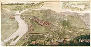
Background imageHungary Collection: Map illustrating the Capture of Buda, 1686 (colour engraving)

Map illustrating the Capture of Buda, 1686 (colour engraving)
CHT237181 Map illustrating the Capture of Buda, 1686 (colour engraving) by Austrian School, (17th century); Private Collection; (add.info.: seizing of Buda from Turks)

Background imageHungary Collection: Map of Raab, from Civitates Orbis Terrarum by Georg Braun (1541-1622

Map of Raab, from Civitates Orbis Terrarum by Georg Braun (1541-1622
STC138940 Map of Raab, from Civitates Orbis Terrarum by Georg Braun (1541-1622) and Frans Hogenberg (1535-90) 1597 (coloured engraving) by Hoefnagel

Background imageHungary Collection: Map of the south occidental part of the Kingdom of Hungary (Engraving, 1717)

Map of the south occidental part of the Kingdom of Hungary (Engraving, 1717)
LRI4712558 Map of the south occidental part of the Kingdom of Hungary (Engraving, 1717) by Nolin, Jean-Baptiste (c.1657-1708); Private Collection; (add.info)

Background imageHungary Collection: Hungary (engraving, 1596)

Hungary (engraving, 1596)
LRI4718179 Hungary (engraving, 1596) by Mercator, Gerardus (1512-94); Private Collection; (add.info.: Hungary, 1608: Hungary - in " Atlas Ssive Corsmographicae Meditationes" by Gerard)

Background imageHungary Collection: Map of Hungary, 1570 (engraving)

Map of Hungary, 1570 (engraving)
LRI4704855 Map of Hungary, 1570 (engraving) by Ortelius, Abraham (1527-98); Museo Navale di Pegli, Genoa, Italy; (add.info.: Hungarian Descriptio, Wolfgango Lazio Auct)

Background imageHungary Collection: Antique Map of Austria Hungary, details of Vienna and Budapest, 19th Century

Antique Map of Austria Hungary, details of Vienna and Budapest, 19th Century


All Professionally Made to Order for Quick Shipping


-

Hungary Collection

Hungary is a landlocked country located in Central Europe, bordered by Austria, Slovakia, Ukraine, Romania, Serbia, Croatia and Slovenia. The country has a population of approximately 9.8 million people and its capital city is Budapest. Hungary's economy is heavily reliant on exports and foreign investment with industries such as automotive manufacturing being major contributors to the country's GDP. The Hungarian currency is the forint (HUF) and the official language spoken is Hungarian. A rich cultural heritage with influences from various civilizations including Roman Empire, Ottoman Empire and Habsburg Monarchy which can be seen in its architecture and cuisine.
+

Our beautiful Wall Art and Photo Gifts include Framed Prints, Photo Prints, Poster Prints, Canvas Prints, Jigsaw Puzzles, Metal Prints and so much more

The Hungary collection from Media Storehouse is a stunning collection of wall art and framed prints that showcase the beauty, history, and culture of Hungary. Our collection features an array of maps and charts that depict the country's geography, topography, landmarks, cities, towns, rivers, lakes, mountains, forests and more. Each print in our collection is carefully crafted to provide a unique perspective on Hungary's rich heritage. From vintage maps dating back to the 16th century to modern-day satellite images capturing every detail of the landscape - there is something for everyone in this impressive range. Whether you're looking for a beautiful piece of artwork to adorn your home or office walls or searching for a thoughtful gift for someone special who loves all things Hungarian - Media Storehouse has got you covered with their Hungary collection. With high-quality printing techniques used on premium paper stock materials - these prints are sure to impress anyone who sees them.
+

What are Hungary (Maps and Charts) art prints?

Hungary art prints are high-quality reproductions of vintage maps and charts depicting Hungary. These prints showcase the intricate details of historical cartography, highlighting the country's geography, topography, landmarks, and cities. We offer a unique perspective on Hungary's past and present landscapes, allowing viewers to explore its rich history through visual representation. These art prints are perfect for those who appreciate both history and aesthetics. They make great additions to any home or office decor as they add character and sophistication to any space. Additionally, these prints can serve as educational tools for students studying geography or history. We offer a wide selection of Hungary art prints in various sizes that cater to different preferences. Our collection includes antique maps from renowned cartographers such as Gerard Mercator, Johann Baptist Homann, John Speed, among others. Each print is carefully reproduced using state-of-the-art printing technology to ensure maximum quality and longevity.
+

What Hungary (Maps and Charts) art prints can I buy from Media Storehouse?

We offer a wide range of Hungary maps and charts art prints that are perfect for decorating your home or office space. You can choose from a variety of styles, including vintage maps, satellite images, and modern designs. Some popular options include the Budapest city map, Danube River chart, and Hungarian wine regions map. These art prints are available in different sizes to suit your needs and preferences. They are printed on high-quality paper using advanced printing techniques to ensure vibrant colors and sharp details. Whether you're looking for a unique gift idea or want to add some personality to your living space, we have something for everyone. In addition to Hungary maps and charts art prints, Media Storehouse also offers a vast collection of artwork from around the world. From iconic landmarks to stunning landscapes, there's no shortage of beautiful pieces to choose from. Browse our selection today and find the perfect piece for your home or office.
+

How do I buy Hungary (Maps and Charts) art prints?

To purchase Hungary art prints from Media Storehouse, you can browse our extensive collection of high-quality images online. Once you have found the print that you would like to purchase, simply select the size and format that suits your needs. You can choose from a range of options including canvas prints, framed prints or unframed prints. To complete your order, add the item to your cart and proceed to checkout. At this stage, you will be prompted to enter your shipping details and payment information. We accept a variety of payment methods including credit cards and PayPal. Once your order has been processed, it will be printed on demand using state-of-the-art printing technology before being shipped directly to your door. With a wide selection of Hungary art prints available at Media Storehouse, finding the perfect piece for your home or office is easy.
+

How much do Hungary (Maps and Charts) art prints cost?

We offer a wide range of Hungary maps and charts art prints that are available at varying prices. Our collection includes vintage and contemporary designs featuring different regions, cities, landmarks, and attractions in Hungary. The cost of each print depends on various factors such as the size, quality of paper or canvas used, printing technique employed, and the complexity of the artwork. We have affordable options for those who want to decorate their homes or offices with beautiful Hungarian art prints without breaking the bank. On the other hand, we also have premium-quality prints for collectors or enthusiasts who value high-resolution images and archival-grade materials. Regardless of your budget or preference, you can find a Hungary map or chart art print that suits your needs at Media Storehouse. We take pride in our extensive selection of artworks from around the world that cater to diverse tastes and interests.
+

How will my Hungary (Maps and Charts) art prints be delivered to me?

We take great care in delivering your Hungary art prints to you. We use high-quality packaging materials to ensure that your print arrives in perfect condition. Your print will be carefully rolled and placed into a sturdy tube for protection during transit. We work with trusted delivery partners who offer reliable and secure shipping services. Once your order has been dispatched, you will receive a tracking number so that you can keep an eye on the progress of your delivery. Our aim is to provide our customers with a hassle-free experience when it comes to receiving their artwork. If for any reason there are issues with the delivery or if the product arrives damaged, please do not hesitate to contact us and we will do everything we can to resolve the issue as quickly as possible. You can expect a professional service from Media Storehouse when it comes to delivering your Hungary art prints.