Fraud Blocker Skip to main content

Home > Maps and Charts > Germany

Germany Collection (page 7)

Germany is a country located in central Europe with a population of over 83 million people and has a diverse landscape

6,585 items

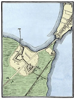
Background imageGermany Collection: Map of British Fortifications in Boston (Massachusetts, USA) 1775-1776

Map of British Fortifications in Boston (Massachusetts, USA) 1775-1776. (War of Independence of the United States)
NWI4843691 Map of British Fortifications in Boston (Massachusetts, USA) 1775-1776. (War of Independence of the United States, 1776-1783)

Background imageGermany Collection: War of Independence of the United States of America (1775-1783)

War of Independence of the United States of America (1775-1783): English colony of North America in 1776
NWI4842561 War of Independence of the United States of America (1775-1783): English colony of North America in 1776. Color lithography.; (add.info)

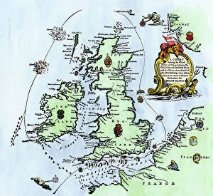
Background imageGermany Collection: United States of America Independence War (1775-1783): Route of American ships 'Ranger'

United States of America Independence War (1775-1783): Route of American ships "Ranger"
NWI4842352 United States of America Independence War (1775-1783): Route of American ships "Ranger" and "Bonhomme Richard" near the British islands during the war

Background imageGermany Collection: Map of Arctic trips by Henry Hudson, English explorer (1570-1611) published in 1612 in ' Voyages'

Map of Arctic trips by Henry Hudson, English explorer (1570-1611) published in 1612 in " Voyages"
NWI4849415 Map of Arctic trips by Henry Hudson, English explorer (1570-1611) published in 1612 in " Voyages". Colouring engraving of the 19th century.; (add.info)

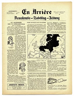
Background imageGermany Collection: Back, Satirical in N & B, War of 14 -18, Press/Media, Germany Prussia

Back, Satirical in N & B, War of 14 -18, Press/Media, Germany Prussia
ICA4849062 Back, Satirical in N & B, War of 14 -18, Press/Media, Germany Prussia; (add.info.: Back, Satirical in N & B, War of 14 -18, Press/Media, Germany Prussia); Photo © Caricadoc

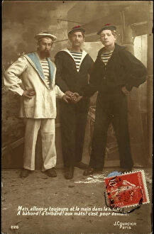
Background imageGermany Collection: First World War: Patriotic map showing three sailors of the allies: French, English and Russian

First World War: Patriotic map showing three sailors of the allies: French, English and Russian
LUX4745102 First World War: Patriotic map showing three sailors of the allies: French, English and Russian, hand in hand on a warship, declaring: But let's always go and hand in hand a babord

Background imageGermany Collection: First World War: France, Patriotic Map showing a dog lying down with writing

First World War: France, Patriotic Map showing a dog lying down with writing, Who said german sausage
LUX4741340 First World War: France, Patriotic Map showing a dog lying down with writing, Who said german sausage? (who said German sausage)

Background imageGermany Collection: First World War: France, Patriotic Map showing, next to the portrait of William II in the Hussard

First World War: France, Patriotic Map showing, next to the portrait of William II in the Hussard of Death
LUX4739949 First World War: France, Patriotic Map showing, next to the portrait of William II in the Hussard of Death, the horoscope of the latter announcing his defeat, 1915

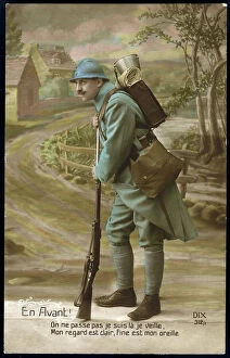
Background imageGermany Collection: First World War: France, Patriotic Map showing a soldier in uniform in a bucolic

First World War: France, Patriotic Map showing a soldier in uniform in a bucolic
LUX4740697 First World War: France, Patriotic Map showing a soldier in uniform in a bucolic and country setting of an Eastern village, ready to fight against the Germans, 1915

Background imageGermany Collection: First World War: France, Patriotic Map showing three young women future victim of William II in

First World War: France, Patriotic Map showing three young women future victim of William II in prayer before their
LUX4739812 First World War: France, Patriotic Map showing three young women future victim of William II in prayer before their death, titled: William Epiting His Victimes, 1914

Background imageGermany Collection: First World War: France, Patriotic Map showing a gargoyle of cathedrale transforms into German

First World War: France, Patriotic Map showing a gargoyle of cathedrale transforms into German general entitled
LUX4738739 First World War: France, Patriotic Map showing a gargoyle of cathedrale transforms into German general entitled: The monsters of cathedrals number 1 William II (1859-1941)

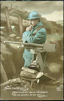
Background imageGermany Collection: First World War: France, Patriotic map showing in a bucolic trench a soldier in a pensive uniform

First World War: France, Patriotic map showing in a bucolic trench a soldier in a pensive uniform
LUX4738514 First World War: France, Patriotic map showing in a bucolic trench a soldier in a pensive uniform and determines next to his machine gun and trophee, a German helmet, 1915

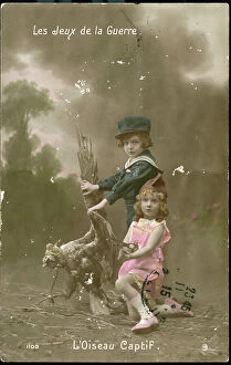
Background imageGermany Collection: First World War: France, Patriotic Map showing a little boy and a little girl in Kepi

First World War: France, Patriotic Map showing a little boy and a little girl in Kepi
LUX4738294 First World War: France, Patriotic Map showing a little boy and a little girl in Kepi and Phrygian hat holding the German eagle by the paste, 1915

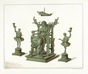
Background imageGermany Collection: Bronze statues of house gods from the Thermae bathhouse at Regio IX, Insula IV, 5

Bronze statues of house gods from the Thermae bathhouse at Regio IX, Insula IV, 5. Chromolithograph by J.G
FLO4687178 Bronze statues of house gods from the Thermae bathhouse at Regio IX, Insula IV, 5. Chromolithograph by J.G. Bach after an illustration by Miss Amy Butts from Emile Presuhn (1844-1878)

Background imageGermany Collection: Floor mosaic from the House of Epigrams, Regio V, Insula 1, 18

Floor mosaic from the House of Epigrams, Regio V, Insula 1, 18. Chromolithograph by Victor Steeger after an
FLO4687154 Floor mosaic from the House of Epigrams, Regio V, Insula 1, 18. Chromolithograph by Victor Steeger after an illustration by Geremia Discanno from Emile Presuhn (1844-1878)

Background imageGermany Collection: Floor mosaic from the new fullonica (fuller's shop), Regio VI, Insula XIV, 21

Floor mosaic from the new fullonica (fuller's shop), Regio VI, Insula XIV, 21
FLO4687150 Floor mosaic from the new fullonica (fuller's shop), Regio VI, Insula XIV, 21. Chromolithograph by Victor Steeger after an illustration by Geremia Discanno from Emile Presuhn (1844-1878)

Background imageGermany Collection: Marble bust of the owner from the House of Vesonius Primus, a fuller

Marble bust of the owner from the House of Vesonius Primus, a fuller. Chromolithograph by Victor Steeger after an
FLO4687114 Marble bust of the owner from the House of Vesonius Primus, a fuller. Chromolithograph by Victor Steeger after an illustration by Geremia Discanno from Emile Presuhn (1844-1878)

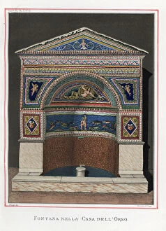
Background imageGermany Collection: Fountain from Regio VII.II.45, House of the Bear, Pompeii. Venus reclines above a blue sea of fishes

Fountain from Regio VII.II.45, House of the Bear, Pompeii. Venus reclines above a blue sea of fishes
FLO4686913 Fountain from Regio VII.II.45, House of the Bear, Pompeii. Venus reclines above a blue sea of fishes, with cupids in attendance

Background imageGermany Collection: Curious wall painting in muted colours from the oecus (salon)

Curious wall painting in muted colours from the oecus (salon) of the Casa del Meleagro or the House of Meleager, Reg
FLO4686886 Curious wall painting in muted colours from the oecus (salon) of the Casa del Meleagro or the House of Meleager, Reg. VI, Ins. IX, No. 2

Background imageGermany Collection: Geographic map of Great Britain, Scotland and Ireland, the Atlantic Ocean and the North Sea

Geographic map of Great Britain, Scotland and Ireland, the Atlantic Ocean and the North Sea
NWI4832911 Geographic map of Great Britain, Scotland and Ireland, the Atlantic Ocean and the North Sea, showing the route of the Spanish Great Armada (Invincible Armada) in 1588

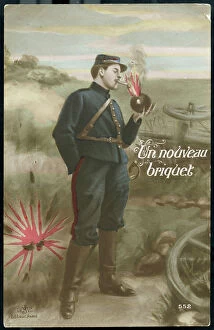
Background imageGermany Collection: First World War: France, Patriotic Map showing a French soldier lighting a cigarette with a German

First World War: France, Patriotic Map showing a French soldier lighting a cigarette with a German bomb
LUX4738964 First World War: France, Patriotic Map showing a French soldier lighting a cigarette with a German bomb, entitled A new brick

Background imageGermany Collection: First World War: France, Patriotic Map showing William II and the Kronp-Reims, 1914

First World War: France, Patriotic Map showing William II and the Kronp-Reims, 1914, cartoonist: H. Clement
LUX4739401 First World War: France, Patriotic Map showing William II and the Kronp-Reims, 1914, cartoonist: H. Clement; (add.info.: First World War - War 14-18 (1914-1918) - World War I (WWI or WW1)

Background imageGermany Collection: First World War: France, Comedy Patriotic Map showing German soldiers picking up liquorice sticks

First World War: France, Comedy Patriotic Map showing German soldiers picking up liquorice sticks in France, 1914
LUX4739331 First World War: France, Comedy Patriotic Map showing German soldiers picking up liquorice sticks in France, 1914; (add.info)

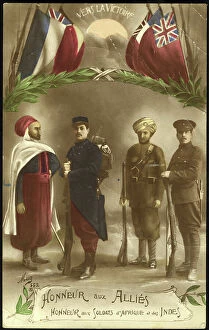
Background imageGermany Collection: First World War: Patriotic map showing soldiers from Africa and India in the aid of the allies

First World War: Patriotic map showing soldiers from Africa and India in the aid of the allies, 1916, Baker
LUX4744489 First World War: Patriotic map showing soldiers from Africa and India in the aid of the allies, 1916, Baker; (add.info.: World War I - War 14-18 (1914-1918) - World War I (WWI or WW1)

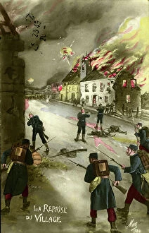
Background imageGermany Collection: First World War: Patriotic map showing a fight between the French and Germans in a village, 1915

First World War: Patriotic map showing a fight between the French and Germans in a village, 1915
LUX4744325 First World War: Patriotic map showing a fight between the French and Germans in a village, 1915, the resumption of the village'; (add.info)

Background imageGermany Collection: First World War: Patriotic map showing a soldier holding a Prussian flag has his hand which he has

First World War: Patriotic map showing a soldier holding a Prussian flag has his hand which he has just taken
LUX4744308 First World War: Patriotic map showing a soldier holding a Prussian flag has his hand which he has just taken, congratulated by his superior and sent back to the front declaring

Background imageGermany Collection: South Africa when the country was a British colony, 1870s. Lithograph of the 19th century

South Africa when the country was a British colony, 1870s. Lithograph of the 19th century
NWI4855278 South Africa when the country was a British colony, 1870s. Lithograph of the 19th century.; (add.info.: South Africa when the country was a British colony, 1870s)

Background imageGermany Collection: Geographic map of England and France after the Brittany trade in the Hundred Years War in 1360

Geographic map of England and France after the Brittany trade in the Hundred Years War in 1360
NWI4874497 Geographic map of England and France after the Brittany trade in the Hundred Years War in 1360. Lithograph of the 19th century.; (add.info)

Background imageGermany Collection: Geographic map of England and Wales, circa 1870. 19th century colour engraving

Geographic map of England and Wales, circa 1870. 19th century colour engraving
NWI4874357 Geographic map of England and Wales, circa 1870. 19th century colour engraving; (add.info.: Geographic map of England and Wales, circa 1870)

Background imageGermany Collection: Map of the Count of Durham England), circa 1870. 19th century lithography

Map of the Count of Durham England), circa 1870. 19th century lithography
NWI4874845 Map of the Count of Durham England), circa 1870. 19th century lithography.; (add.info.: Map of the Count of Durham England), circa 1870

Background imageGermany Collection: Map of England and Wales, circa 1870. 19th century lithography

Map of England and Wales, circa 1870. 19th century lithography
NWI4874691 Map of England and Wales, circa 1870. 19th century lithography.; (add.info.: Map of England and Wales, circa 1870. 19th century lithography.); Photo © North Wind Pictures

Background imageGermany Collection: Map of the Earl of Middlesex (England), circa 1870. 19th century lithography

Map of the Earl of Middlesex (England), circa 1870. 19th century lithography
NWI4875178 Map of the Earl of Middlesex (England), circa 1870. 19th century lithography.; (add.info.: Map of the Earl of Middlesex (England), circa 1870

Background imageGermany Collection: Map of the Earl of Wiltshire (England), circa 1870. 19th century lithography

Map of the Earl of Wiltshire (England), circa 1870. 19th century lithography
NWI4875514 Map of the Earl of Wiltshire (England), circa 1870. 19th century lithography.; (add.info.: Map of the Earl of Wiltshire (England), circa 1870

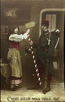
Background imageGermany Collection: First World War: Patriotic map showing an Alsatian greeting a French soldier who brings her back a

First World War: Patriotic map showing an Alsatian greeting a French soldier who brings her back a German helmet
LUX4744337 First World War: Patriotic map showing an Alsatian greeting a French soldier who brings her back a German helmet and a border post in trophee, declaring dear sister here

Background imageGermany Collection: Patriotic map showing France and England contemplating a sphere titled sister nations, 1915

Patriotic map showing France and England contemplating a sphere titled sister nations, 1915
LUX4743748 Patriotic map showing France and England contemplating a sphere titled sister nations, 1915; (add.info.: Patriotic map showing France)

Background imageGermany Collection: First World War: Patriotic map showing a French soldier and an English soldier consoling a Belgian

First World War: Patriotic map showing a French soldier and an English soldier consoling a Belgian soldier
LUX4743971 First World War: Patriotic map showing a French soldier and an English soldier consoling a Belgian soldier and titled Brother of Arms

Background imageGermany Collection: First World War: France, Patriotic Map showing a young woman in a Phrygian hat representing

First World War: France, Patriotic Map showing a young woman in a Phrygian hat representing the republic
LUX4742433 First World War: France, Patriotic Map showing a young woman in a Phrygian hat representing the republic, encouraging soldiers to charge the German Armee

Background imageGermany Collection: Germany, Thuringia, the Wartburg, the so called Landgrafenhaus inside, the third floor

Germany, Thuringia, the Wartburg, the so called Landgrafenhaus inside, the third floor, 1876 (engraving)
UTD4916625 Germany, Thuringia, the Wartburg, the so called Landgrafenhaus inside, the third floor, 1876 (engraving); (add.info.: Germany, Thuringia, the Wartburg, the so called Landgrafenhaus inside)

Background imageGermany Collection: Germany, Thuringia, the Wartburg, plan of the castle, 1876 (engraving)

Germany, Thuringia, the Wartburg, plan of the castle, 1876 (engraving)
UTD4916513 Germany, Thuringia, the Wartburg, plan of the castle, 1876 (engraving); (add.info.: Germany, Thuringia, the Wartburg, plan of the castle)

Background imageGermany Collection: First World War: France, Patriotic Map Showing a Caricature of the German Soldier, 1916

First World War: France, Patriotic Map Showing a Caricature of the German Soldier, 1916
LUX4741845 First World War: France, Patriotic Map Showing a Caricature of the German Soldier, 1916, Map titled: Pig's Head at the Buche; (add.info)

Background imageGermany Collection: First World War: France, Patriotic Map showing a drawing of the French repelling the Germans under

First World War: France, Patriotic Map showing a drawing of the French repelling the Germans under the command of Joan
LUX4741698 First World War: France, Patriotic Map showing a drawing of the French repelling the Germans under the command of Joan of Arc, 1915

Background imageGermany Collection: First World War: France, Patriotic Map showing William II on him everything the Germans took

First World War: France, Patriotic Map showing William II on him everything the Germans took during their invasion
LUX4739840 First World War: France, Patriotic Map showing William II on him everything the Germans took during their invasion, champagne, pendulum, lace

Background imageGermany Collection: Large penguins (Pinguinus impennis) standing at the top of a cliff. This large bird, unable to fly

Large penguins (Pinguinus impennis) standing at the top of a cliff. This large bird, unable to fly
FLO4639319 Large penguins (Pinguinus impennis) standing at the top of a cliff. This large bird, unable to fly, lived on the edge of the Atlantic Ocean

Background imageGermany Collection: Altlantique Limulus polyphemus, arthropod chelicere. Colour illustration by Heinrich Harder

Altlantique Limulus polyphemus, arthropod chelicere. Colour illustration by Heinrich Harder (1858-1935)
FLO4639195 Altlantique Limulus polyphemus, arthropod chelicere. Colour illustration by Heinrich Harder (1858-1935), in " Tiere der Urwelt" (Animals of Prehistory)

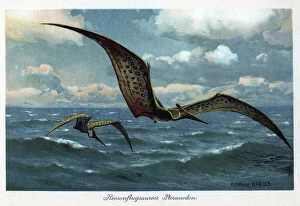
Background imageGermany Collection: The pteranodons (wings without teeth) were large flying dinosaurs

The pteranodons (wings without teeth) were large flying dinosaurs, with a wingspan of more than 9 metres
FLO4639182 The pteranodons (wings without teeth) were large flying dinosaurs, with a wingspan of more than 9 metres, and lived in the Upper Cretace period

Background imageGermany Collection: Dinocerata, (Terrible a horn) species of herbivore, resembling rhinoceros

Dinocerata, (Terrible a horn) species of herbivore, resembling rhinoceros
FLO4639842 Dinocerata, (Terrible a horn) species of herbivore, resembling rhinoceros, creature a hoof famous for their paired horns and their canine defenses

Background imageGermany Collection: Two Archeopteryx searching the shore. These missing animals are considered the oldest known animals

Two Archeopteryx searching the shore. These missing animals are considered the oldest known animals
FLO4639193 Two Archeopteryx searching the shore. These missing animals are considered the oldest known animals. They lived in the Upper Jurassic period 150 to 148 million years ago

Background imageGermany Collection: Weimar, Germany

Weimar, Germany
2901912 Weimar, Germany; (add.info.: Located on Ilm river; was medieval center; ruled by counts of Weimar-Orlamde from 1247)


All Professionally Made to Order for Quick Shipping


-

Germany Collection

Germany is a country located in central Europe with a population of over 83 million people and has a diverse landscape, ranging from the Alps in the south to the North Sea and Baltic Sea coasts in the north. The country is known for its strong economy, which is driven by industries such as automotive manufacturing, engineering, and pharmaceuticals. It also has a rich cultural history, with famous composers like Beethoven and Bach hailing from the country. Its capital city Berlin is renowned for its vibrant art scene and historical landmarks such as the Brandenburg Gate.

+

Our beautiful Wall Art and Photo Gifts include Framed Prints, Photo Prints, Poster Prints, Canvas Prints, Jigsaw Puzzles, Metal Prints and so much more

The Germany collection from Media Storehouse offers a wide selection of wall art and framed prints that showcase the beauty, history, and culture of Germany. Our collection features an array of maps and charts that depict the country's geography, landmarks, cities, regions, and historical events. From vintage maps to modern designs, our collection caters to different tastes and preferences. Some of the popular items in our collection include antique city plans of Berlin or Munich; topographic maps of Bavaria or Black Forest; political maps showing Germany's borders over time; charts illustrating Germanic tribes' migration patterns during ancient times. These artworks are available in various sizes and formats such as canvas prints or traditional frames. They make great decorations for homes, offices or public spaces like museums or libraries. The Germany collection is a must-see for anyone interested in exploring the rich heritage of this fascinating country through visual art.
+

What are Germany (Maps and Charts) art prints?

Germany art prints are high-quality reproductions of historical maps and charts depicting various regions, cities, and landmarks in Germany. These prints showcase the intricate details of the original maps and charts, including topography, street names, buildings, rivers, and other geographical features. These art prints are perfect for history enthusiasts who want to explore Germany's rich cultural heritage or for those who simply appreciate beautiful cartographic artwork. They can be used as decorative pieces in homes or offices or as educational tools in schools and libraries. We offer a wide range of Germany art prints that cater to different tastes and preferences. You can choose from vintage-style sepia-toned maps to colorful contemporary designs that highlight specific areas or themes such as wine regions or cycling routes. These art prints provide a unique way to experience Germany's geography and history while adding aesthetic value to any space.
+

What Germany (Maps and Charts) art prints can I buy from Media Storehouse?

We offer a wide range of Germany maps and charts art prints that you can purchase. These include vintage maps, city plans, topographical charts, and historical atlases. You can choose from different styles and sizes to suit your preferences. One popular option is the antique map of Germany created by cartographer Gerard Mercator in 1595. This beautifully detailed map shows the country's regions, cities, rivers, and mountains as they were known during the Renaissance period. Another interesting print is the Berlin Wall Map which depicts the infamous wall that divided East and West Berlin during the Cold War era. The map includes details on checkpoints, watchtowers, escape tunnels and other features related to this historic event. Whether you are looking for a decorative piece for your home or office or an educational resource for teaching purposes, we have a variety of Germany maps and charts art prints available to suit your needs.
+

How do I buy Germany (Maps and Charts) art prints?

To buy Germany art prints from Media Storehouse, you can browse our extensive collection of high-quality prints online. Simply search for the specific artwork or artist you are interested in, or filter by category to find maps and charts related to Germany. Once you have found a print that catches your eye, select the size and format that best suits your needs. We offer a range of options for printing on different materials such as canvas, photographic paper, and fine art paper. You can also choose to have your print framed or unframed depending on your preference. Once you have made your selection, simply add it to your cart and proceed to checkout. Payment is easy with various payment methods available including credit card payments. Buying Germany art prints from Media Storehouse is a straightforward process that allows you to easily access beautiful artworks at affordable prices.
+

How much do Germany (Maps and Charts) art prints cost?

We offer a wide range of Germany art prints at varying prices. Our collection includes vintage maps, historical charts, and modern interpretations of the country's geography. The cost of each print depends on several factors such as size, framing options, and printing material. We understand that every customer has unique preferences when it comes to purchasing art prints. That is why we have made sure to provide a diverse selection that caters to different tastes and budgets. Whether you are looking for an affordable poster or a high-quality canvas print, we have something for everyone. Our Germany art prints make great additions to any home or office space. They are not only aesthetically pleasing but also educational pieces that can spark interesting conversations about history and geography. So if you're interested in adding some German-inspired artwork to your collection, be sure to check out our selection today.
+

How will my Germany (Maps and Charts) art prints be delivered to me?

Your Germany art prints will be delivered to you in a safe and secure manner by our trusted delivery partners. We take great care to ensure that your artwork is packaged with the utmost care, so it arrives at your doorstep in pristine condition. Depending on the size of your order, we may use different shipping methods such as standard post or courier services. We understand how important it is for you to receive your artwork promptly, which is why we work hard to dispatch all orders as quickly as possible. Once dispatched, you will receive an email notification containing tracking information so that you can keep track of your package's progress. We are committed to providing our customers with high-quality products and exceptional service. If for any reason you are not completely satisfied with your purchase, please do not hesitate to contact us so that we can resolve any issues promptly.