Fraud Blocker Skip to main content

Home > Maps and Charts > Denmark

Denmark Collection (page 8)

Denmark is a Nordic country located in Northern Europe and has a population of approximately 5.8 million people and covers an area of 42,924 square kilometers

393 items

Background imageDenmark Collection: Poole BH15 2 Map

Poole BH15 2 Map
Postcode Sector Map of Poole BH15 2

Background imageDenmark Collection: Bournemouth BH9 1 Map

Bournemouth BH9 1 Map
Postcode Sector Map of Bournemouth BH9 1

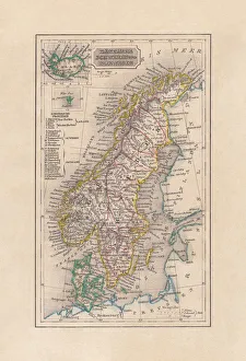
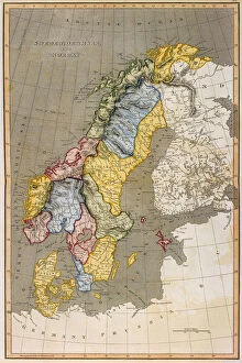
Background imageDenmark Collection: Old map of Scandinavia and Iceland, steel engraving, published 1857

Old map of Scandinavia and Iceland, steel engraving, published 1857
Old map of Denmark, Sweden and Norway. Steel engraving with hand coloured borderlines, published in 1857

Background imageDenmark Collection: Antique map of Denmark and Iceland

Antique map of Denmark and Iceland

Background imageDenmark Collection: The Battle of Jutland Bank, May 31-June 1, 1916, (c1920). Creator: Unknown

The Battle of Jutland Bank, May 31-June 1, 1916, (c1920). Creator: Unknown
The Battle of Jutland Bank, May 31-June 1, 1916, (c1920). Map showing the Approximate Positions of the British and German Fleets at Various Stages of the Battle

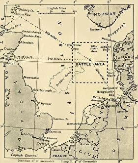
Background imageDenmark Collection: The Scene of the Battle of Jutland, May 31-June 1, 1916, (c1920). Creator: Unknown

The Scene of the Battle of Jutland, May 31-June 1, 1916, (c1920). Creator: Unknown
The Scene of the Battle of Jutland, May 31-June 1, 1916, (c1920). Map of the North Sea, showing the coastlines of Norway, Denmark, Germany, Holland, Belgium and Great Britain

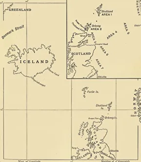
Background imageDenmark Collection: Map showing the Scope of the Operations of the 10th Cruiser Squadron... 1916, (c1920)

Map showing the Scope of the Operations of the 10th Cruiser Squadron... 1916, (c1920)
Map showing the Scope of the Operations of the 10th Cruiser Squadron, First World War, 1916, (c1920). Also known as the Northern Patrol

Background imageDenmark Collection: Map of Central Europe, Showing the Principal Theatre of War, 1919

Map of Central Europe, Showing the Principal Theatre of War, 1919. Europe during the First World War, 1914-1919. From " The History of the Great European War: its causes and effects", Vol

Background imageDenmark Collection: England, Scotland and Ireland - Time of Viking Invasions, 1926. Creators: Unknown

England, Scotland and Ireland - Time of Viking Invasions, 1926. Creators: Unknown
England, Scotland and Ireland - Time of Viking Invasions, 1926. Map of Britain during the 9th-11th century. Towns of Viking foundation in Ireland underlined

Background imageDenmark Collection: Map of Denmark 1896

Map of Denmark 1896
Andres Allgemeiner Handatlas - Bielefeld und Leipzig 1896

Background imageDenmark Collection: Antique map of Sweden, Norway, Denmark, 1897, late 19th Century

Antique map of Sweden, Norway, Denmark, 1897, late 19th Century
Vintage engraving of a Antique map of Sweden, Norway, Denmark, 1897, late 19th Century

Background imageDenmark Collection: Map of Denmark, 1902. Creator: Unknown

Map of Denmark, 1902. Creator: Unknown
Map of Denmark, 1902. Showing the various counties and islands, and inset of Copenhagen. From The Century Atlas of the World. [John Walker & Co, Ltd. London, 1902]

Background imageDenmark Collection: Danish Invasion of Wessex 876-878, (1935)

Danish Invasion of Wessex 876-878, (1935). Map of England, Wales and part of Scotland, showing significant locations (with contemporary place names) during the invasions from Scandinavia

Background imageDenmark Collection: Alfreds Last War - Third Phase, 893. April to (?) June, (1935)

Alfreds Last War - Third Phase, 893. April to (?) June, (1935). Map of the south-east of England, showing Burhs (Old English fortifications) of the Anglo-Saxon King Alfred the Great, Danish forts

Background imageDenmark Collection: Alfreds Last War - Opening Phases. From about October 892-March 893, (1935)

Alfreds Last War - Opening Phases. From about October 892-March 893, (1935). Map of the south-east of England, showing Burhs (Old English fortifications) of the Anglo-Saxon King Alfred the Great

Background imageDenmark Collection: Campaigns of the Great Danish Army 865-875. (1935)

Campaigns of the Great Danish Army 865-875. (1935). Map of Britain showing significant locations (with contemporary place names) during the invasions from Scandinavia

Background imageDenmark Collection: Map of Southern Scandinavia and Denmark

Map of Southern Scandinavia and Denmark. Plate 42 from The Times Atlas

Background imageDenmark Collection: British, Dutch, French, Spanish, Portuguese, Italian, Danish colonies, lithograph, 1897

British, Dutch, French, Spanish, Portuguese, Italian, Danish colonies, lithograph, 1897
British, Dutch, French, Spanish, Portuguese, Italian and Danish colonies at the end of the 19th century. Lithograph, published in 1897

Background imageDenmark Collection: Map of Copenhagen and sourroundings, Denmark, wood engraving, published 1897

Map of Copenhagen and sourroundings, Denmark, wood engraving, published 1897
Map of Copenhagen and sourroundings, Denmark. Wood engraving, published in 1897

Background imageDenmark Collection: Engraving: Copenhagen, Stockholm, Antwerp and Amsterdam

Engraving: Copenhagen, Stockholm, Antwerp and Amsterdam
Engraved illustrations of the cities of Copenhagen, Stockholm, Antwerp and Amsterdam from Iconographic Encyclopedia of Science, Literature and Art, Published in 1851

Background imageDenmark Collection: Engraving: Map of Copenhagen

Engraving: Map of Copenhagen
Engraved illustrations of the Map of Copenhagen from Iconographic Encyclopedia of Science, Literature and Art, Published in 1851. Copyright has expired on this artwork. Digitally restored

Background imageDenmark Collection: Map showing Tycho Brahes system of planetary orbits, 1660-1661

Map showing Tycho Brahes system of planetary orbits, 1660-1661. From The Celestial Atlas, or The Harmony of the Universe (Atlas coelestis seu harmonia macrocosmica) by Andreas Cellarius

Background imageDenmark Collection: Map showing Tycho Brahes system of planetary orbits around the Earth, 1660-1661

Map showing Tycho Brahes system of planetary orbits around the Earth, 1660-1661. From The Celestial Atlas, or The Harmony of the Universe (Atlas coelestis seu harmonia macrocosmica)

Background imageDenmark Collection: Map of Europe 1897

Map of Europe 1897
Natural Elementary Geography by Redway and Hinman - NY/Cincinnati/Chicago 1897

Background imageDenmark Collection: The Map of the First Kamchatka Expedition, 1725-1730. Artist: Bering, Vitus Jonassen (1681-1741)

The Map of the First Kamchatka Expedition, 1725-1730. Artist: Bering, Vitus Jonassen (1681-1741)
The Map of the First Kamchatka Expedition, 1725-1730. Found in the collection of National Library of Sweden

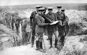
Background imageDenmark Collection: King George V (1865-1936) at St Georges Hill, near Fricourt, 10th August 1916, (1936)

King George V (1865-1936) at St Georges Hill, near Fricourt, 10th August 1916, (1936)
King George V (1865-1936) (1936) with General Sir Henry Seymour Rawlinson and General Congreve at St Georges Hill, near Fricourt, 10th August 1916

Background imageDenmark Collection: Map of Europe 1877

Map of Europe 1877
Warrens Common School Geography 1877

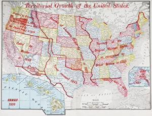
Background imageDenmark Collection: Map from 1898 showing the territorial growth of the United States of America

Map from 1898 showing the territorial growth of the United States of America. From The History of Our Country, published 1900

Background imageDenmark Collection: Map of Copenhagen

Map of Copenhagen 1837

Background imageDenmark Collection: Cartoon map of Denmark

Cartoon map of Denmark

Background imageDenmark Collection: Labeled European Map

Labeled European Map
Labeled European map concept showing countries with labels. EPS 10 file. Transparency effects used on highlight elements

Background imageDenmark Collection: Map of Sweden with Denmark and Norway

Map of Sweden with Denmark and Norway

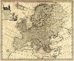
Background imageDenmark Collection: Antique Map of Europe 1744

Antique Map of Europe 1744
An engraved map of Europe with ornamental cartouche and relief shown pictorially by Emanuel Bowen 1744, London, Geographer to His Majesty

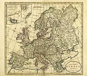
Background imageDenmark Collection: Antique Map of Europe, 1785

Antique Map of Europe, 1785
An accurate map of Europe from the best authorities. London: C. Dilly & G. Robinson: 1785. Original size: 35.7 x 37.4 cm. Coloured, Inset: Spitsbergen, East and West Greenland, and Iceland

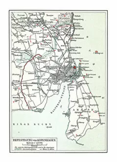
Background imageDenmark Collection: Old chromolithograph map of fortification of Copenhagen, Denmark (fortress war)

Old chromolithograph map of fortification of Copenhagen, Denmark (fortress war)
Copyright has expired on this artwork. From my own archives, digitally restored

Background imageDenmark Collection: Old chromolithograph map of fortification of Copenhagen, Denmark (fortress war)

Old chromolithograph map of fortification of Copenhagen, Denmark (fortress war)
Copyright has expired on this artwork. From my own archives, digitally restored

Background imageDenmark Collection: 17th century map of Russia and surrounding countries by Dutch artist, engraver

17th century map of Russia and surrounding countries by Dutch artist, engraver, publisher and cartographer Nicolaes Visscher I, 1618 -1679

Background imageDenmark Collection: Greenlanders (engraving)

Greenlanders (engraving)
7167614 Greenlanders (engraving) by English School, (19th century); Private Collection; (add.info.: Greenlanders. Illustration for The Childs Companion and Juvenile Instructor)

Background imageDenmark Collection: Greenlanders (engraving)

Greenlanders (engraving)
7167645 Greenlanders (engraving) by English School, (19th century); Private Collection; (add.info.: Greenlanders. Illustration for The Childs Companion and Juvenile Instructor)

Background imageDenmark Collection: Danes (engraving)

Danes (engraving)
7167638 Danes (engraving) by English School, (19th century); Private Collection; (add.info.: Danes. Illustration for The Childs Companion and Juvenile Instructor (Religious Tract Society)

Background imageDenmark Collection: The Seat of War in Denmark (engraving)

The Seat of War in Denmark (engraving)
1103118 The Seat of War in Denmark (engraving) by English School, (19th century); Private Collection; (add.info.: The Seat of War in Denmark)

Background imageDenmark Collection: Antique map of Denmark

Antique map of Denmark
Vintage map from 1864 of a Denmark

Background imageDenmark Collection: Chart Showing The Course Of The British Fleet In The Battle Of Jutland Bank During World War I

Chart Showing The Course Of The British Fleet In The Battle Of Jutland Bank During World War I. From The Year 1916 Illustrated

Background imageDenmark Collection: Map of Europe 1895

Map of Europe 1895
The Rand-McNally Grammar School Geography 1895 - Chicago & New York

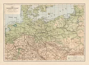
Background imageDenmark Collection: North German lowland map, 19th century view, lithograph, published 1884

North German lowland map, 19th century view, lithograph, published 1884
Old Topographic map of the North German lowland in German language. Lithograph, published in 1884

Background imageDenmark Collection: Buildings of the world Exhibitions, 19th century

Buildings of the world Exhibitions, 19th century
Exhibition buildings of world exhibitions in the 19th century: 1-3) Buildings for the World Exhibition 1893 in Chicago, USA: 1) Machine exhibition building, 2) Building for horticulture

Background imageDenmark Collection: Map of Europe 1889

Map of Europe 1889
Indiana Educational Series The Complete Geography - Indianapolis 1889

Background imageDenmark Collection: antique, archival, baltic, border, cartography, denmark, document, europe, european

antique, archival, baltic, border, cartography, denmark, document, europe, european, finland, geography, historic, historical, latitude, longitude, map, nobody, north, norway, region, scale


All Professionally Made to Order for Quick Shipping


-

Denmark Collection

Denmark is a Nordic country located in Northern Europe and has a population of approximately 5.8 million people and covers an area of 42,924 square kilometers. The country is known for its high standard of living, social welfare system, and strong economy. Denmark's capital city is Copenhagen, which is also the largest city in the country with a population of over 600,000 people. A constitutional monarchy system with Queen Margrethe II as the current monarch. The official language spoken is Danish and the currency used is the Danish krone (DKK). A diverse landscape that includes beaches, forests, lakes, and islands scattered throughout the surrounding seas.
+

Our beautiful pictures are available as Framed Prints, Photos, Wall Art and Photo Gifts

The Denmark collection from Media Storehouse offers a stunning selection of wall art and framed prints that showcase the beauty and history of Denmark. Our collection features a wide range of maps and charts that depict the country's geography, landmarks, cities, regions, and historical events. These high-quality prints are perfect for anyone who loves Danish culture or wants to add some unique décor to their home or office. From vintage maps dating back centuries to modern designs with vibrant colors, there is something for everyone in this collection. Each print is carefully crafted using premium materials such as archival paper and fade-resistant ink to ensure long-lasting quality. Whether you're looking for a striking centerpiece or an accent piece to complement your existing décor, these prints are sure to impress. The Denmark collection from Media Storehouse is an excellent choice for anyone who appreciates beautiful artwork that celebrates the rich history of this fascinating country.
+

What are Denmark (Maps and Charts) art prints?

Denmark art prints are a collection of high-quality, visually stunning prints that showcase the beauty and intricacies of Denmark's geography. These prints feature detailed maps and charts that highlight the country's topography, waterways, cities, towns, and landmarks. They are perfect for anyone who loves to travel or has an interest in geography. These art prints are created using state-of-the-art printing technology to ensure that they capture every detail of the original map or chart. The result is a beautiful piece of artwork that can be displayed in any home or office. Whether you're looking for a unique gift for someone special or want to add some visual interest to your own space, Denmark art prints are an excellent choice. With their intricate details and vibrant colors, these prints will transport you straight to Denmark without ever leaving your home.
+

What Denmark (Maps and Charts) art prints can I buy from Media Storehouse?

We offer a wide range of Denmark art prints, including maps and charts. These prints showcase the beauty and history of Denmark in stunning detail, making them perfect for anyone who loves this fascinating country. Whether you're looking for vintage maps or contemporary designs, we have something to suit every taste. Some of the most popular Denmark art prints available from Media Storehouse include detailed city maps that highlight all the major landmarks and attractions. You can also find beautiful coastal charts that show off the country's stunning coastline and islands. In addition to these traditional map-based designs, Media Storehouse also offers a range of artistic interpretations of Denmark. From abstract paintings to photographic collages, these unique prints capture the essence of this vibrant nation in a truly original way. So if you're looking for high-quality Denmark art prints that will add style and sophistication to your home or office, look no further than Media Storehouse.
+

How do I buy Denmark (Maps and Charts) art prints?

To purchase Denmark art prints from Media Storehouse, you can browse our extensive collection of high-quality images online. Once you have found the print that you would like to purchase, simply add it to your cart and proceed to checkout. You will be prompted to enter your shipping and payment information before completing your order. We offer a range of sizes for their art prints, so be sure to select the size that best fits your needs. We also offer framing options if you prefer a ready-to-hang piece. Their Denmark art prints are perfect for adding a touch of history or geography to any room in your home or office. Whether you are looking for a vintage map or a modern chart, we have something for everyone's taste. With our easy ordering process and fast shipping times, purchasing artwork has never been easier.
+

How much do Denmark (Maps and Charts) art prints cost?

We offer a wide range of Denmark maps and charts art prints. Our collection includes various styles and sizes to suit your preferences. The cost of our Denmark maps and charts art prints varies depending on the size, style, and material you choose. We have options ranging from small posters to large canvas prints that can fit any budget. Our Denmark maps and charts art prints are perfect for adding a touch of elegance to any room in your home or office. They make great gifts for anyone who loves history, geography or travel. You can browse our selection online at Media Storehouse without worrying about shipping costs or delivery times as we provide fast shipping services worldwide. Whether you're looking for a vintage map of Copenhagen or an antique chart of the North Sea, we've got you covered with high-quality Denmark maps and charts art prints that will last for years to come.
+

How will my Denmark (Maps and Charts) art prints be delivered to me?

Your Denmark art prints will be delivered to you in a safe and secure manner. We take great care in packaging your artwork so that it arrives at your doorstep undamaged. We use high-quality materials such as sturdy cardboard tubes or flat packaging to ensure that your prints are protected during transit. Once your order has been processed, our team will carefully package your artwork and dispatch it for delivery. Depending on the size of the print, we may use different courier services to deliver your order. However, rest assured that all our couriers are reliable and experienced in handling delicate items like art prints. When you receive your Denmark art prints, please inspect them carefully to ensure they have arrived in perfect condition. If there are any issues with the delivery or quality of the product, please do not hesitate to contact us so we can assist you further.