Home > Europe > United Kingdom > England > London > Sights > Holland Park
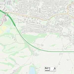
Plymouth PL7 5 Map

![]()
Wall Art and Photo Gifts from Map Marketing
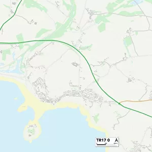
Plymouth PL7 5 Map
Postcode Sector Map of Plymouth PL7 5
Media ID 19978371
Barn Close Berrys Lane Birchwood Gardens Bridle Close Chapel Lane Deep Lane Eagle Close Eagle Road Fairway Gardens Garden Close Holland Road Kay Close Kingsway Meadow Close New Park Road Newnham Close Oakfield Close Park Lane Plymouth Port Lane Sandy Lane The Paddock Langage
FEATURES IN THESE COLLECTIONS
> Animals
> Mammals
> Muridae
> Western Mouse
> Europe
> United Kingdom
> England
> London
> Sights
> Holland Park
> Europe
> United Kingdom
> England
> Maps
> Europe
> United Kingdom
> England
> Plymouth
> Map Marketing
> Postcode Sector Maps
> PL - Plymouth
> Maps and Charts
> Related Images
MADE IN THE UK
Safe Shipping with 30 Day Money Back Guarantee
FREE PERSONALISATION*
We are proud to offer a range of customisation features including Personalised Captions, Color Filters and Picture Zoom Tools
SECURE PAYMENTS
We happily accept a wide range of payment options so you can pay for the things you need in the way that is most convenient for you
* Options may vary by product and licensing agreement. Zoomed Pictures can be adjusted in the Basket.