Home > Europe > United Kingdom > England > Oxfordshire > Moreton
West Oxfordshire OX29 5 Map

![]()
Wall Art and Photo Gifts from Map Marketing
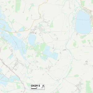
West Oxfordshire OX29 5 Map
Postcode Sector Map of West Oxfordshire OX29 5
Media ID 19978982
Burr Close Chapel Lane Griffiths Close Main Road Moreton Moreton Lane New Road Sutton Sutton Lane The Close The Green The Row West End West Oxfordshire Willowbrook
FEATURES IN THESE COLLECTIONS
> Europe
> United Kingdom
> England
> Oxfordshire
> Eynsham
> Europe
> United Kingdom
> England
> Oxfordshire
> Moreton
> Europe
> United Kingdom
> England
> Oxfordshire
> Related Images
> Europe
> United Kingdom
> England
> Oxfordshire
> Windrush
> Map Marketing
> Postcode Sector Maps
> OX - Oxford
> Maps and Charts
> Related Images
MADE IN THE UK
Safe Shipping with 30 Day Money Back Guarantee
FREE PERSONALISATION*
We are proud to offer a range of customisation features including Personalised Captions, Color Filters and Picture Zoom Tools
SECURE PAYMENTS
We happily accept a wide range of payment options so you can pay for the things you need in the way that is most convenient for you
* Options may vary by product and licensing agreement. Zoomed Pictures can be adjusted in the Basket.