Home > Europe > United Kingdom > England > London > Sights > Lee Valley
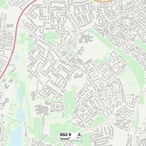
East Hertfordshire SG13 8 Map

![]()
Wall Art and Photo Gifts from Map Marketing
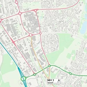
East Hertfordshire SG13 8 Map
Postcode Sector Map of East Hertfordshire SG13 8
Media ID 19981224
Back Lane Breach Lane Broad Green Cecil Road Church Road Cranborne Close East Hertfordshire Glovers Close Hale Road Highfield Road Hillside Terrace Lee Close Liberty Close Mandeville Close Mandeville Road New Park Road Newgate Street Oak Grove Orchard Close Pearson Avenue Queens Road Stocking Lane The Boundary The Chestnuts The Dell Valley Close Warwick Close Wentworth Road West Street Wilton Crescent Waterdale
FEATURES IN THESE COLLECTIONS
> Animals
> Mammals
> Muridae
> Little Wood Mouse
> Arts
> Portraits
> Pop art gallery
> Street art portraits
> Europe
> United Kingdom
> England
> Hertfordshire
> Berkhamsted
> Europe
> United Kingdom
> England
> Hertfordshire
> Green Street
> Europe
> United Kingdom
> England
> Hertfordshire
> Hatfield
> Europe
> United Kingdom
> England
> Hertfordshire
> Park Street
> Europe
> United Kingdom
> England
> Hertfordshire
> Related Images
> Europe
> United Kingdom
> England
> London
> Sights
> Lee Valley
> Map Marketing
> Postcode Sector Maps
> SG - Stevenage
> Maps and Charts
> Related Images
MADE IN THE UK
Safe Shipping with 30 Day Money Back Guarantee
FREE PERSONALISATION*
We are proud to offer a range of customisation features including Personalised Captions, Color Filters and Picture Zoom Tools
SECURE PAYMENTS
We happily accept a wide range of payment options so you can pay for the things you need in the way that is most convenient for you
* Options may vary by product and licensing agreement. Zoomed Pictures can be adjusted in the Basket.