Home > Europe > United Kingdom > Wales > Pembrokeshire > Pembroke
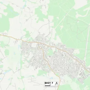
Poole BH12 4 Map

![]()
Wall Art and Photo Gifts from Map Marketing
Poole BH12 4 Map
Postcode Sector Map of Poole BH12 4
Media ID 19965510
Alder Crescent Alder Road Aspen Gardens Aspen Road Aspen Way Berkeley Avenue Bowden Road Bridport Road Broom Road Dudley Gardens Grange Gardens Guernsey Road Hudson Close Jersey Close Jersey Road Ling Road Manor Avenue Morrison Avenue Pembroke Road Pine Avenue Poole Wyvern Close Yarrow Close Yarrow Road
FEATURES IN THESE COLLECTIONS
> Animals
> Birds
> Passerines
> Thrushes
> Related Images
> Animals
> Mammals
> Muridae
> Heath Mouse
> Animals
> Mammals
> Muridae
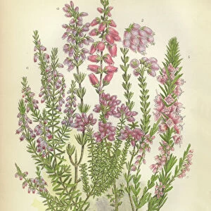
> Ling
> Europe
> United Kingdom
> Wales
> Pembrokeshire
> Pembroke
> Map Marketing
> Postcode Sector Maps
> BH - Bournemouth
> Maps and Charts
> Related Images
MADE IN THE UK
Safe Shipping with 30 Day Money Back Guarantee
FREE PERSONALISATION*
We are proud to offer a range of customisation features including Personalised Captions, Color Filters and Picture Zoom Tools
SECURE PAYMENTS
We happily accept a wide range of payment options so you can pay for the things you need in the way that is most convenient for you
* Options may vary by product and licensing agreement. Zoomed Pictures can be adjusted in the Basket.