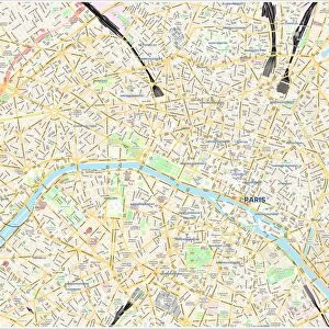
Jigsaw Puzzle > North America > United States of America > New York > New York > Sights > Wall Street
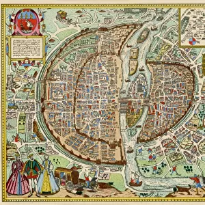
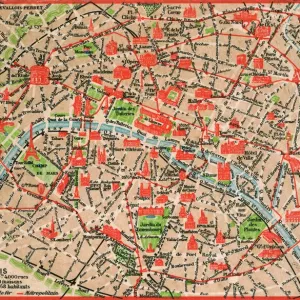
Jigsaw Puzzle : PARIS MAP, 1581. Map of Paris, France, by Georg Braun from Civitates Orbis Terarum, 1581


![]()
Jigsaw Puzzles from Granger
PARIS MAP, 1581. Map of Paris, France, by Georg Braun from Civitates Orbis Terarum, 1581
PARIS MAP, 1581.
Map of Paris, France, by Georg Braun from Civitates Orbis Terarum, 1581
Granger holds millions of images spanning more than 25,000 years of world history, from before the Stone Age to the dawn of the Space Age
Media ID 6263237
1581 Braun Civitates Orbis Terrarum Georg Moat Seine Wall
Jigsaw Puzzle (400 Pieces)
Step back in time with our Paris Map jigsaw puzzle from the Media Storehouse collection. This intriguing puzzle showcases an historic map of Paris, France, created by Georg Braun in 1581 as part of the renowned Civitates Orbis Terarum series. Delve into the rich history of this iconic city as you piece together the vibrant and detailed image of Paris as it appeared over 400 years ago. A fascinating puzzle for history enthusiasts, geography buffs, or anyone who loves a good challenge. Bring the past to life with this captivating jigsaw puzzle from Media Storehouse.
400 piece puzzles are custom made in the UK and hand-finished on 100% recycled 1.5 mm millboard. There is a level of repetition in jigsaw shapes with each matching piece away from its pair. The completed puzzle measures 31x47cm and is delivered packaged in an attractive presentation box specially designed to fit most letter box slots
Jigsaw Puzzles are an ideal gift for any occasion
Estimated Product Size is 47.2cm x 31.5cm (18.6" x 12.4")
These are individually made so all sizes are approximate
Artwork printed orientated as per the preview above, with landscape (horizontal) or portrait (vertical) orientation to match the source image.
FEATURES IN THESE COLLECTIONS
> Granger Art on Demand
> Maps
> Europe
> France
> Paris
> Maps
> Europe
> France
> Paris
> River Seine
> Maps and Charts
> Related Images
> North America
> United States of America
> New York
> New York
> Sights
> Wall Street
EDITORS COMMENTS
This print showcases a remarkable piece of history - the "PARIS MAP, 1581". Created by Georg Braun for Civitates Orbis Terarum in the late 16th century, this map offers a fascinating glimpse into the city of Paris during that era. The intricately detailed engraving depicts the bustling streets and winding alleys of Paris, with its iconic River Seine flowing gracefully through its heart. The map also highlights significant landmarks such as walls, moats, and even a carousel collection - providing an invaluable snapshot of French culture at the time. As we observe this historical artifact closely, we can't help but be drawn to the people depicted within it. A woman and man caught in conversation near one corner remind us that life has always thrived on these very streets. Their presence adds depth to our understanding of how society functioned centuries ago. This print from Granger Art on Demand allows us to appreciate not only the artistry involved in creating such a detailed map but also serves as a reminder of how cities evolve over time. It is an excellent addition for any history enthusiast or lover of all things Parisian who wishes to immerse themselves in France's rich past.
MADE IN THE UK
Safe Shipping with 30 Day Money Back Guarantee
FREE PERSONALISATION*
We are proud to offer a range of customisation features including Personalised Captions, Color Filters and Picture Zoom Tools
SECURE PAYMENTS
We happily accept a wide range of payment options so you can pay for the things you need in the way that is most convenient for you
* Options may vary by product and licensing agreement. Zoomed Pictures can be adjusted in the Basket.