Jigsaw Puzzle > Oceania > Samoa > Maps
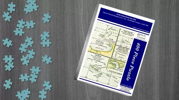
Jigsaw Puzzle : Pacific island Samoa map 1898


![]()
Jigsaw Puzzles from Fine Art Storehouse
Pacific island Samoa map 1898
Map from Physical Geography by R. S. Tarr - The MacMillan Company - London 1898
Unleash your creativity and transform your space into a visual masterpiece!
THEPALMER
Media ID 20773157
© A 2014 Roberto Adrian Photography
Jigsaw Puzzle (400 Pieces)
Discover the rich history of Pacific islands with our exquisite jigsaw puzzle from Media Storehouse. This captivating puzzle features a vintage map of Samoa from 1898, sourced from the esteemed "Physical Geography" book by R.S. Tarr published by The MacMillan Company in London. Immerse yourself in the intricate details of this intriguing piece, bringing the history of Samoa to life in your home. The stunning image of "Pacific island Samoa map 1898" by THEPALMER from Fine Art Storehouse is a must-have for history enthusiasts, puzzle lovers, and anyone seeking a challenging yet rewarding pastime.
400 piece puzzles are custom made in the UK and hand-finished on 100% recycled 1.5 mm millboard. There is a level of repetition in jigsaw shapes with each matching piece away from its pair. The completed puzzle measures 31x47cm and is delivered packaged in an attractive presentation box specially designed to fit most letter box slots
Jigsaw Puzzles are an ideal gift for any occasion
Estimated Product Size is 31.5cm x 47.2cm (12.4" x 18.6")
These are individually made so all sizes are approximate
Artwork printed orientated as per the preview above, with landscape (horizontal) or portrait (vertical) orientation to match the source image.
FEATURES IN THESE COLLECTIONS
> Europe
> United Kingdom
> England
> London
> Related Images
> Maps and Charts
> Related Images
EDITORS COMMENTS
In this print titled "Pacific island Samoa map 1898" we are transported back in time to the late 19th century. The image showcases a beautifully detailed map, sourced from the esteemed book "Physical Geography" by R. S. Tarr and published by The MacMillan Company in London, 1898. The map itself is a testament to the artistry and precision of cartography during that era. Every contour line, river, mountain range, and coastal feature has been meticulously drawn with utmost care and accuracy. It serves as a visual representation of the Pacific island nation of Samoa at a significant moment in history. As we gaze upon this vintage piece, our imagination takes flight as we envision explorers poring over similar maps before embarking on daring voyages across vast oceans. We can almost feel their excitement and anticipation for what lies beyond these shores. "The Palmer" an artist associated with Fine Art Storehouse, has skillfully captured this historical artifact through photography, preserving its essence for generations to come. Through his lens, he allows us to appreciate not only the scientific value of such maps but also their aesthetic appeal. This print invites us to delve into the rich tapestry of human exploration and discovery while celebrating the beauty inherent in both nature's landscapes and man-made creations like maps. It serves as a reminder that even within seemingly mundane objects lie stories waiting to be unraveled – stories that connect us to our past while inspiring future journeys into uncharted territories.
MADE IN THE UK
Safe Shipping with 30 Day Money Back Guarantee
FREE PERSONALISATION*
We are proud to offer a range of customisation features including Personalised Captions, Color Filters and Picture Zoom Tools
SECURE PAYMENTS
We happily accept a wide range of payment options so you can pay for the things you need in the way that is most convenient for you
* Options may vary by product and licensing agreement. Zoomed Pictures can be adjusted in the Basket.