Fraud Blocker Skip to main content

Home > Heritage Images > Maps Charts & Plans

Maps Charts & Plans Collection

Choose a picture from our Maps Charts & Plans Collection for your Wall Art and Photo Gifts

41 items

We are proud to offer this selection in partnership with Heritage Images

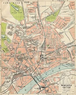
Background imageMaps Charts & Plans Collection: Newcastle-on-Tyne, c20th Century. Artist: John Bartholomew

Newcastle-on-Tyne, c20th Century. Artist: John Bartholomew
Newcastle-on-Tyne, c20th Century. [John Bartholomew & Son, Edinburgh]

Background imageMaps Charts & Plans Collection: Map of Ancient Italy, c1910s. Artist: Emery Walker Ltd

Map of Ancient Italy, c1910s. Artist: Emery Walker Ltd
Map of Ancient Italy, c1910s

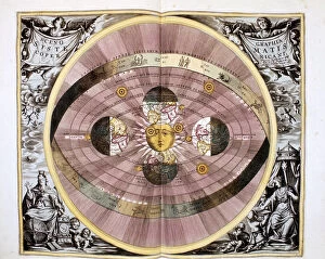
Background imageMaps Charts & Plans Collection: Copernican (heliocentric / Sun-centred) system of the Universe, 1708

Copernican (heliocentric / Sun-centred) system of the Universe, 1708
Copernican (heliocentric/Sun-centred) system of the Universe, 1761. Illustration showing ecliptic and the orbit of the Earth and the planets

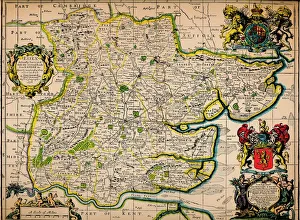
Background imageMaps Charts & Plans Collection: Map of Essex, 1678. Artists: John Ogilby, William Morgan

Map of Essex, 1678. Artists: John Ogilby, William Morgan
Map of Essex, 1678. From Essex, actually surveyed, with the several Roads from London &c. by Francis Lamb. [Philip Lea, Essex, 1678]

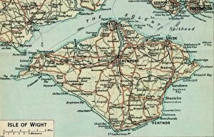
Background imageMaps Charts & Plans Collection: Isle of Wight. c20th Century. Artist: John Bartholomew

Isle of Wight. c20th Century. Artist: John Bartholomew
Isle of Wight. c20th Century. [John Bartholomew & Son, Edinburgh]

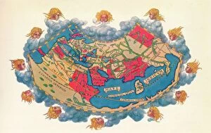
Background imageMaps Charts & Plans Collection: Ptolemys Map of the World cA. D 150. (1912) Artist: Claudius Ptolemy

Ptolemys Map of the World cA. D 150. (1912) Artist: Claudius Ptolemy
Ptolemys Map of the World cA.D 150. The Ptolemy world map is a map of the known world to Hellenistic society in the 2nd century AD

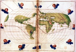
Background imageMaps Charts & Plans Collection: Map of Magellans round the world voyage, 1519-1521

Map of Magellans round the world voyage, 1519-1521. A Portuguese-born navigator sponsored by Spain, Ferdinand Magellan (c1480-1521)

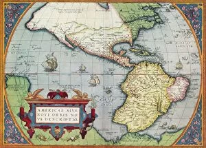
Background imageMaps Charts & Plans Collection: America, or the New World: From the Theatrum Orbis Terrarum by Abraham Ortelius, 1570, 1570

America, or the New World: From the Theatrum Orbis Terrarum by Abraham Ortelius, 1570, 1570
America, or the New World: From the Theatrum Orbis Terrarum by Abraham Ortelius, 1570, (1936). From The Connoisseur, Vol. 98, edited by H. Granville Fell. [International Studio, London, 1936]

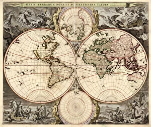
Background imageMaps Charts & Plans Collection: Orbis terrarum nova et accuratissima tabula, ca 1690. Artist: Visscher, Nicolaes (1618-1679)

Orbis terrarum nova et accuratissima tabula, ca 1690. Artist: Visscher, Nicolaes (1618-1679)
Orbis terrarum nova et accuratissima tabula, ca 1690. Private Collection

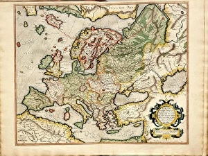
Background imageMaps Charts & Plans Collection: Atlas sive Cosmographicae Meditationes de Fabrica Mundi et Fabricati Fugura (Europe: Livonia)

Atlas sive Cosmographicae Meditationes de Fabrica Mundi et Fabricati Fugura (Europe: Livonia, Russia Artist: Mercator)
Atlas sive Cosmographicae Meditationes de Fabrica Mundi et Fabricati Fugura (Europe: Livonia, Russia, Lithuania). Private Collection

Background imageMaps Charts & Plans Collection: Map of Asia, c1902. Artist: W & AK Johnston

Map of Asia, c1902. Artist: W & AK Johnston
Map of Asia, c1902. From Encyclopedia Britannica Ninth Edition. [W&AK Johnston]

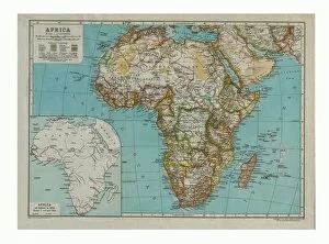
Background imageMaps Charts & Plans Collection: Map of Africa, c1910. Artist: Gull Engraving Company

Map of Africa, c1910. Artist: Gull Engraving Company
Map of Africa, c1910 with insert as known in 1850. [Encyclopaedia Britannica Co]

Background imageMaps Charts & Plans Collection: Map of Australia, c1910. Artist: Gull Engraving Company

Map of Australia, c1910. Artist: Gull Engraving Company
Map of Australia, c1910. [Encyclopaedia Britannica Co]

Background imageMaps Charts & Plans Collection: Chart of the Spanish Armadas course, 1588 (1893)

Chart of the Spanish Armadas course, 1588 (1893). Pines engraving of 1739, of a tapestry then in the House of Lords. An illustration from A Short History of the English People, by John Richard Green

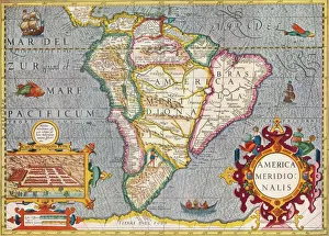
Background imageMaps Charts & Plans Collection: South America (America Meridionalis): from the Atlas of Gerardus Mercator, 1633, (1936)

South America (America Meridionalis): from the Atlas of Gerardus Mercator, 1633, (1936). Artist: Gerardus Mercator
South America (America Meridionalis): from the Atlas of Gerardus Mercator, 1633, (1936). Published at Antwerp by Hondius From The Connoisseur, Vol. 98, edited by H. Granville Fell

Background imageMaps Charts & Plans Collection: Map of Africa in 1891 showing Routes of Explorers

Map of Africa in 1891 showing Routes of Explorers

Background imageMaps Charts & Plans Collection: Norfolk Broads, c20th Century. Artist: John Bartholomew

Norfolk Broads, c20th Century. Artist: John Bartholomew
Norfolk Broads, c20th Century. [John Bartholomew & Son, Edinburgh]

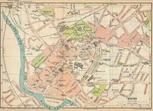
Background imageMaps Charts & Plans Collection: Exeter, c20th Century. Artist: John Bartholomew

Exeter, c20th Century. Artist: John Bartholomew
Exeter, c20th Century. [John Bartholomew & Son, Edinburgh]

Background imageMaps Charts & Plans Collection: Folkestone, c20th Century. Artist: John Bartholomew

Folkestone, c20th Century. Artist: John Bartholomew
Folkestone, c20th Century. [John Bartholomew & Son, Edinburgh]

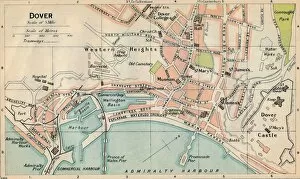
Background imageMaps Charts & Plans Collection: Dover, c20th Century. Artist: John Bartholomew

Dover, c20th Century. Artist: John Bartholomew
Dover, c20th Century. [John Bartholomew & Son, Edinburgh]

Background imageMaps Charts & Plans Collection: Oxford, c20th Century. Artist: John Bartholomew

Oxford, c20th Century. Artist: John Bartholomew
Oxford, c20th Century. [John Bartholomew & Son, Edinburgh]

Background imageMaps Charts & Plans Collection: Norwich, c20th Century. Artist: John Bartholomew

Norwich, c20th Century. Artist: John Bartholomew
Norwich, c20th Century. [John Bartholomew & Son, Edinburgh]

Background imageMaps Charts & Plans Collection: Cambridge, c20th Century. Artist: John Bartholomew

Cambridge, c20th Century. Artist: John Bartholomew
Cambridge, c20th Century. [John Bartholomew & Son, Edinburgh]

Background imageMaps Charts & Plans Collection: Shrewsbury, c20th Century. Artist: John Bartholomew

Shrewsbury, c20th Century. Artist: John Bartholomew
Shrewsbury, c20th Century. [John Bartholomew & Son, Edinburgh]

Background imageMaps Charts & Plans Collection: Lincoln, c20th Century. Artist: John Bartholomew

Lincoln, c20th Century. Artist: John Bartholomew
Lincoln, c20th Century. [John Bartholomew & Son, Edinburgh]

Background imageMaps Charts & Plans Collection: Central Birmingham, c20th Century. Artist: John Bartholomew

Central Birmingham, c20th Century. Artist: John Bartholomew
Central Birmingham, c20th Century. [John Bartholomew & Son, Edinburgh]

Background imageMaps Charts & Plans Collection: York, c20th Century. Artist: John Bartholomew

York, c20th Century. Artist: John Bartholomew
York, c20th Century. [John Bartholomew & Son, Edinburgh]

Background imageMaps Charts & Plans Collection: Hull, c20th Century. Artist: John Bartholomew

Hull, c20th Century. Artist: John Bartholomew
Hull, c20th Century. [John Bartholomew & Son, Edinburgh]

Background imageMaps Charts & Plans Collection: Matlock & Dovedale, c20th Century. Artist: John Bartholomew

Matlock & Dovedale, c20th Century. Artist: John Bartholomew
Matlock & Dovedale, c20th Century. [John Bartholomew & Son, Edinburgh]

Background imageMaps Charts & Plans Collection: High Peak District, c20th Century. Artist: John Bartholomew

High Peak District, c20th Century. Artist: John Bartholomew
High Peak District, c20th Century. [John Bartholomew & Son, Edinburgh]

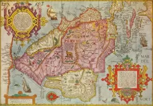
Background imageMaps Charts & Plans Collection: Map of Peru, c1599. Artist: Arnoldus Florentius

Map of Peru, c1599. Artist: Arnoldus Florentius
Map of Peru, c1599. A map of South America and the Caribbean, with Chile, Peru, Brazil, Cuba and Florida. From Adventures By Sea From Art of Old Time, by Basil Lubbock. [The Studio Ltd. London, 1925]

Background imageMaps Charts & Plans Collection: Brighton, c20th Century. Artist: John Bartholomew

Brighton, c20th Century. Artist: John Bartholomew
Brighton, c20th Century. [John Bartholomew & Son, Edinburgh]

Background imageMaps Charts & Plans Collection: Plan of Paris, c1630 (1915)

Plan of Paris, c1630 (1915). From Paris Past and Present. [London Offices of the Studio, London, 1915]

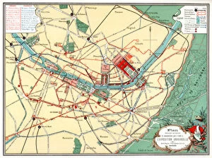
Background imageMaps Charts & Plans Collection: Plan of the Universal Exposition, Paris, 1889

Plan of the Universal Exposition, Paris, 1889. The Exposition Universelle of 1889 was staged in commemration of the centenary of the French Revolution

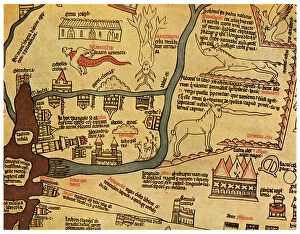
Background imageMaps Charts & Plans Collection: The Nile Delta, Egypt, c1280 (1956)

The Nile Delta, Egypt, c1280 (1956). Detail from the Hereford Mappa Mundi, Hereford Cathedral. Attributed to Richard de Bello, the Hereford Mappa Mundi is the largest known existing medieval map

Background imageMaps Charts & Plans Collection: Scandinavia, c1906, (1907)

Scandinavia, c1906, (1907). From The Worlds History, Volume VI. Edited by Dr. H. F. Helmolt [William Heinemann, London, 1907]

Background imageMaps Charts & Plans Collection: A plan of the city of Cologne

A plan of the city of Cologne. Hand-coloured later

Background imageMaps Charts & Plans Collection: Scenography of the Ptolemaic cosmography (From Andreas Cellarius Harmonia Macrocosmica), c. 1660

Scenography of the Ptolemaic cosmography (From Andreas Cellarius Harmonia Macrocosmica), c. 1660. From a private collection

Background imageMaps Charts & Plans Collection: Mexico City in the early 16th century

Mexico City in the early 16th century. Depiction probably based on a sketch in the conquistador Hernan Cortes book of 1524. From the British Museum


All Professionally Made to Order for Quick Shipping


-

Why Choose Us?

We are a leading provider of Art Prints and Photo Gifts since 2003, working in partnership with a range of Sporting Clubs, Charities, Museums and Picture Libraries. A large share of profits from any of their images will go directly towards supporting that charity or club. Our archive of images is carefully curated to bring you a wide range of subjects, including landscapes, wildlife, architecture, and more. We ship from our partner labs in the UK, USA, EU (Netherlands) and Australia.
+

How do I place an order?

Ordering is quick & easy - Just follow 5 Simple Steps:
  1. Find your image: Use our search box or browse our online photo Collections to find the image you want.

  2. Choose your print format: Select your desired product and add it to your cart.

  3. Enter your details: If you're a returning customer, simply enter your email address and password, and we'll fill in your billing and shipping address details. All personal details are held securely and are fully GDPR compliant. As standard, we remove all Personally Identifiable Information after 12 months.

  4. Pay for your purchase: We use state-of-the-art security for online shopping and do not have access to your card details.

  5. Sit back and relax: We'll email you confirmation of your order and when it's dispatched. Registered customers can also track orders in the 'My Account' area.

+

How do I pay for an order?

You can pay for your order with most of the major credit and debit cards, or PayPal. For added security, major financial institutions process payment details separately and securely on our behalf. We do not have access to your online payment card details. Online payments are preferred however we do take phone orders. For UK customers only we accept cheques issued against a UK bank.
+

Is my data safe?

We take data security very seriously. We do not have access to your full card details and all payments are requested over a fully secure connection. Additionally, we fully comply with current European and GDPR legislation, and automatically remove all personal data after at most 12 months (unless you have an account with us and have signed in recently). We also have a strict opt-in policy and would never sell your personal details. Your data is only used to fulfill your order promptly and efficiently.
+

Is wall art ready to hang?

For quick and easy installation all wall art, including framed prints, canvas prints and metal prints are supplied with a ready to hang solution on the back. Generally, saw tooth hangers are applied as they allow wall art to hang flush against the wall. The serrated edge of the hanger prevents the frame from shifting or tilting when hung.
+

Are the photo prints fade resistant?

Yes, we use archival quality photo paper photographic paper for vivid reproduction Prints are an accurate representations of the original artwork, which is preserved for artistic character and authenticity. We guarantee they match previews shown on our web site