Greetings Card > Maps and Charts > Related Images
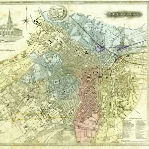
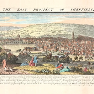
Greetings Card : Map of the parish of Sheffield by W. Fairbank and Son (engraved by J. Cary), 1795
![]()

Cards from Sheffield City Archives
Map of the parish of Sheffield by W. Fairbank and Son (engraved by J. Cary), 1795
Scale 3.3 inches : 1 mile.Engraved by J. Cary.Original at Sheffield Local Studies Library:s 127 L; other copies at Sheffield City Archives: FC/She/4L and ACM/She/162
Sheffield City Archives and Local Studies Library has an unrivalled collection of images of Sheffield, England
Media ID 14046217
© Sheffield City Council
Greetings Card (A5)
Introducing the latest addition to our Media Storehouse Greetings Cards collection: a unique and captivating design featuring a historical map of Sheffield. This exquisite card showcases an engraving of "Map of the Parish of Sheffield" by W. Fairbank and Son, expertly engraved by J. Cary in 1795. The intricate detail of the map, originally housed at the Sheffield Local Studies Library, transports you back in time to the streets of Sheffield over two centuries ago. Impress your loved ones with this thoughtful and authentic greeting card that tells a story of history and tradition. Perfect for birthday, anniversary, or just because occasions, this card is sure to leave a lasting impression.
Create your own greetings card. Size when folded is A5 (14.5x21cm or 5.7x8.3 inches)
Greetings Cards suitable for Birthdays, Weddings, Anniversaries, Graduations, Thank You and much more
Estimated Image Size (if not cropped) is 21cm x 14.5cm (8.3" x 5.7")
Estimated Product Size is 21cm x 29cm (8.3" x 11.4")
These are individually made so all sizes are approximate
Artwork printed orientated as per the preview above, with landscape (horizontal) orientation to match the source image.
FEATURES IN THESE COLLECTIONS
> Maps and Charts
> Related Images
> Sheffield City Archives
> Maps and Plans
EDITORS COMMENTS
This print showcases the historical "Map of the parish of Sheffield" meticulously crafted by W. Fairbank and Son in 1795. Engraved with utmost precision by J. Cary, this remarkable piece offers a fascinating glimpse into the past, allowing us to traverse through time and explore the intricate details of Sheffield's parish boundaries. With a scale of 3.3 inches to 1 mile, this map provides an exceptional level of accuracy for its era, enabling viewers to immerse themselves in the rich tapestry of Sheffield's landscape and architecture as it stood over two centuries ago. The delicate engravings beautifully capture every street, lane, and building within the parish limits. Preserved at Sheffield Local Studies Library under reference s 127 L, this original artifact holds immense historical significance for both locals and enthusiasts alike. It serves as an invaluable resource for researchers delving into Sheffield's past or individuals seeking to trace their ancestral roots within these hallowed grounds. While other copies can be found at Sheffield City Archives (FC/She/4L) and ACM/She/162), it is important to note that this caption does not mention any commercial use associated with these maps. Instead, it focuses on appreciating their cultural value as a window into history – inviting all who gaze upon them to embark on a journey back in time through the streets and stories woven within each line engraving on this remarkable piece from Sheffield City Archives.
MADE IN THE UK
Safe Shipping with 30 Day Money Back Guarantee
FREE PERSONALISATION*
We are proud to offer a range of customisation features including Personalised Captions, Color Filters and Picture Zoom Tools
SECURE PAYMENTS
We happily accept a wide range of payment options so you can pay for the things you need in the way that is most convenient for you
* Options may vary by product and licensing agreement. Zoomed Pictures can be adjusted in the Basket.


