Greetings Card > Maps and Charts > Early Maps
Greetings Card : Crusades Map


![]()
Cards from Mary Evans Picture Library
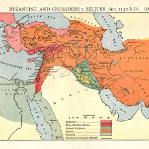
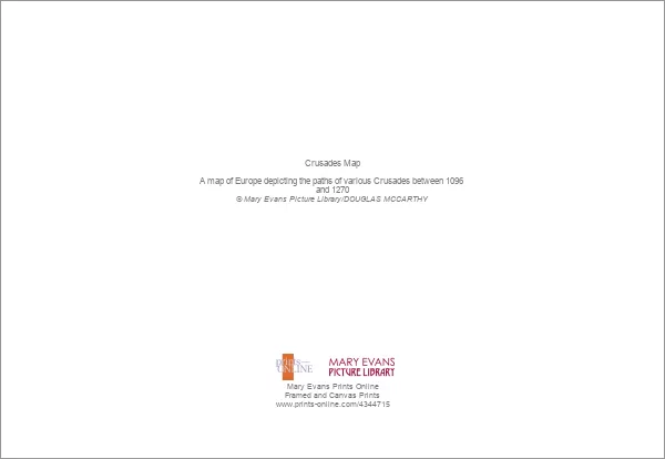
Crusades Map
A map of Europe depicting the paths of various Crusades between 1096 and 1270
Mary Evans Picture Library makes available wonderful images created for people to enjoy over the centuries
Media ID 4344715
© Mary Evans Picture Library 2015 - https://copyrighthub.org/s0/hub1/creation/maryevans/MaryEvansPictureID/10139291
1096 1270 Crusades Depicting Paths
Greetings Card (A5)
Discover the rich history of the Crusades with our captivating range of greeting cards from Media Storehouse. Featuring the intricately detailed "Crusades Map" by Rights Managed from Mary Evans Prints Online, these cards transport you back in time as you explore the paths of the various Crusades between 1096 and 1270. Perfect for history enthusiasts, these high-quality cards are a thoughtful and unique way to express your sentiments. Whether for a special occasion or just to brighten someone's day, our Crusades Map greeting cards are sure to leave a lasting impression.
Create your own greetings card. Size when folded is A5 (14.5x21cm or 5.7x8.3 inches)
Greetings Cards suitable for Birthdays, Weddings, Anniversaries, Graduations, Thank You and much more
Estimated Image Size (if not cropped) is 21cm x 14.5cm (8.3" x 5.7")
Estimated Product Size is 21cm x 29cm (8.3" x 11.4")
These are individually made so all sizes are approximate
Artwork printed orientated as per the preview above, with landscape (horizontal) orientation to match the source image.
FEATURES IN THESE COLLECTIONS
> Europe
> Related Images
> Maps and Charts
> Early Maps
> Maps and Charts
> Related Images
> Popular Themes
> Maps and Charts
EDITORS COMMENTS
This striking print captures a detailed and historically significant Crusades Map, showcasing the paths of various Crusades that took place between 1096 and 1270 across Europe. The intricate design of the map allows viewers to trace the movements of armies, battles, and key events that shaped this tumultuous period in history.
The Crusades were a series of religious wars sanctioned by the Latin Church in the medieval period, with the goal of reclaiming Jerusalem and other holy sites from Muslim rule. This map provides a visual representation of how these military campaigns unfolded over several centuries, highlighting the strategic routes taken by crusaders as they journeyed through different regions of Europe.
From major cities to important landmarks, each detail on this map offers valuable insights into the political dynamics and cultural exchanges that occurred during this time. By studying the paths depicted on this historical artifact, one can gain a deeper understanding of how these conflicts impacted societies across Europe and beyond.
Whether you are a history enthusiast or simply intrigued by ancient warfare, this image is sure to spark curiosity and prompt reflection on the lasting legacy of the Crusades. It serves as a powerful reminder of how past events continue to shape our present-day world.
MADE IN THE UK
Safe Shipping with 30 Day Money Back Guarantee
FREE PERSONALISATION*
We are proud to offer a range of customisation features including Personalised Captions, Color Filters and Picture Zoom Tools
SECURE PAYMENTS
We happily accept a wide range of payment options so you can pay for the things you need in the way that is most convenient for you
* Options may vary by product and licensing agreement. Zoomed Pictures can be adjusted in the Basket.