Greetings Card > Europe > United Kingdom > Wales > Maps
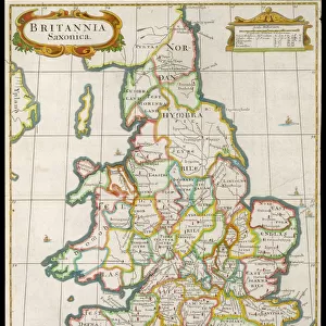
Greetings Card : Map of England and Wales showing the Principal Religious Houses in the time of Henry VIII


![]()
Cards from MapSeeker
Map of England and Wales showing the Principal Religious Houses in the time of Henry VIII
BHISM008
Welcome to the Mapseeker Image library and enter an historic gateway to one of the largest on-line collections of Historic Maps, Nostalgic Views, Vista's and Panorama's from a World gone by.
Media ID 20347206
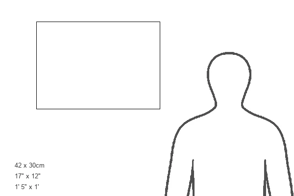
Greetings Card Large (A4)
Discover the rich religious history of England and Wales during the reign of Henry VIII with our exquisite greeting cards from Media Storehouse. Featuring a beautifully detailed map from MapSeeker, this card showcases the principal religious houses of the time, offering a captivating glimpse into the past. Perfect for history enthusiasts or those with a deep appreciation for religious and cultural heritage, this card is a thoughtful and unique way to express your sentiments. Add a personal message and send a piece of history to your loved ones.
Create your own large greetings card. Size when folded is A4 (21x30cm or 8.3x11.7 inches)
Greetings Cards suitable for Birthdays, Weddings, Anniversaries, Graduations, Thank You and much more
Estimated Image Size (if not cropped) is 21cm x 29.7cm (8.3" x 11.7")
Estimated Product Size is 42cm x 29.7cm (16.5" x 11.7")
These are individually made so all sizes are approximate
Artwork printed orientated as per the preview above, with portrait (vertical) orientation to match the source image.
FEATURES IN THESE COLLECTIONS
> Europe
> United Kingdom
> England
> Maps
> Europe
> United Kingdom
> Wales
> Maps
> Europe
> United Kingdom
> Wales
> Posters
> Europe
> United Kingdom
> Wales
> Related Images
> Maps and Charts
> Related Images
> Maps and Charts
> Wales
> MapSeeker
> Maps from the British Isles
> England with Wales PORTFOLIO
EDITORS COMMENTS
This print showcases a historically significant artifact, the "Map of England and Wales showing the Principal Religious Houses in the time of Henry VIII (BHISM008)". Steeped in rich cultural heritage, this map offers a fascinating glimpse into a pivotal era during the reign of King Henry VIII. With intricate details and meticulous craftsmanship, this map provides an invaluable visual representation of religious houses that dotted the English and Welsh landscapes during Henry VIII's rule. It transports us back to a time when monasteries, abbeys, priories, and other religious institutions played a central role in society. As we examine this remarkable piece closely, we can trace our fingers along ancient roads connecting these sacred sites. Each location is meticulously labeled, allowing us to appreciate their sheer number and geographical distribution across England and Wales. From grand monastic complexes nestled amidst lush green valleys to secluded priories perched on rocky cliffs overlooking vast oceans – every dot on this map tells its own story. Beyond its aesthetic appeal lies historical significance. This map serves as an essential resource for scholars studying Tudor history or those intrigued by religious transformations during Henry VIII's reign. It sheds light on his dissolution of monasteries between 1536-1541 – one of the most transformative events in British history. Whether you are an avid historian or simply captivated by maps that transport you through time, this print offers both beauty and knowledge. Display it proudly as a testament to our shared past while marveling at how much has changed
MADE IN THE UK
Safe Shipping with 30 Day Money Back Guarantee
FREE PERSONALISATION*
We are proud to offer a range of customisation features including Personalised Captions, Color Filters and Picture Zoom Tools
SECURE PAYMENTS
We happily accept a wide range of payment options so you can pay for the things you need in the way that is most convenient for you
* Options may vary by product and licensing agreement. Zoomed Pictures can be adjusted in the Basket.