Greetings Card > Maps and Charts > Americas
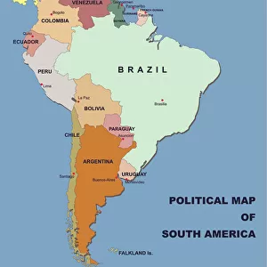
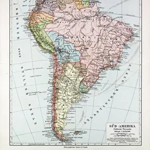
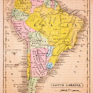
Greetings Card : South America map countries and cities


![]()
Cards from Fine Art Storehouse
South America map countries and cities
Vector illustration of South America map
Unleash your creativity and transform your space into a visual masterpiece!
Media ID 14457387
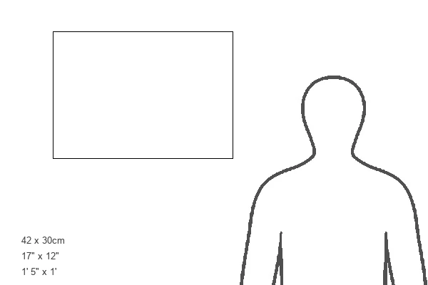
Greetings Card Large (A4)
"Add a touch of worldly charm to your correspondence with our South America Greetings Cards from Media Storehouse, brought to you by Fine Art Storehouse. These beautifully designed cards feature an intricately detailed vector illustration of the South American map, showcasing the diverse countries and cities of this vibrant continent. Express your thoughts and feelings in a unique and visually stunning way, making every message an adventure. Perfect for birthdays, anniversaries, or just to say hello, these cards are sure to brighten up any mailbox. Add a personal touch with a handwritten note and send a piece of the world right to their doorstep."
Create your own large greetings card. Size when folded is A4 (21x30cm or 8.3x11.7 inches)
Greetings Cards suitable for Birthdays, Weddings, Anniversaries, Graduations, Thank You and much more
Estimated Image Size (if not cropped) is 21cm x 29.7cm (8.3" x 11.7")
Estimated Product Size is 42cm x 29.7cm (16.5" x 11.7")
These are individually made so all sizes are approximate
Artwork printed orientated as per the preview above, with portrait (vertical) orientation to match the source image.
FEATURES IN THESE COLLECTIONS
> Maps and Charts
> Related Images
> South America
> Related Images
EDITORS COMMENTS
This print showcases a beautifully detailed vector illustration of the South America map, highlighting its countries and cities. The intricate design captures the essence of this diverse continent, inviting viewers to embark on a visual journey through its rich cultural heritage. From the vibrant streets of Rio de Janeiro to the ancient ruins of Machu Picchu, this artwork encapsulates the allure and mystique that South America exudes. Each country is meticulously outlined with precision, allowing us to appreciate their unique shapes and sizes. As our eyes wander across the map, we are drawn towards bustling metropolises like Buenos Aires and Santiago, as well as hidden gems such as Cartagena and Cusco. The colors chosen for this illustration evoke a sense of warmth and vibrancy, mirroring the lively spirit found throughout South America. Shades of green symbolize lush rainforests while shades of blue represent vast oceans surrounding these magnificent lands. Whether you have traveled extensively in South America or dreamt about exploring its wonders someday, this print serves as an exquisite reminder of all that awaits within this enchanting continent. Hang it on your wall to ignite conversations about past adventures or inspire future ones.
MADE IN THE UK
Safe Shipping with 30 Day Money Back Guarantee
FREE PERSONALISATION*
We are proud to offer a range of customisation features including Personalised Captions, Color Filters and Picture Zoom Tools
SECURE PAYMENTS
We happily accept a wide range of payment options so you can pay for the things you need in the way that is most convenient for you
* Options may vary by product and licensing agreement. Zoomed Pictures can be adjusted in the Basket.