Greetings Card > Maps and Charts > Related Images
Greetings Card : Map of Khartoum and vicinity at the time of siege of Khartoum 1884


![]()
Cards from Fine Art Storehouse
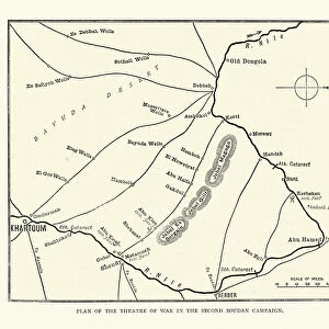
Map of Khartoum and vicinity at the time of siege of Khartoum 1884
Vintage illustration of Map of Khartoum and vicinity at the time of siege of Khartoum 1884
Unleash your creativity and transform your space into a visual masterpiece!
duncan1890
Media ID 21157915
© of Duncan P Walker
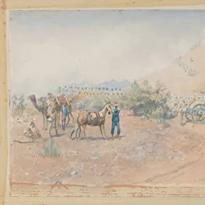
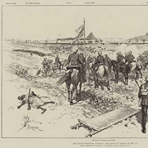
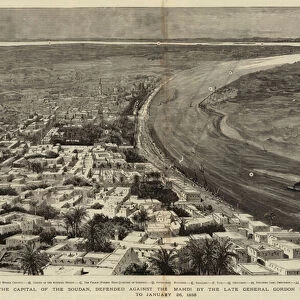
British Army Mahdist Mahdist War
Greetings Card Large (A4)
Step back in time with our captivating selection of vintage greeting cards from Media Storehouse. This particular card features an intriguing illustration of a Map of Khartoum and its vicinity during the historic Siege of 1884, as depicted by the talented artist duncan1890 from our Fine Art Storehouse collection. Add a touch of history and intrigue to your correspondence with this exquisite, one-of-a-kind greeting card. Perfect for history buffs, geography enthusiasts, or anyone who appreciates the charm of vintage illustrations. Send a piece of the past with our Media Storehouse Greetings Cards.
Create your own large greetings card. Size when folded is A4 (21x30cm or 8.3x11.7 inches)
Greetings Cards suitable for Birthdays, Weddings, Anniversaries, Graduations, Thank You and much more
Estimated Image Size (if not cropped) is 29.7cm x 21cm (11.7" x 8.3")
Estimated Product Size is 29.7cm x 42cm (11.7" x 16.5")
These are individually made so all sizes are approximate
Artwork printed orientated as per the preview above, with landscape (horizontal) orientation to match the source image.
FEATURES IN THESE COLLECTIONS
> Fine Art Storehouse
> History
> Battles & Wars
> Historcal Battle Maps and Plans
> Maps and Charts
> Related Images
EDITORS COMMENTS
This vintage illustration captures a fascinating piece of history - the Map of Khartoum and vicinity during the infamous Siege of Khartoum in 1884. The print showcases intricate details, providing a glimpse into the strategic landscape that defined this pivotal moment in time. The British army, led by General Charles Gordon, found themselves besieged by Mahdist forces during the Mahdist War. This conflict marked a significant chapter in Sudan's struggle for independence from colonial rule. As we examine this map, it becomes evident how crucial geography was to both sides involved. Duncan1890's artistic rendering beautifully brings forth the intricacies of this historical event. The attention to detail is remarkable; every contour and landmark is meticulously depicted, allowing us to visualize the challenges faced by both armies. This print serves as a reminder of the sacrifices made by soldiers on both sides and offers an opportunity for reflection on past conflicts that have shaped our world today. It invites viewers to delve into history and explore not only military strategies but also cultural dynamics at play during this era. Whether you are an avid history enthusiast or simply appreciate fine art, this print will transport you back in time to witness one of Sudan's most significant battles unfold before your eyes.
MADE IN THE UK
Safe Shipping with 30 Day Money Back Guarantee
FREE PERSONALISATION*
We are proud to offer a range of customisation features including Personalised Captions, Color Filters and Picture Zoom Tools
SECURE PAYMENTS
We happily accept a wide range of payment options so you can pay for the things you need in the way that is most convenient for you
* Options may vary by product and licensing agreement. Zoomed Pictures can be adjusted in the Basket.