Home > Arts > Artists > F > William Faden
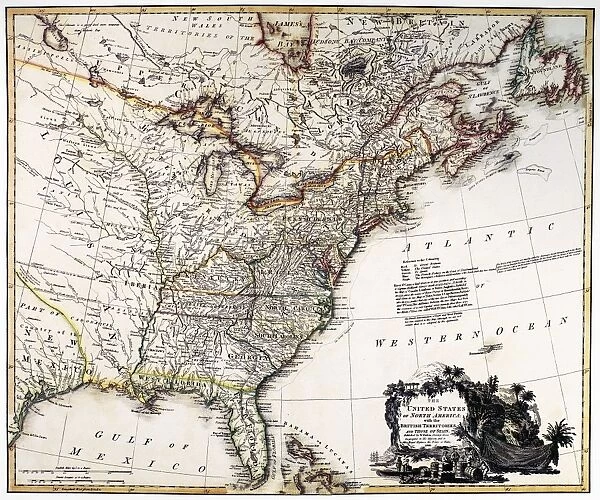
MAP OF AMERICA, 1809. Map of the United States of America by William Faden, 1809
![]()

Wall Art and Photo Gifts from Granger
MAP OF AMERICA, 1809. Map of the United States of America by William Faden, 1809
Granger holds millions of images spanning more than 25,000 years of world history, from before the Stone Age to the dawn of the Space Age
Media ID 7560241
1809 British Eastern Territory Faden Northwest Territories Will I Am
FEATURES IN THESE COLLECTIONS
> Arts
> Artists
> F
> William Faden
> Maps and Charts
> Early Maps
> North America
> United States of America
> Related Images
MAP OF AMERICA, 1809 - A Glimpse into the Early American Landscape
EDITORS COMMENTS
. This print takes us back to the year 1809, offering a fascinating glimpse into the early days of America. The Map of the United States of America by William Faden showcases an intricate engraving that beautifully captures the vastness and diversity of this young nation. As our eyes wander across this historic map, we are transported to a time when America was still expanding its territories. The eastern region is depicted with remarkable detail, showcasing major cities and rivers that played crucial roles in shaping American history. From New York City's bustling streets to Boston's rich historical heritage, every element on this map tells a story. But it doesn't stop there - as we move westward, we encounter uncharted territories and British claims scattered throughout what would become today's Midwest and Northwest regions. These areas were yet to be fully explored or settled by European colonizers. The artistry behind this engraving is truly impressive; delicate lines intertwine with carefully placed text labels providing valuable insights into geographical features and political boundaries at that time. This print from Granger Art on Demand allows us to appreciate not only the beauty but also the historical significance of maps as vital tools for exploration and understanding. It serves as a reminder of how far America has come since those early days while igniting curiosity about what lies beyond its borders.
MADE IN THE UK
Safe Shipping with 30 Day Money Back Guarantee
FREE PERSONALISATION*
We are proud to offer a range of customisation features including Personalised Captions, Color Filters and Picture Zoom Tools
SECURE PAYMENTS
We happily accept a wide range of payment options so you can pay for the things you need in the way that is most convenient for you
* Options may vary by product and licensing agreement. Zoomed Pictures can be adjusted in the Basket.


