Glass Place Mat > Arts > Artists > O > Oceanic Oceanic
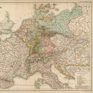
Glass Place Mat : Map of the Suez Canal, Egypt, wood engraving, published in 1869


![]()
Home Decor from Fine Art Storehouse
Map of the Suez Canal, Egypt, wood engraving, published in 1869
Historical map of the Suez Canal - an artificial sea-level waterway in Egypt, connecting the Mediterranean Sea to the Red Sea through the Isthmus of Suez and dividing Africa and Asia. The 193.30-kilometre-long (120.11 mi) canal is a key trade route between Europe and Asia. Construction of the canal lasted from 1859 to 1869. It offers vessels a direct route between the North Atlantic and northern Indian oceans via the Mediterranean Sea and the Red Sea. Wood engraving, published in 1869 (Explanations in German)
Unleash your creativity and transform your space into a visual masterpiece!
ZU_09
Media ID 35842272
Glass Place Mat (Set of 4)
Set of 4 Glass Place Mats. Stylish and elegant polished safety glass, toughened and heat resistant (275x225mm, 7mm thick). Matching Coasters also available.
Set of 4 Glass Place Mats. Elegant polished safety glass and heat resistant. Matching Coasters may also be available
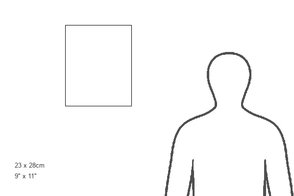
Estimated Image Size (if not cropped) is 22.5cm x 25.4cm (8.9" x 10")
Estimated Product Size is 22.5cm x 27.5cm (8.9" x 10.8")
These are individually made so all sizes are approximate
FEATURES IN THESE COLLECTIONS
> Fine Art Storehouse
> Map
> Historical Maps
> Africa
> Egypt
> Related Images
> Arts
> Artists
> O
> Oceanic Oceanic
> Maps and Charts
> Early Maps
> Maps and Charts
> Related Images
EDITORS COMMENTS
This stunning wood engraving depicts a historical map of the Suez Canal, an engineering marvel that connects the Mediterranean Sea to the Red Sea through the Isthmus of Suez in Egypt. Completed in 1869 after a construction period of ten years, the Suez Canal is a vital waterway that divides Africa and Asia and offers vessels a direct route between the North Atlantic and northern Indian oceans. The intricate details of this map reveal the canal's winding path, with its various locks and chambers designed to maintain the same water level throughout the canal, allowing for the passage of ships of various sizes. The map also highlights the major cities and landmarks along the canal's banks, including Port Said and Suez, which served as important hubs for the transportation of goods and passengers. The wood engraving, published in 1869, is a testament to the technological advancements of the time and the ambition of European powers to expand their trade networks. The map is adorned with explanations in German, reflecting the European interest in the canal and its strategic significance in global trade. This historical map is not only an essential piece of cartographic history but also a beautiful work of art that showcases the intricacy and detail of wood engraving as a printing technique. It is a reminder of the Suez Canal's enduring importance as a key trade route and a symbol of human ingenuity and perseverance.
MADE IN THE UK
Safe Shipping with 30 Day Money Back Guarantee
FREE PERSONALISATION*
We are proud to offer a range of customisation features including Personalised Captions, Color Filters and Picture Zoom Tools
SECURE PAYMENTS
We happily accept a wide range of payment options so you can pay for the things you need in the way that is most convenient for you
* Options may vary by product and licensing agreement. Zoomed Pictures can be adjusted in the Basket.