Glass Frame > Europe > France > Paris > Maps
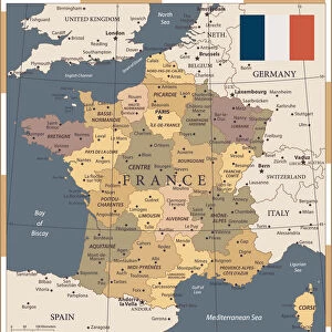
Glass Frame : France Administrative Political Map


![]()
Mounted Prints from Map Marketing
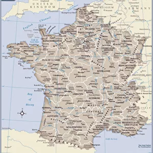
France Administrative Political Map
A detailed Administrative map of France showing the political administrative divisions of the country. Each Departement is coloured individually and numbered with the appropriate Numero de Departement and then grouped into the larger Regions. Within each Departement the constituent Cantons are also marked. Major cities and towns are shown and there are inserts showing Paris and its environs as well as Corsica and Franceaes dependent overseas territories
Media ID 19949231
© Map Marketing Ltd
Administrative Canton Counties
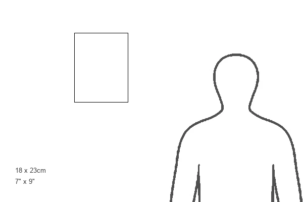
8"x6" Glass Mount
Wall mounted or free-standing, these black edged glass frames feature a smooth chamfered edge and a stylish black border (on back face of the glass). Manufactured from 4mm thick glass, Glass Mounts are a durable, professional way of displaying and protecting your prints. Your 8x6 print is slotted into the back of the frame so can easily be changed if needed.
Tempered Glass Mounts are ideal for wall display, plus the smaller sizes can also be used free-standing via an integral stand
Estimated Image Size (if not cropped) is 15.2cm x 20.3cm (6" x 8")
Estimated Product Size is 17.7cm x 22.8cm (7" x 9")
These are individually made so all sizes are approximate
Artwork printed orientated as per the preview above, with portrait (vertical) orientation to match the source image.
FEATURES IN THESE COLLECTIONS
> Arts
> Photorealistic artworks
> Detailed art pieces
> Masterful detailing in art
> Europe
> France
> Canton
> Related Images
> Europe
> France
> Paris
> Maps
> Europe
> France
> Paris
> Politics
> Maps and Charts
> Popular Maps
> Maps and Charts
> Related Images
MADE IN THE UK
Safe Shipping with 30 Day Money Back Guarantee
FREE PERSONALISATION*
We are proud to offer a range of customisation features including Personalised Captions, Color Filters and Picture Zoom Tools
SECURE PAYMENTS
We happily accept a wide range of payment options so you can pay for the things you need in the way that is most convenient for you
* Options may vary by product and licensing agreement. Zoomed Pictures can be adjusted in the Basket.