
Wind Rose Collection
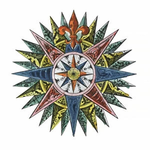
The wind rose, a symbol of navigation and exploration, has been depicted in various maps throughout history


All Professionally Made to Order for Quick Shipping
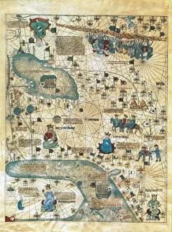
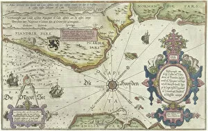
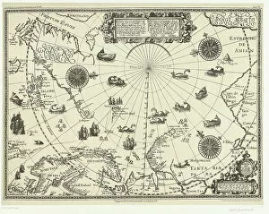
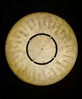
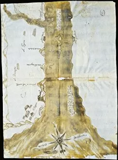
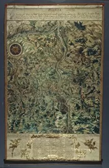
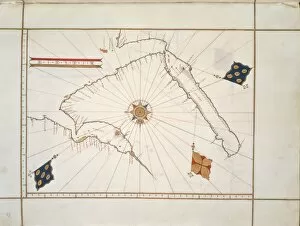
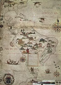
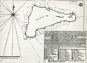
The wind rose, a symbol of navigation and exploration, has been depicted in various maps throughout history. One such example is the Map of Scandinavia from Carta Marina, created by Olaus Magnus in 1539. This intricate sea map showcases the Scandinavian region with its detailed coastlines and cities. Another fascinating portrayal can be found in the Map of Cathay, China, which was part of the Catalan Atlas crafted for Charles V, King of France around 1375. This ancient map attributed to Abraham and Jafuda Cresques Maiorca provides insight into how China was perceived during that time period. Moving on to South America, we encounter a highly detailed hand-drawn map within the outline of this vast continent. Complete with a compass rose and marking the equator, this depiction offers valuable geographical information about Brazil. Engravings also played a significant role in capturing coastal regions like Flanders, Normandy, England's Isle of Wight to Dover stretch as well as parts of Norway and Sweden. These engravings from between 1580-83 showcase meticulous cartographic work that aided sailors navigating these treacherous waters. Further north lies Newcastle upon Tyne along England's North coast near which Dutch voyages were documented on a map highlighting countries surrounding the Arctic Circle in 1598 litho print. This particular representation sheds light on early Dutch explorations amidst icy terrains. Lastly, we come across yet another engraving showcasing Sweden's coastline between Kalmar and Stockholm dating back to 1580-83. The attention to detail allows us to visualize maritime routes taken during that era. Throughout history, wind roses have served as essential tools for mariners seeking direction at sea. A copper-made maritime compass from 1596 beautifully captures one such wind rose design used by seafarers during their voyages across uncharted waters.