Fraud Blocker Skip to main content

Urbanisation Collection (page 6)

"Captivating Urbanisation: A Global Perspective" Sheffield, UK - An aerial image captures the dynamic growth of this industrial city

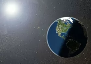
Background imageUrbanisation Collection: The Americas, satellite image

The Americas, satellite image. Oceans are blue and land is green and brown. City lights (yellow) in dark areas show areas of dense population

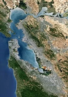
Background imageUrbanisation Collection: San Francisco Bay, USA, satellite image

San Francisco Bay, USA, satellite image
San Francisco Bay, USA. Satellite image of the San Francisco Bay area in California, USA. North is at top. The city of San Francisco is located on the tip of the San Francisco Peninsula

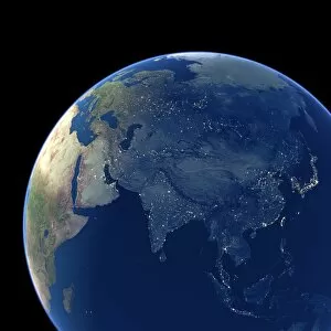
Background imageUrbanisation Collection: Asia at night, satellite image

Asia at night, satellite image. City lights (yellow) show areas of dense population. Large, densely populated areas include India (lower centre), China (lower right) and Japan (right)

Background imageUrbanisation Collection: Paris, France, satellite image

Paris, France, satellite image
Paris, France. Satellite image of the city of Paris (centre) and its surrounding area in north-central France. North is at top

Background imageUrbanisation Collection: New York City, USA, satellite image

New York City, USA, satellite image
New York city, USA, and its surrounding area, satellite image. North is at top. The island of Manhattan is at upper centre, bordered by the Hudson (left) and East (right) rivers

Background imageUrbanisation Collection: Moscow, Russia, satellite image

Moscow, Russia, satellite image
Moscow, Russia. Satellite image of the city of Moscow (centre) and its surrounding area in west-central Russia. North is at top. The Moskva river is seen running diagonally through the city

Background imageUrbanisation Collection: Madrid, Spain, satellite image

Madrid, Spain, satellite image
Madrid, Spain. Satellite image of the city of Madrid (centre) and its surrounding area in central Spain. North is at top. The river Manzanares is seen flowing through the city from top left to bottom

Background imageUrbanisation Collection: Los Angeles, USA, satellite image

Los Angeles, USA, satellite image
Los Angeles, USA. Satellite image of the city of Los Angeles (centre) and its surrounding area in California, USA. North is at top. The Pacific Ocean is at bottom left

Background imageUrbanisation Collection: Cape Town, South Africa, satellite image

Cape Town, South Africa, satellite image
Cape Town, South Africa. Satellite image of the city of Cape Town (upper centre and left) and its surrounding area in western South Africa. North is at top. Robben Island is at top left

Background imageUrbanisation Collection: Milan, Italy, satellite image

Milan, Italy, satellite image
Milan, Italy. Satellite image of the city of Milan (centre) and its surrounding area in northern Italy. North is at top. Forested areas are dark green

Background imageUrbanisation Collection: Cologne, Germany, satellite image

Cologne, Germany, satellite image
Cologne, Germany. Satellite image of the city of Cologne (centre) and its surrounding area in western Germany. North is at top. The River Rhine is seen running through the city from top to bottom

Background imageUrbanisation Collection: Krakow, satellite image

Krakow, satellite image
Krakow. Satellite image of the city of Krakow (centre) and its surrounding area in southern Poland. North is at top. Forested areas are dark green

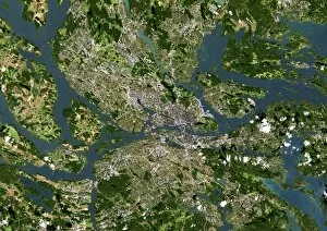
Background imageUrbanisation Collection: Stockholm, satellite image

Stockholm, satellite image. North is at top. Wateris blue, vegeatation is green, bare ground brownand urbanised areas are grey. Cloud cover iswhite. Stockholm is the captial city of Sweden

Background imageUrbanisation Collection: Seoul, satellite image

Seoul, satellite image. North is at top.Vegetation is green, urbanised areas are grey andsediments are grey/brown. Seoul (upper right) isthe capital city of South Korea

Background imageUrbanisation Collection: Sao Paulo, satellite image

Sao Paulo, satellite image. North is at top.Vegetation is green, water is azure and blue andurbanised areas are cream. Sao Paulo is a city inBrazil near the coast of the South Atlantic Ocean(bottom)

Background imageUrbanisation Collection: San Francisco, satellite image

San Francisco, satellite image. North is at top.Vegetation is green, water is blue, bare ground isshades of brown and urbanised areas are grey

Background imageUrbanisation Collection: Paris, satellite image

Paris, satellite image. North is at top. Forest isdark green, cultivated land is light green andcream and urbanised areas are pink and grey.Paris is the capital city of France

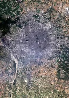
Background imageUrbanisation Collection: Mexico City, satellite image

Mexico City, satellite image. North is at top.Vegetation is green. Urbanised areas are grey, bare or arid ground is brown. Mexico City is thecapital city of Mexico

Background imageUrbanisation Collection: Madrid, satellite image

Madrid, satellite image
Madrid metropolitan area, satellite image. Northis at top. Vegetation is green, densely populatedareas are pink. Arid or bare ground is shades ofcream and orange, water is blue

Background imageUrbanisation Collection: Beijing, China, satellite image

Beijing, China, satellite image. North is at top, urban areas are grey and vegetation is green.Beijing is the capital of the Peoples Republic ofChina

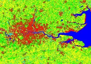
Background imageUrbanisation Collection: London, coloured satellite image

London, coloured satellite image
London, UK, coloured satellite image. Theregion has been colour-coded: red areas areresidences, cyan areas are industrial and greenand yellow areas represent thick and shortvegetation respectively


All Professionally Made to Order for Quick Shipping

"Captivating Urbanisation: A Global Perspective" Sheffield, UK - An aerial image captures the dynamic growth of this industrial city, where urbanisation has transformed its landscape into a bustling metropolis. Vancouver, Canada - Behold the stunning view of this coastal gem; urbanisation harmoniously blends with nature as skyscrapers rise against a backdrop of majestic mountains and sparkling waters. Europe at night - Witness the mesmerizing satellite image showcasing Europe's vibrant cities illuminated by countless lights, symbolizing the continent's rapid urbanisation and thriving economies. Hong Kong at dawn - As day breaks over this iconic skyline, witness how urbanisation has shaped Hong Kong into an architectural marvel that seamlessly merges tradition with modernity. Swanley, Kent, England - From above, observe the main road that runs through this charming town in Kent; a testament to how even smaller communities contribute to the global phenomenon of urbanisation. India at night - This satellite image reveals India's transformation under the cloak of darkness; sprawling cities light up like constellations as urbanisation propels economic progress across diverse landscapes. Modica Italy's old town view – Step back in time amidst narrow cobblestone streets and ancient architecture; while surrounded by history, Modica showcases pockets untouched by modern-day urbanisation. South America at night – Gaze upon a breathtaking satellite image capturing South America’s nocturnal beauty; twinkling lights signify not only major cities but also emerging hubs embracing rapid urban development. London, UK – A bird’s-eye-view unveils London’s grandeur from above; centuries-old landmarks blend harmoniously with contemporary skyscrapers epitomising successful integration within an ever-changing world driven by relentless urbanisation Reading & Southampton (UK)– These two contrasting towns showcase different facets of British suburban life amid ongoing waves of urban expansion—a tale told through their unique architectural landscapes.